


Backpacking Through Breathtakingly Brilliant Beauty
Get away from Familiar… With our Via Dinarica Trail Itinerary
The further we get from Familiar, the happier we become. Julia and I travel because we crave the personal growth that comes from discovering places and cultures that are new to us. Backpacking on the Via Dinarica Trail allowed us to do exactly that. From playfully hurdling language barriers via. impromptu games of charades, to navigating grocery stores and shops filled with unfamiliar foods, to absorbing spontaneous mountainside cheesemaking lessons (and drinking sessions), we found Balkan culture in Bosnia-Herzegovina and Montenegro to be an outpouring of warmth, hospitality and kindness.
In large, that is why we wanted to share our Via Dinarica Trail itinerary.
The geography of these countries is also breathtaking. After trekking to guesthouses that served fresh, homegrown, farm-to-table organic meals*, to homes of complete strangers who generously allowed us to camp in their back yards, and meeting a dog who adopted us, we were already talking about when we’d be back to hike more of this spectacular trail.
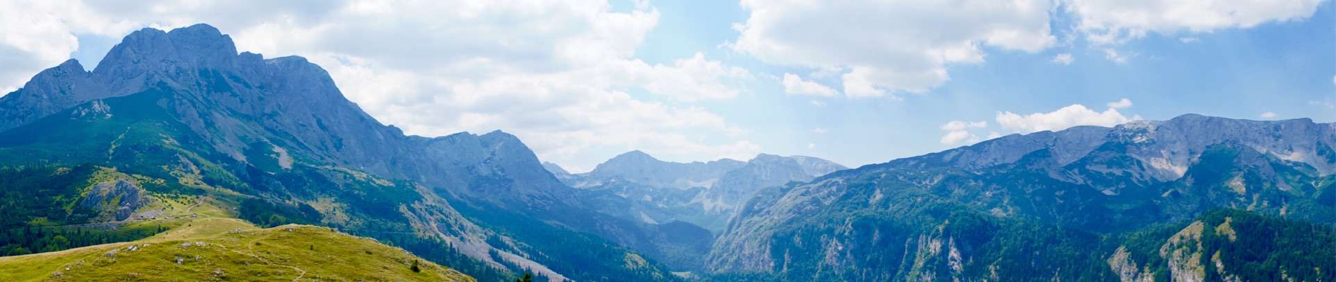
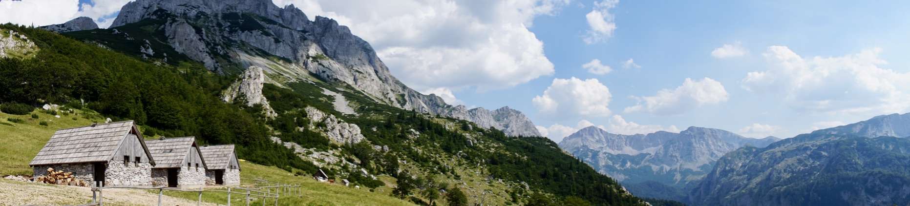
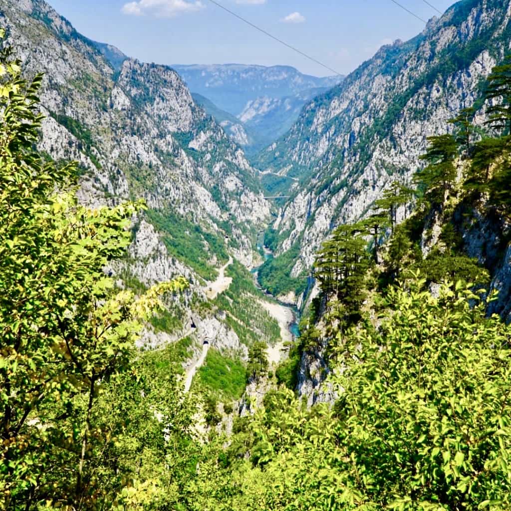
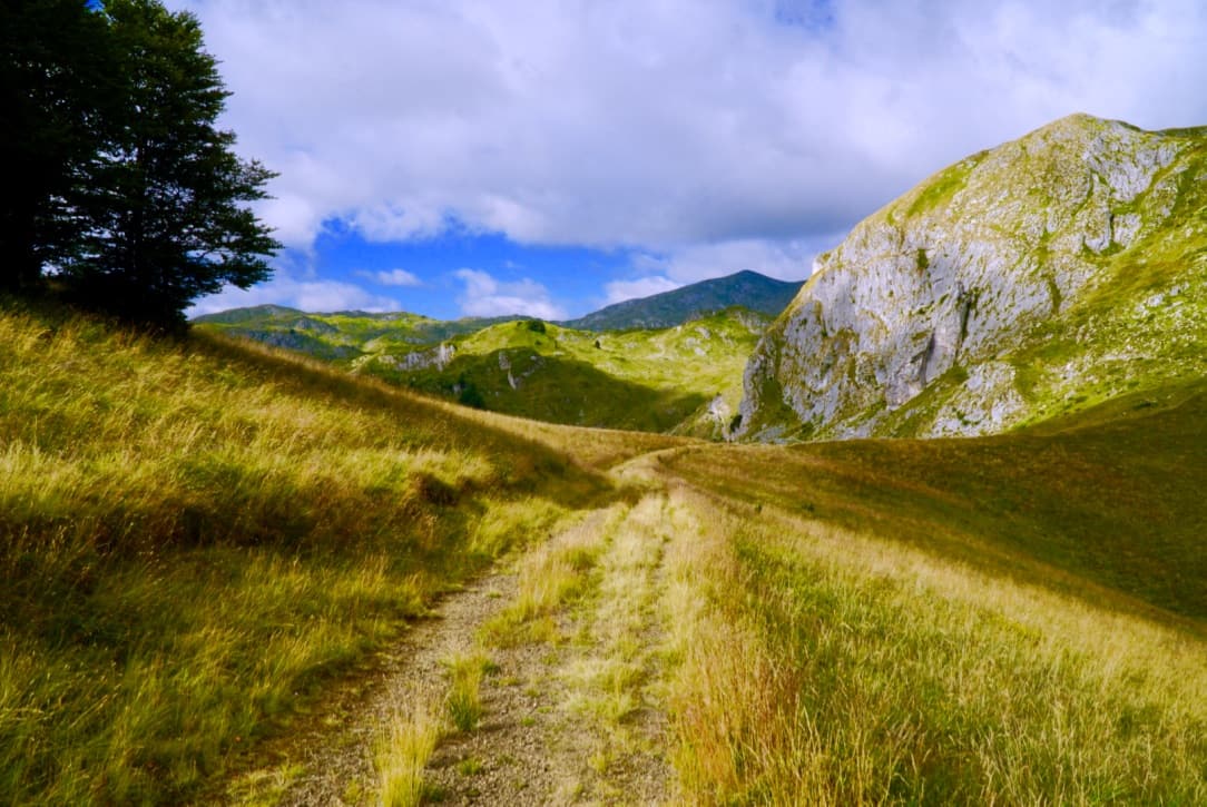
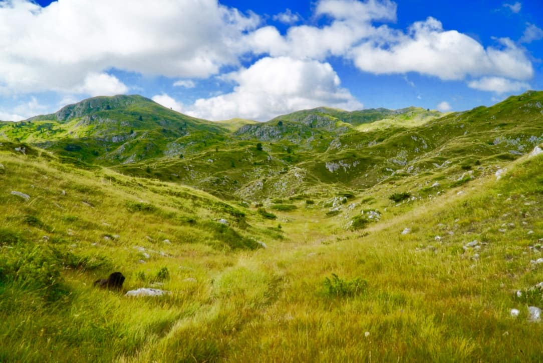
Mt. Maglic
What We Did – Our Via Dinarica Trail Itinerary
Broadly speaking, this was the route of our Via Dinarica Trail itinerary, the one you’ll read more about below.
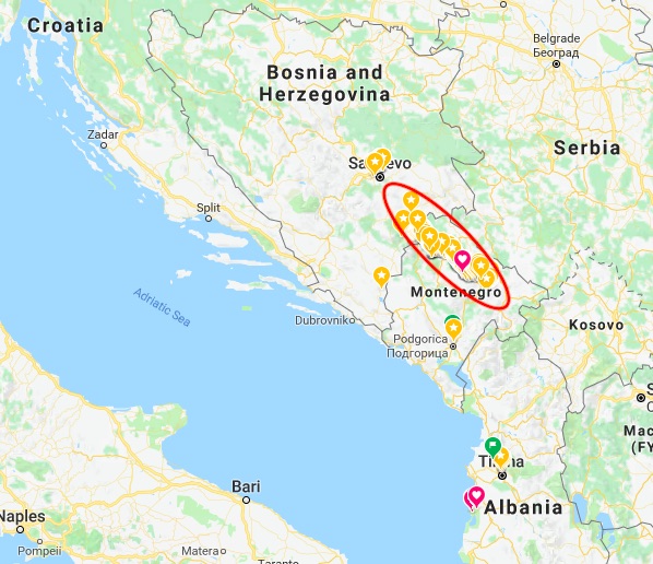
This was our route
More specifically, we backpakced a 10-day section of this magnificent trail. Our Via Dinarica Trail itinerary took us through 138 km (86 miles) of the Dinaric Alps, totalling an elevation gain of about 8,000 meters (26,200 feet). We started in Bosnia-Herzegovina at Sutjeska National Park and ended in Montenegro just shy of Biogradska Gora National Park. A few of our days were quite flat, but most had steep ascents yet moderate descents. The breathtaking terrain ranged from dense pine forests to flower carpeted mountain pastures to alpine zones dotted with emerald lakes to forest-ponds teeming with fish.
Guide-Free
We didn’t hire a guide, as we love the thrill of navigating trails on our own, even if it means getting into some minor pickles. Given the fact that the trail is occasionally difficult to follow, we did indeed get into a few tough spots, but with both our GPS and paper maps, we ended up just fine. If you follow our Via Dinarica Trail itinerary, you’ll certainly be able to avoid some of the mistakes we made.
Go Now – But Read This First
In a sentence, we highly recommend this stretch of the Via Dinarica Trail. This wellspring of cultural experiences as well as sheer natural beauty is still largely undiscovered by mainstream tourists, so go as soon as you can. But before setting out on your own, make sure to also read 12 Things to Consider Before Hiking the Via Dinarica Trail, as there are a number of planning and logistical details you’ll definitely need to think about to ensure you have a safe and enjoyable trek.
In the meantime, here is our Via Dinarica Trail itinerary.
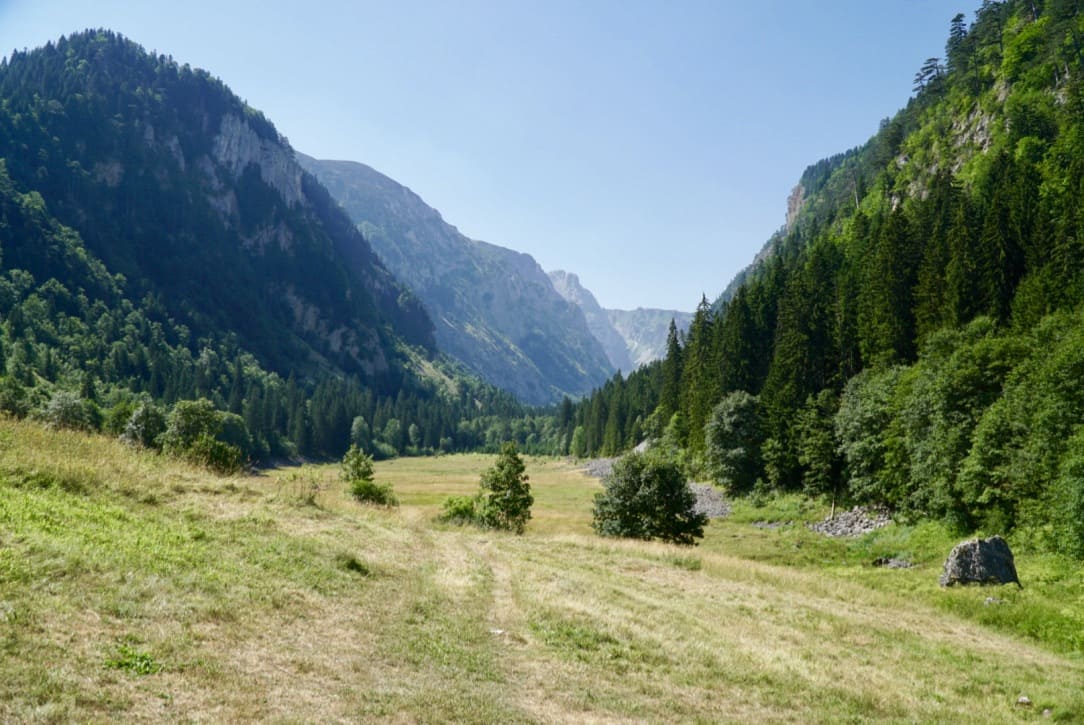
Day 1: Suha to Prijevor Huts on Mt. Maglić (in Sutjeska National Park) – 5 km (sleeping elevation: 1692 m) (Via Dinarica Trail Stage 37)
Sutjeska National Park Via Dinarica Trail Itinerary
Valley up to Prijevor Huts in Sutjeska National Park
We started trekking in Sutjeska National Park via the Suha entrance. We spent the majority of the day picking our way up the left side of this valley, and we didn’t have to worry about protecting ourselves from the sun, as the old growth forest provided us with ample shade. Had we not been in the cool shade of the trees, the steepness of this section of trail would have been significantly more challenging than it already was.

In the blink of an eye, the trees ended, and towering before us at 2386 meters (7828 feet) was Mt. Maglić, Bosnia-Herzegovina’s highest peak. Standing at it’s base, I was acutely aware of how small I am in relation to our beautiful world and universe. Simultaneously however, I was peaceful, calm and completely clear in my mind. The medicinal power of mountains is miraculous.
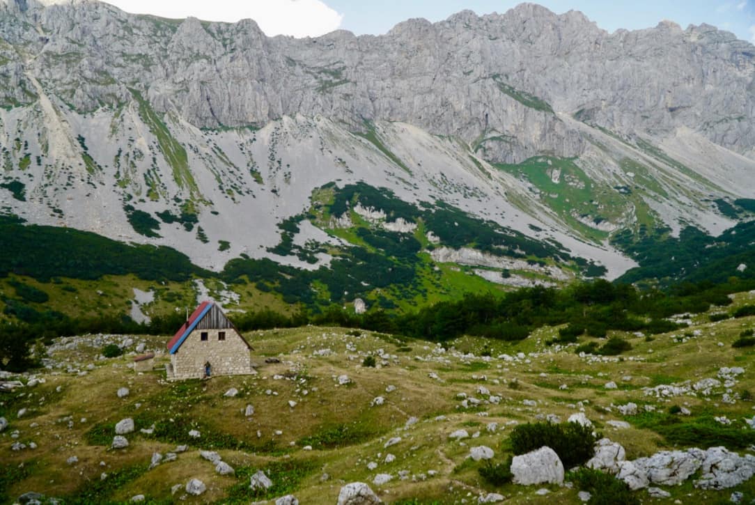
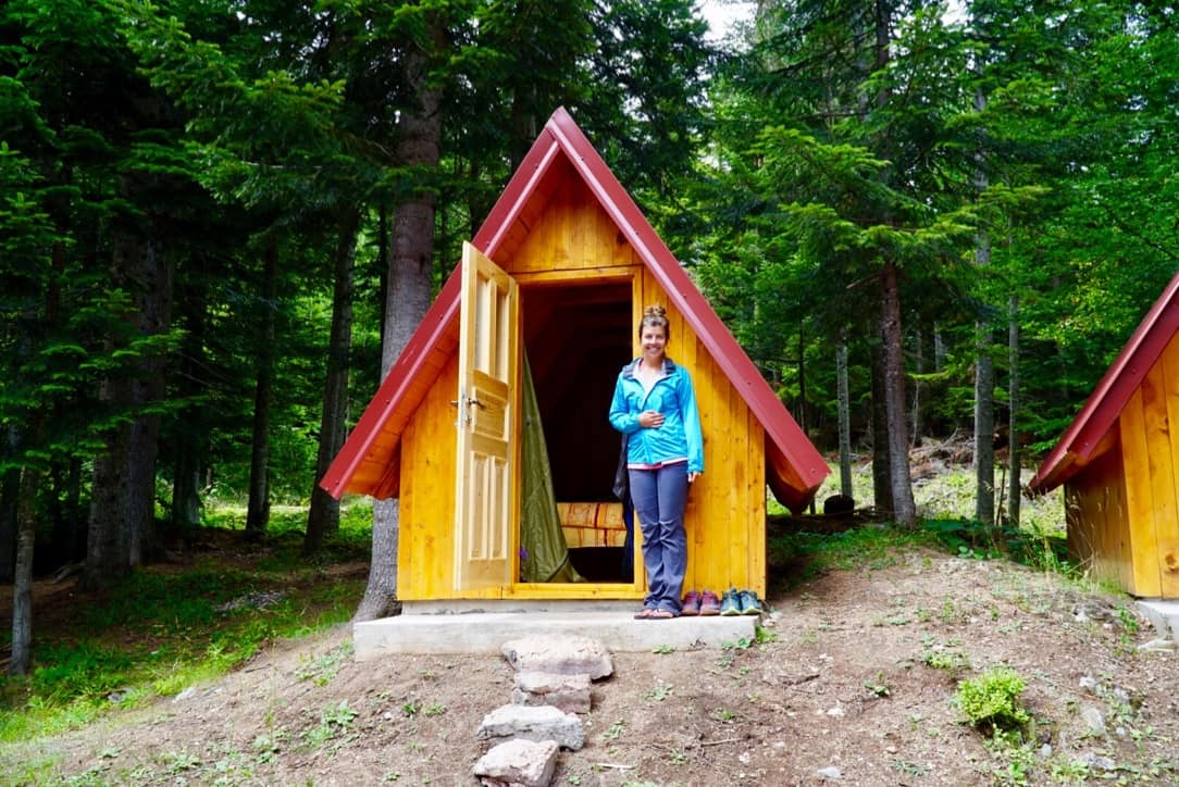
Prijevor Huts
This Via Dinarica Trail itinerary would NOT be complete without mentioning the Prijevor Huts. By early afternoon, we arrived at the Prijevor Huts. Each hut sleeps 6 people, has a toilet, running water and best of all, a wood burning stove. For me, there are few things more enjoyable than slowly drifting off to sleep in a cozy mountain top cabin while being gently warmed by a wood burning stove. And that night, that’s exactly what we experienced!
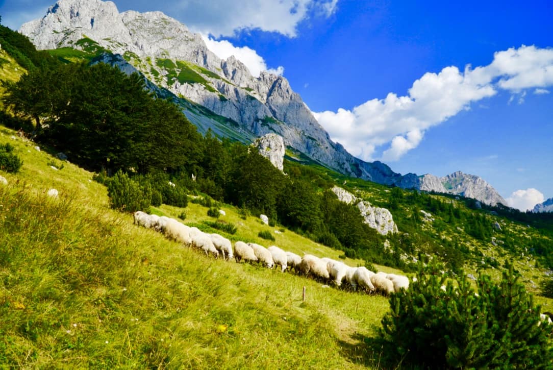
Cheesemaking on the VDT
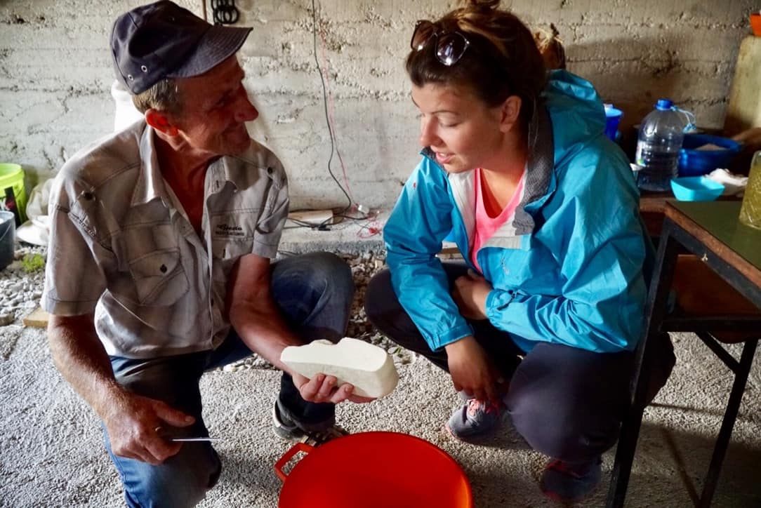
The next morning, Randovan gave us a cheese making lesson. We met Randovan the previous afternoon and learned that he is a herder who seasonally lives and pastures his flocks near the huts in his katun (a summer cottage in the mountains used by shepherds in the Balkans).
During the lesson he milked his 8 cows, boiled the milk (letting us taste the hot milk at the various stages along the way) and then showed us how to make about half a dozen different kinds of cheeses. All the while, he fed us fresh soft chunks of freshly finished cheese, and he gave me shots of plum brandy, loza.
Although I wasn’t particularly keen to take shots at 9:30AM, I didn’t want to be rude, so I did my best to refuse as politely as possible, but I must admit, by the time we started hiking about an hour later, I was a little bit buzzed and and most certainly full with cheese. Radovan’s hospitality was second to none.
Day 2: Prijevor Huts to Mratinje -13 km (sleeping elevation: 1200 m) (Via Dinarica Trail Stage 37)
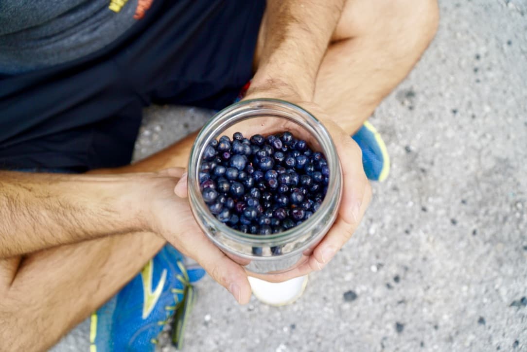
The next day we hiked down to the road, and we found some locals selling fresh picked mountain blueberries! For a little more than US$1, we snacked on a couple of pints! If you do use this Via Dinarica Trail itinerary, try your best to get some blueberries too!
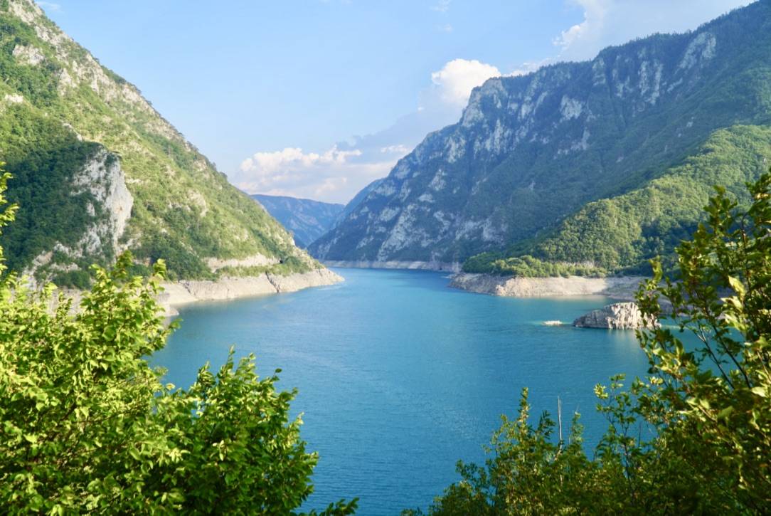
Reservoir Near Martinje
To make a LONG story short, we had to take a bus to Martinje where we hiked along this aqua marine beauty of a reservoir. To find out why we were not able to cross the border from Bosnia-Herzegovina into Montenegro through the mountains, check out 12 Things to Consider Before Hiking the Via Dinarica Trail.
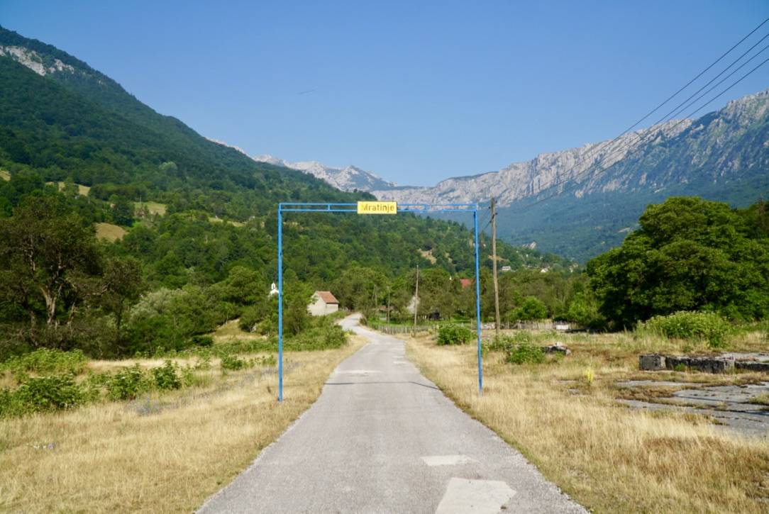
Entry to Martinje
Naturally, the town Martinje is near the Mratinje dam. It’s a quaint farming town nestled in this mountain valley.
Incredible Hospitality
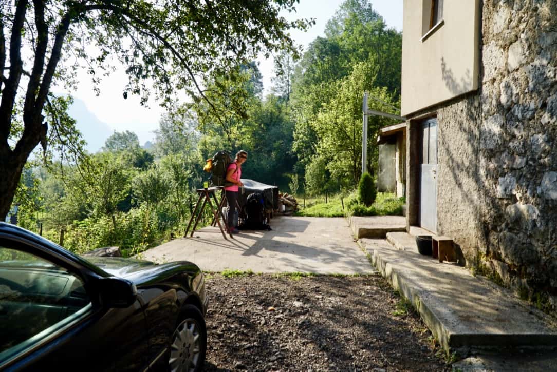
Sleeping in a Strangers Driveway
Although we planned to camp by a mountain lake this night, we ended up camping in this person’s yard! On our way to the lake, one of the local men communicated to us that the lake was too far off to reach before dark. We didn’t want to risk losing the trail (some sections were not well marked), so we asked the man where we might be able to spend the night. In an instant, he gestured to this driveway, so we set up camp. Then a moment after we had finished, he left! A few minutes later other people arrived at the house, and we realized that the man must have told us we could sleep in his neighbor’s yard! We found this hilarious in retrospect, but a little awkward at the time. Oh well.
Day 3: Mratinje to Farm House – 12 km (sleeping elevation: 1250 m) (Via Dinarica Trail Stage 38)
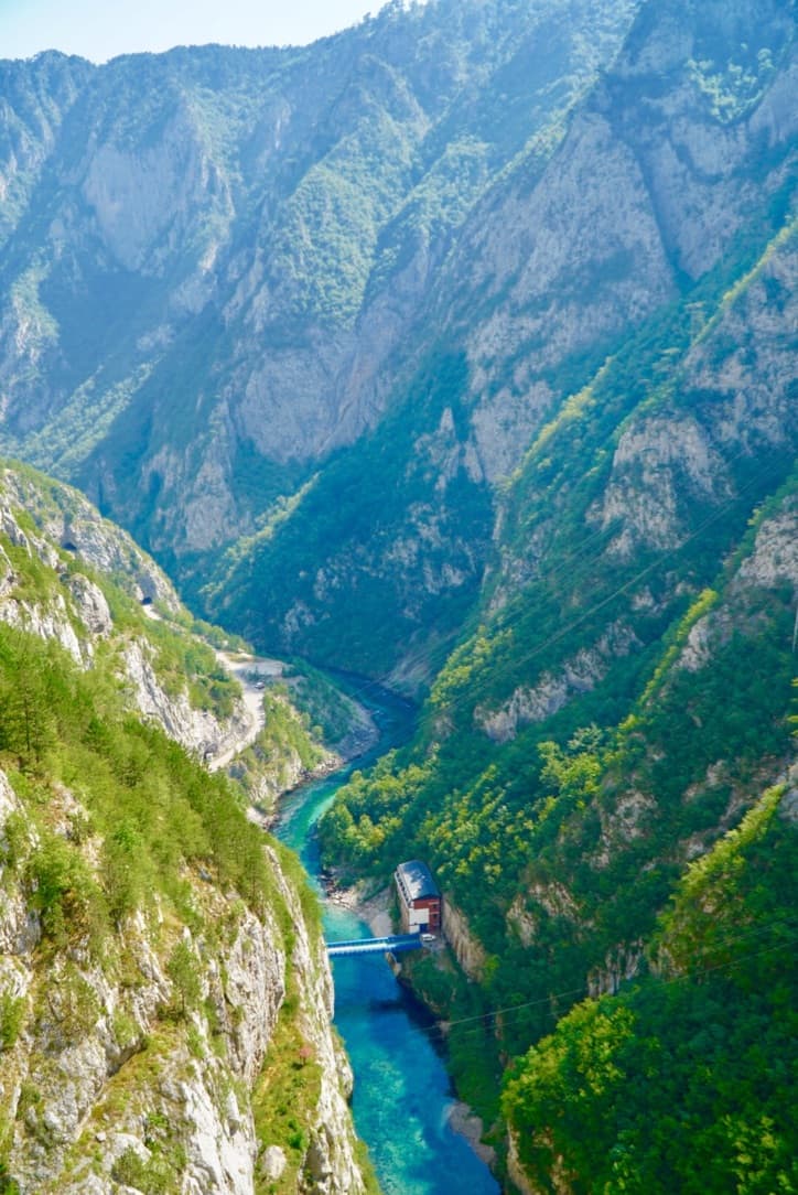
Mratinje Dam
Hiking out of Mratinje, we had to cross the Mratinje Dam through the Piva Canyon. If you’re scared of heights, close your eyes on this part, as you’ll be 220 metres (720 ft) above the river! But if you’re not, you’re in for a scenic treat.
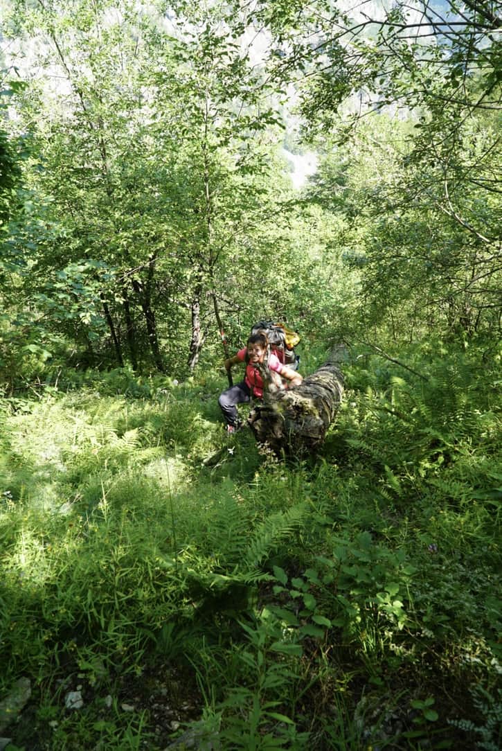
Scrambling up Piva Canyon
Getting from the base of the dam, up to the Piva Plateau, we had to complete a MASSIVE climb. Much of the time we scrambled up rock slides and extremely overgrown sections of trail. Make sure you have GPS capabilities for this section. We go into detail about this and more in 12 Things to Consider Before Hiking the Via Dinarica Trail.
Getting Lost (We Didn’t Have this Via Dinarica Trail Itinerary Yet!)
Super lost in Piva Canyon
And when we say ‘massive’, we really mean it. From the dam to the plateau, we would have climbed 650 meters (2,100 feet) in 1.6 km (1 mile), if we hadn’t gotten terribly lost. But, we did get terribly lost, and we ran out of water. Our GPS was a savior in this situation, and this Via Dinarica Trail itinerary would not be complete without the recommendation to BRING A GPS device, or two. We weren’t quite yet at point of needing to use our paper maps and compass, but we were pretty darn lost. So again, we really recommend you have GPS capabilities for at least this section of the trail and better yet, for the entire thing.
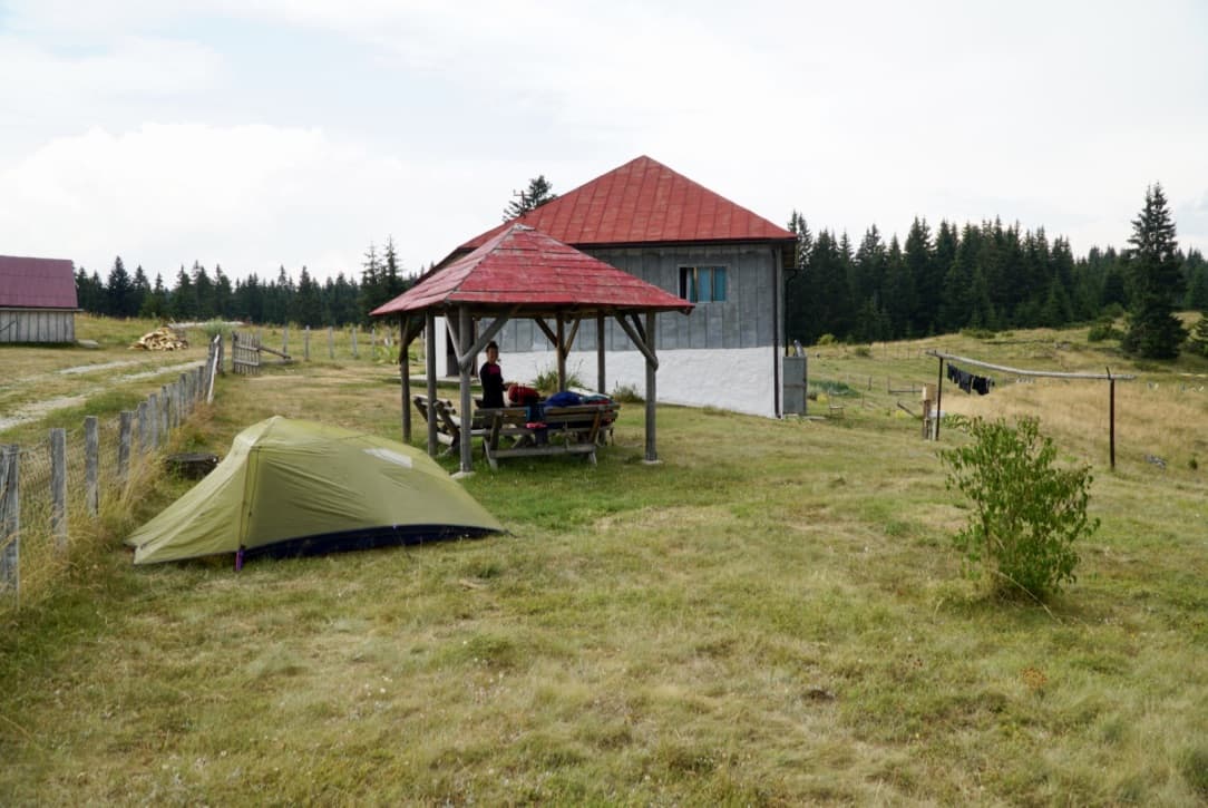
Arriving at the Farmhouse in the Nick of Time
More Hospitality
By this point, we were quite dehydrated, and there were dark clouds quickly moving towards us, but we made it to this farmhouse just before it started to rain. This home is listed on the VDT website as a place to get water, but what was not on our Via Dinarica Trail itinerary was the elderly couple living here who were kind enough to let us camp in their yard. Thankfully we were able to rehydrate and set up camp before the storm. While we were setting up our tent, they even brought us hot coffees and a beer! Trail magic like this is always the best.
4: Farm House to Guest House Nedajno – 18 km (sleeping elevation: 1400 m) (Via Dinarica Trail Stage 39)
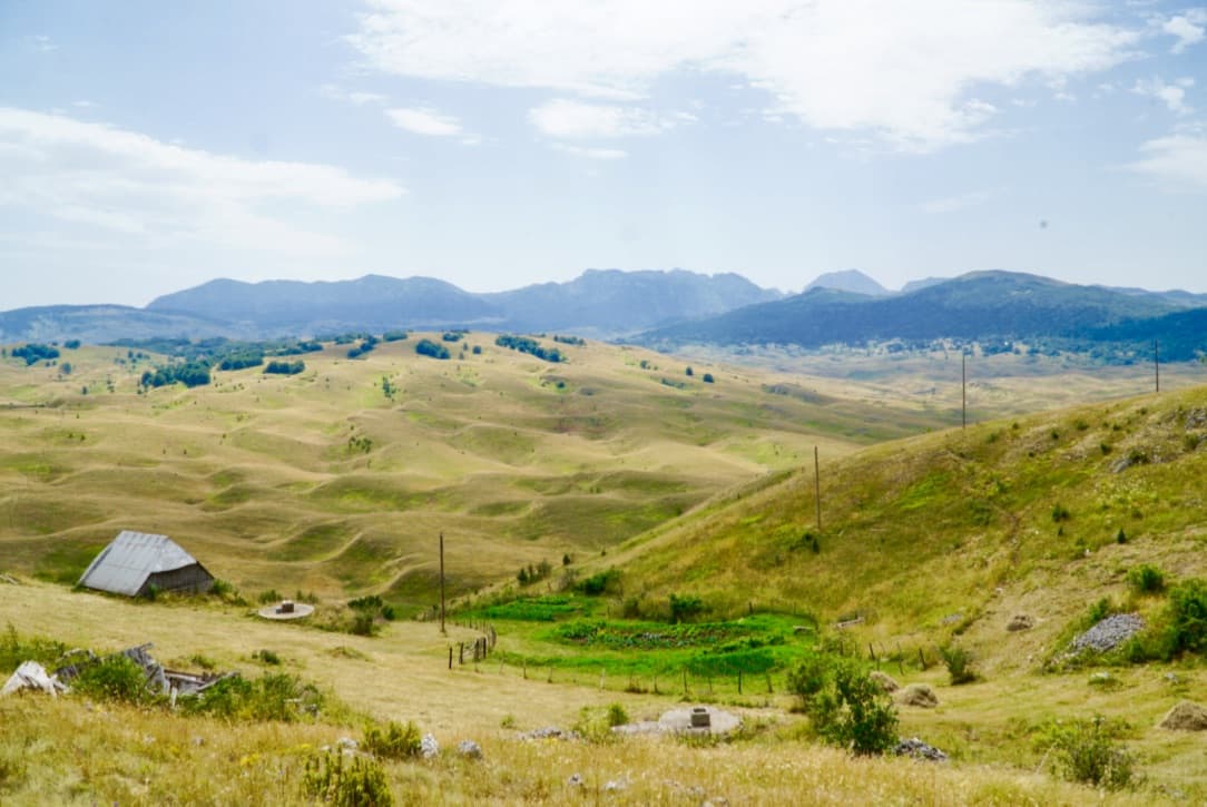
The Piva Plateau – Heading into Nedajno
The Piva Plateau is STUNNING! Its rolling hills are dotted with fresh green farms and fade into distant mountains, forming a seemingly endless carpet of pastoral beauty.
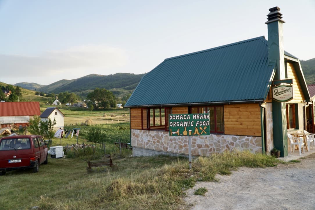
Guesthouse Nedajno
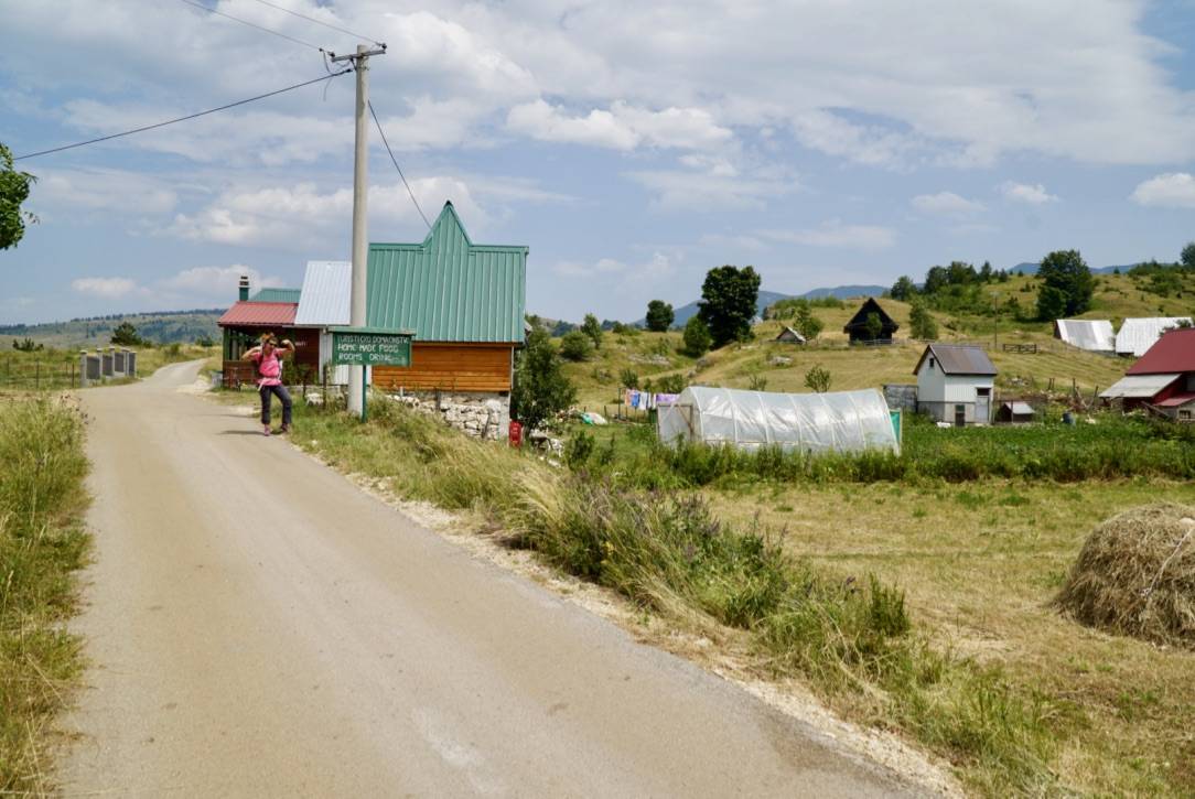
Arriving at Guest House Nedajno
Guesthouse Nedajno* was one of our favorite stops along the trail. This family owned and operated guest house has a capacity of ~15 guests, so it’s a small and intimate place as well as a great one for getting a real taste of Montenegrin culture. It’s also very affordable. For one person’s meals (which were massive, we probably could have shared) and accommodations we paid just under €20 (US$23).
Organic food at Guest House Nedajno
Guest house Nedajno serves scrumptious organic food. From meat dishes, to cheeses, to vegetable ones too, they can accommodate just about any dietary needs.
An Organic Feast
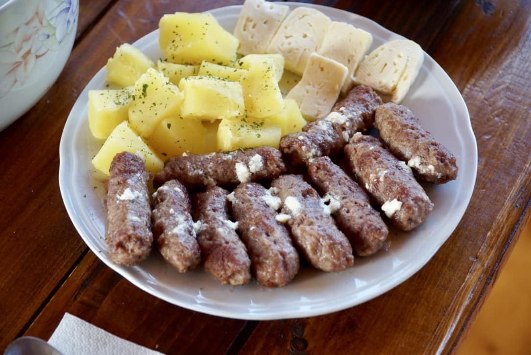
Guest House Nedajno’s home cooking
And again, their portions are MASSIVE. This plate of Ćevapi, a type of skinless minced meat sausage, potatoes, homemade cheese and lamb soup (not pictured) was for one person. By the end of our meal here we were not only stuffed, but infinitely satisfied.
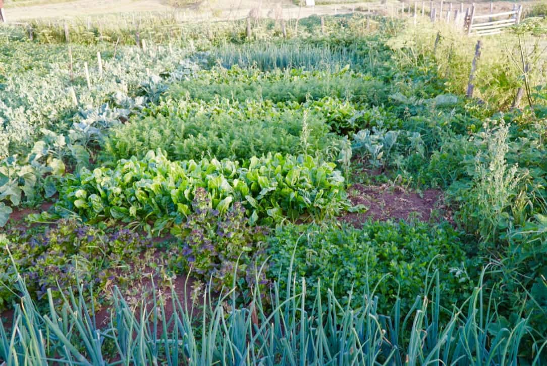
Guest House Nedajno’s Organic Garden
To top the sheer deliciousness and size of the meal was the fact that everything they serve is organic and sourced from either their own backyard or from within 1.5 km (1 mile) of their guesthouse. We only spent one night here, but we wish we had planned to spend a few more.
Day 5: Guest House Nedajno to Planinarski Dom Mountain Hut (Škrčko Jezero – Durmitor National Park) – 13 km (sleeping elevation: 1800 m) (Via Dinarica Trail Stage 39)
Sušica canyon
Although we descended quite a bit while trekking to the bottom of Sušica canyon, the entire hike down was via a mountain road, so it was quite gentle on our knees.
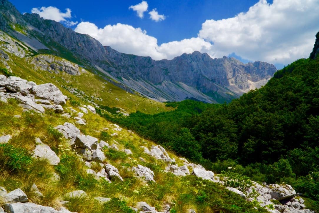
Durmitor National Park
At the bottom, we reached the entrance to Durmitor National Park. The entry fee was €3/person, so it was a good thing we had some money with us.
Nearing Škrčko Jezero
Within Durmitor, we headed to Škrčko Jezero (lake). The climb up to the lake was pretty grueling, but it switch backed enough to keep us from having to take too many breaks. Indeed, slow but steady pacing worked perfectly for us here.
Durmitor National Park Via Dinarica Trail Itinerary
As we continued to gain elevation, the scenery became increasingly breathtaking. Little did we know at this point that the next day we’d be going nearly straight up the wall you can see on the left.
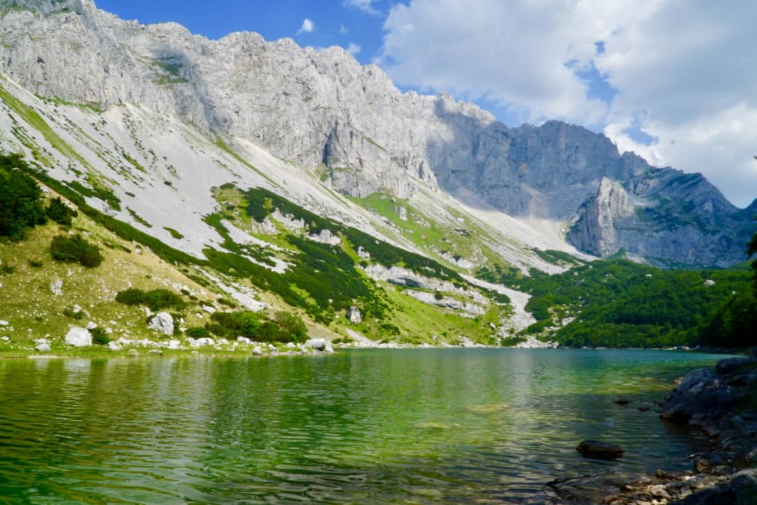
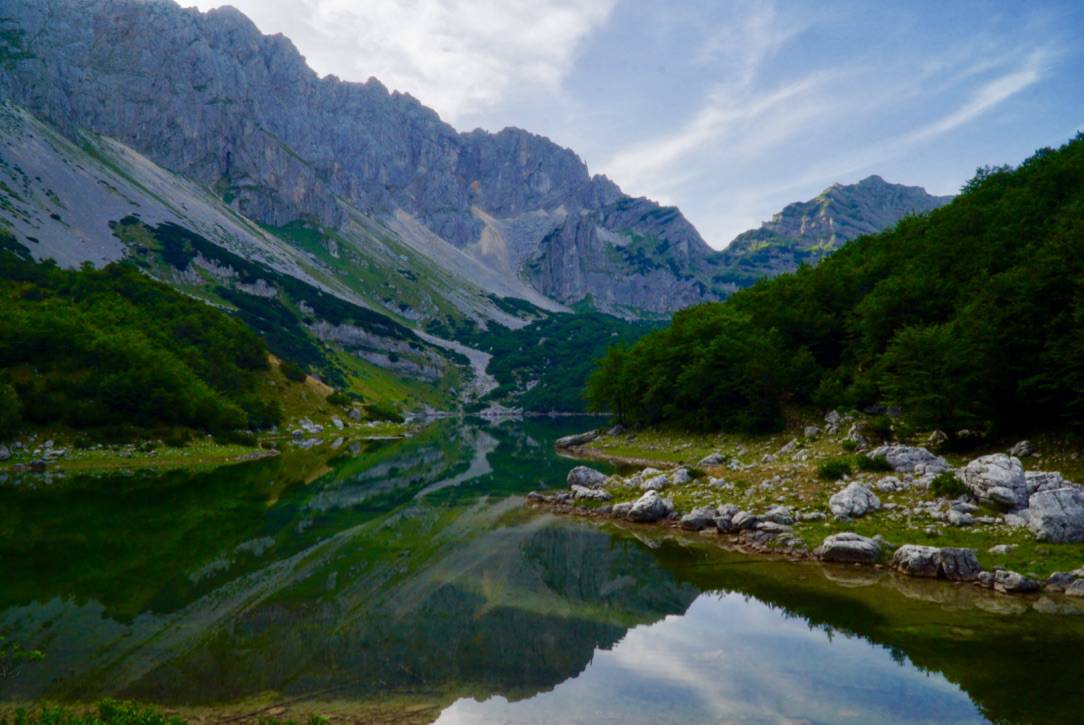
Škrčko Jezero
And then finally, we made it! Refreshing, cool and crystal clear, Škrčko Jezero is quite possibly one of the most beautiful alpine lakes I’ve ever seen. We went for a swim, lounged in the sun, and savored the accomplishment of hiking all the way up there.
Mountain Hut Planinarski Dom
Planinarski Dom Mountain Hut
To our surprise and delight, Planinarski Dom Mountain Hut had room for us to stay that night! We had planned to camp out, but we wanted to get an early start for a big climb we had the next morning, so we decided to sleep in the hut and thus save the time of breaking camp in the morning.
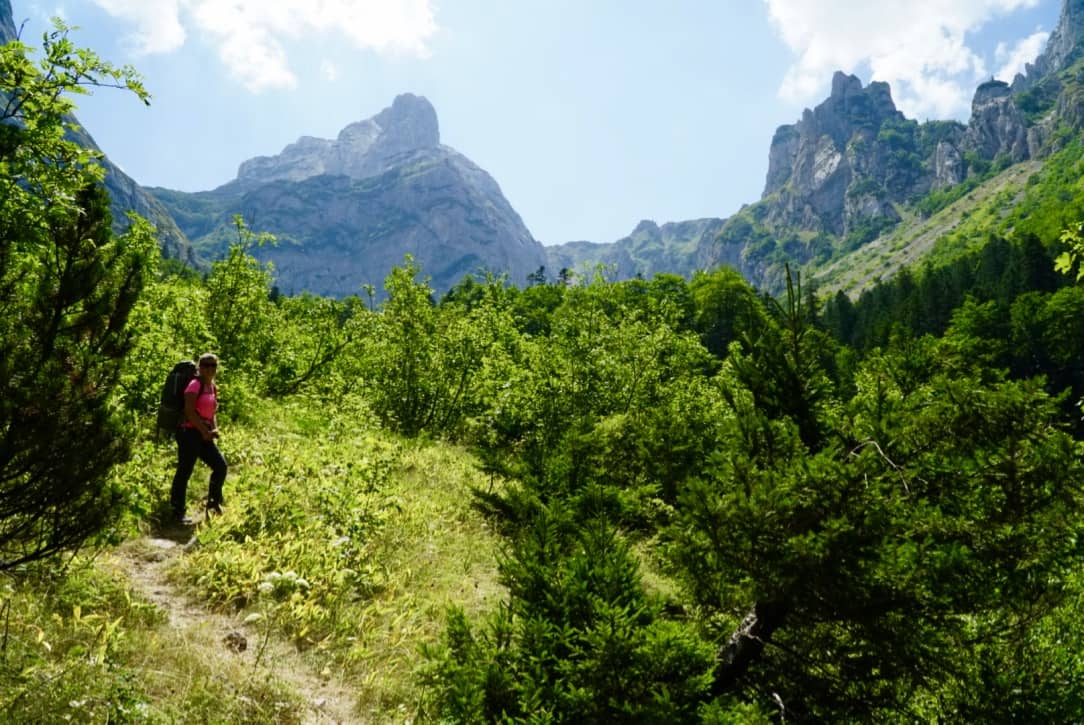
Day 6: Planinarski Dom Mountain Hut (Škrčko Jezero – Durmitor National Park) to Žabljak – 13 km (sleeping elevation: 1300 m) (Via Dinarica Trail Stage 39)
Škrčko Jezero in the Morning
As planned, we got up early, passed by Škrčko for one final goodbye, and then we started to climb, straight up.
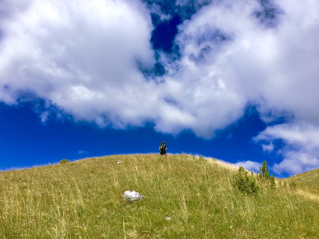
Massive Planinica
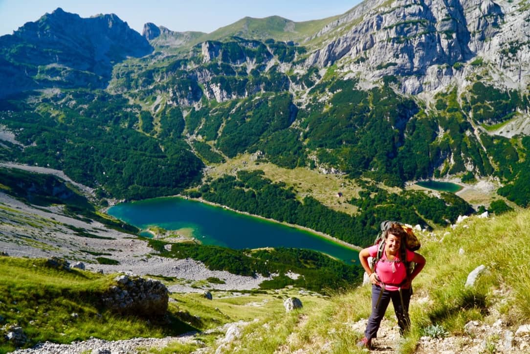
Ascending Mt. Planinica
While Julia looks quite happy at this resting spot, I must admit that we were both pushed nearly to our limit on this ascent up Mt. Planinica. We climbed 610 meters (2,000 feet) in 1.4 km (0.9 mile). This was by far the most challenging stretch of trail on our trek. Later on, we found out there are more gentle routes up Mt. Planinica, and we discuss those in 12 Things to Consider Before Hiking the Via Dinarica Trail.
Into Zabljak
Heading Into Žabljak
However, the hardcore climb up Mt. Planinica was well worth the views at the top. They. Were. Stunning! And the weather could not have been more perfect. Off in the distance, we could see Žabljak, the town in which we’d take a zero day (a rest day), so with a bit of extra pep in our step, we made the 7 mile descent into town. This one was markedly harder on our knees though, and by the time we arrived, we were ready for an extended rest. If you decide to use this Via Dinarica Trail itinerary when you head out to the VDT, consider skipping this massive climb if you’re not into a ass-kicking workout. However, in retrospect, I’m glad we did it, and I’d definitely take this route again.
Day 7: Zero Day in Žabljak – 0 km (sleeping elevation: 1300 m)
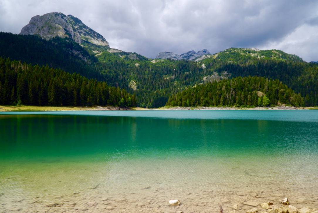
Black Lake in Žabljak
On our zero day in Žabljak, we slept in late, ate lots of good food and took a gentle stroll around Black Lake. Flitting around without our packs was luxurious, and the lake was gorgeous! I sure love hiking, but zero days are fantastic too.
Day 8: Žabljak to Zminica Jezero – 14 km (sleeping elevation: 1300 m) (Via Dinarica Trail Stage 40)
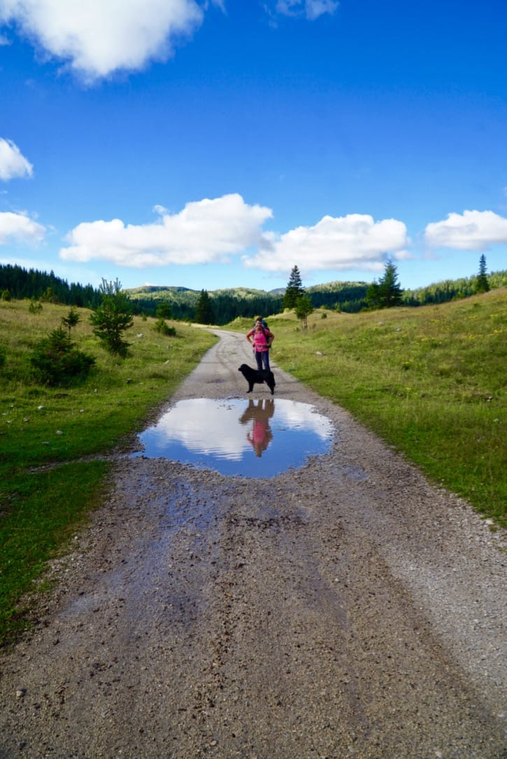
A Dog Adopted Us
After a zero day in Žabljak, we were resupplied and nicely rested, so we hiked onward. On our way, this dog started following us. We didn’t think much of it, as there were a good number of other farm dogs we’d seen along the trail.
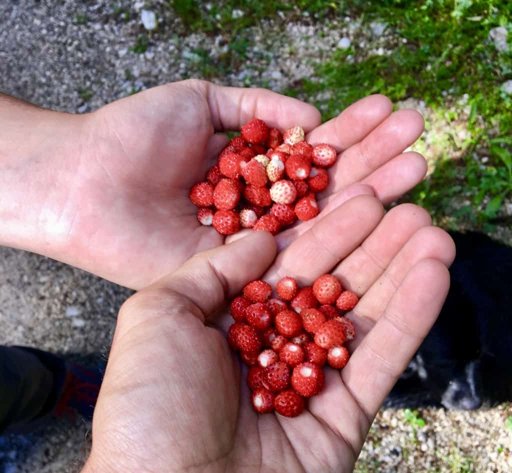
Picking Berries on the Via Dinarica Trail
While we only took one picture of these wild mountain strawberries, we could have taken dozens more. The section we hiked on the Via Dinarica Trail was thickly lined with strawberries, blueberries, blackberries and raspberries. No wonder this is Grizzly country.
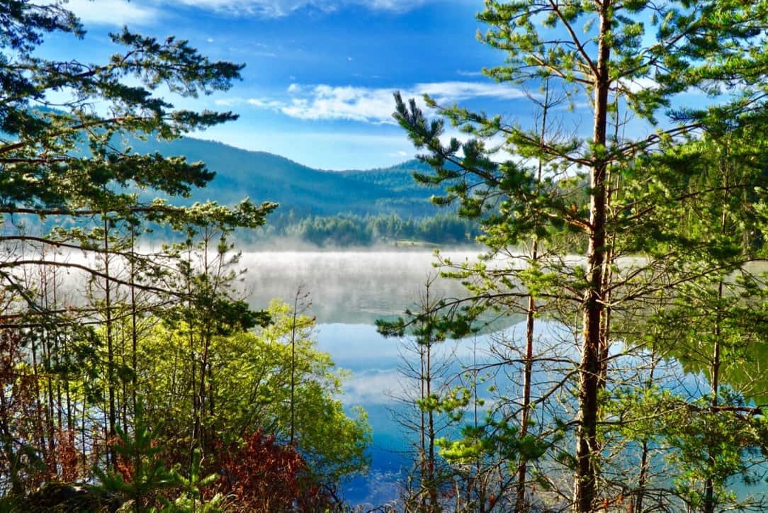
Zminičko Jezero
After a relatively effortless 16km (10 miles) on flat terrain, we arrived at Zminičko Jezero. The picture above is indeed of the lake, but it was taken the next morning. The night we arrived, we were quite abruptly greeted by an intense thunder and lightning storm. Think ‘discotech’ to understand how much lightning we experienced. Frankly, it was terrifying, but there was nothing we could do other than stay low in our tent and hope for the best. Clearly and thankfully, we made it out unscathed, albeit a little wet.
Day 9: Zminičko Jezero to Guesthouse Zabojsko Jezero – 18 km (sleeping elevation: 1500 m) (Via Dinarica Trail Stage 40)
Open fields on the Via Dinarica Trail
After our restless night in the thunder and lightning storm, we were glad to experience blue skies again.
Guesthouse Zabojsko Jezero
We were surprised to arrive at Guesthouse Zabojsko Jezero*, as we hadn’t noticed it on the maps when we had been researching our route, and actually stayed in one of the rooms near their restaurant. Thus, we’ve included it in our Via Dinarica Trail itinerary! We were planning to camp this night, but since we did not sleep much the night before, and since we were still a bit shell shocked from all the thunder and lightning, we opted for this cute little A-frame instead. For €10/person we not only got to sleep in the little cabin, but we also got another organic, locally sourced and homemade meal. We were on cloud 9!
A Frog Hatch on the Via Dinarica Trail
We felt thrilled both to be a guesthouse and to see this tremendous frog hatch! There were tens if not a few hundred thousand newly born teeny-tiny frogs hopping just about anywhere we looked. We had to delicately pick our way back to the guesthouse to avoid squashing any of them.
Day 10: Guesthouse Zabojsko Jezero to Mojkovac – 32 km (sleeping elevation: 1000 m) (Via Dinarica Trail Stage 40)
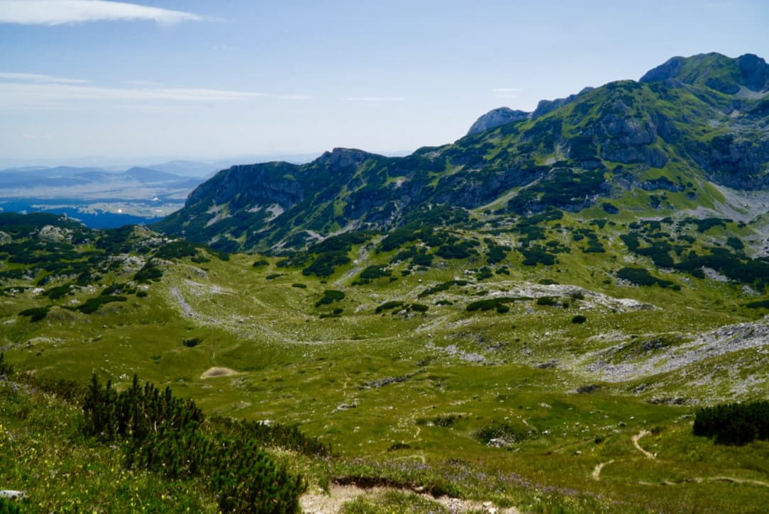
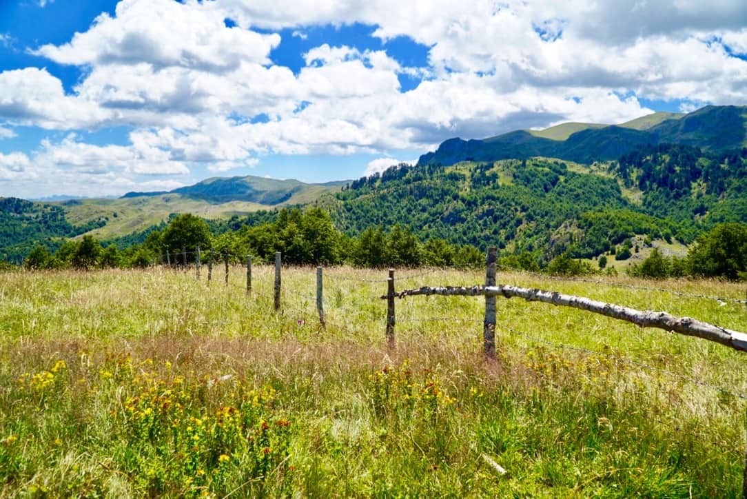
Big Blue Sky on the Via Dinarica Trail
After we left Guesthouse Zabojsko Jezero, we encountered a lot of wide open fields. We felt thankful for our GPS capabilities on this stretch of trail. This was because many of the trail markers had been painted on rocks, and many of those rocks were hidden in the tall grass.
Endless Fields on the Via Dinarica Trail
This stretch of trail was stunningly beautiful, but it would have been nearly impossible to follow without GPS. We highly recommend you bring GPS when hiking on the VDT. For specifics on this as well as other planning and logistics you ought to consider before hitting the trail, make sure you read 12 Things to Consider Before Hiking the Via Dinarica Trail. As an aside, can you see our friend hiding in the picture?
Via Dinarica Trail Via Dinarica Trail Itinerary
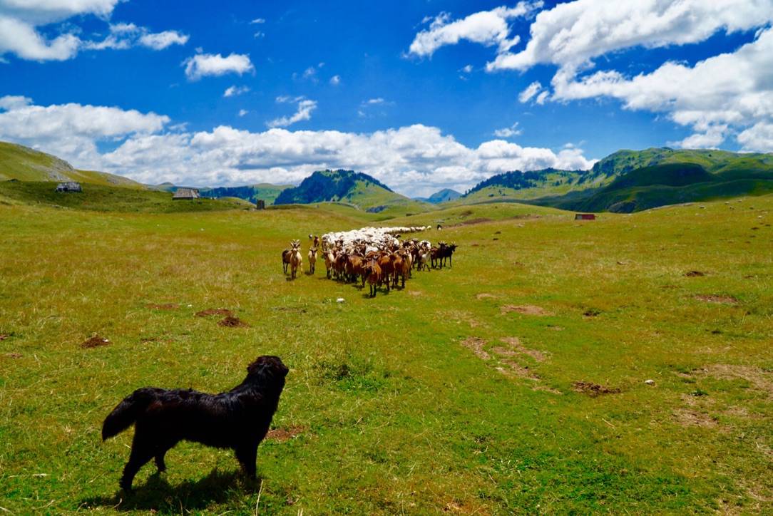
If you couldn’t see it in the last photo, our canine friend was still following us! In fact, she followed us for 3 days and nearly 50 km (30 miles)! Although she got a few bulls to charge us, we grew to love her and even considered taking her back to Hong Kong with us. When we eventually had to say goodbye to her, it was tear jerkingly tough.
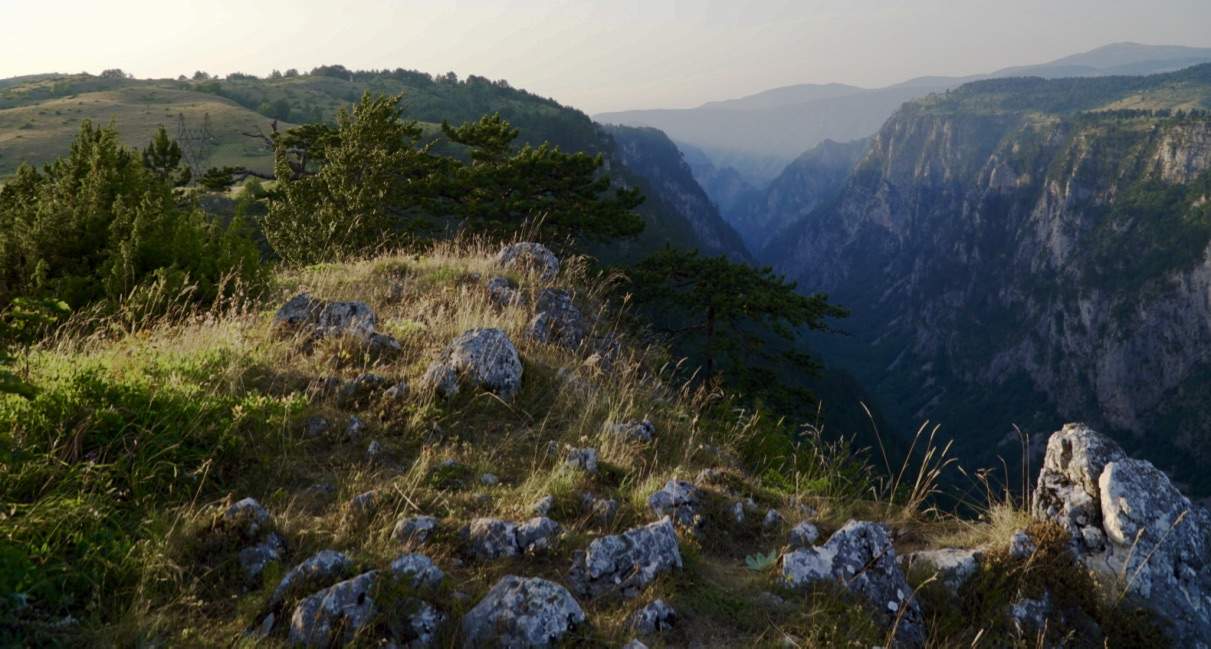
A View before Mojkovac
Wanting More
As we reached the final few miles of our journey we realized the Via Dinarica Trail is unrelentingly beautiful. Unrelentingly. Although we thought hiking nearly 100 miles of of the VDT would satisfy our desire to explore it, our hike only served to intensify it. We are certainly planning to hike more, if not all, of this spectacular trail, and we highly recommend it to anyone who loves the great outdoors.
So there ya have it, our Via Dinarica Trail itinerary has come to an end! However, don’t attempt it without proper planning. If you’d like to learn what we learned, and potentially avoid making some of the mistakes we made, definitely check out 12 Things to Consider Before Hiking the Via Dinarica Trail.
Source https://www.forsomethingmore.com/via-dinarica-trail-itinerary/