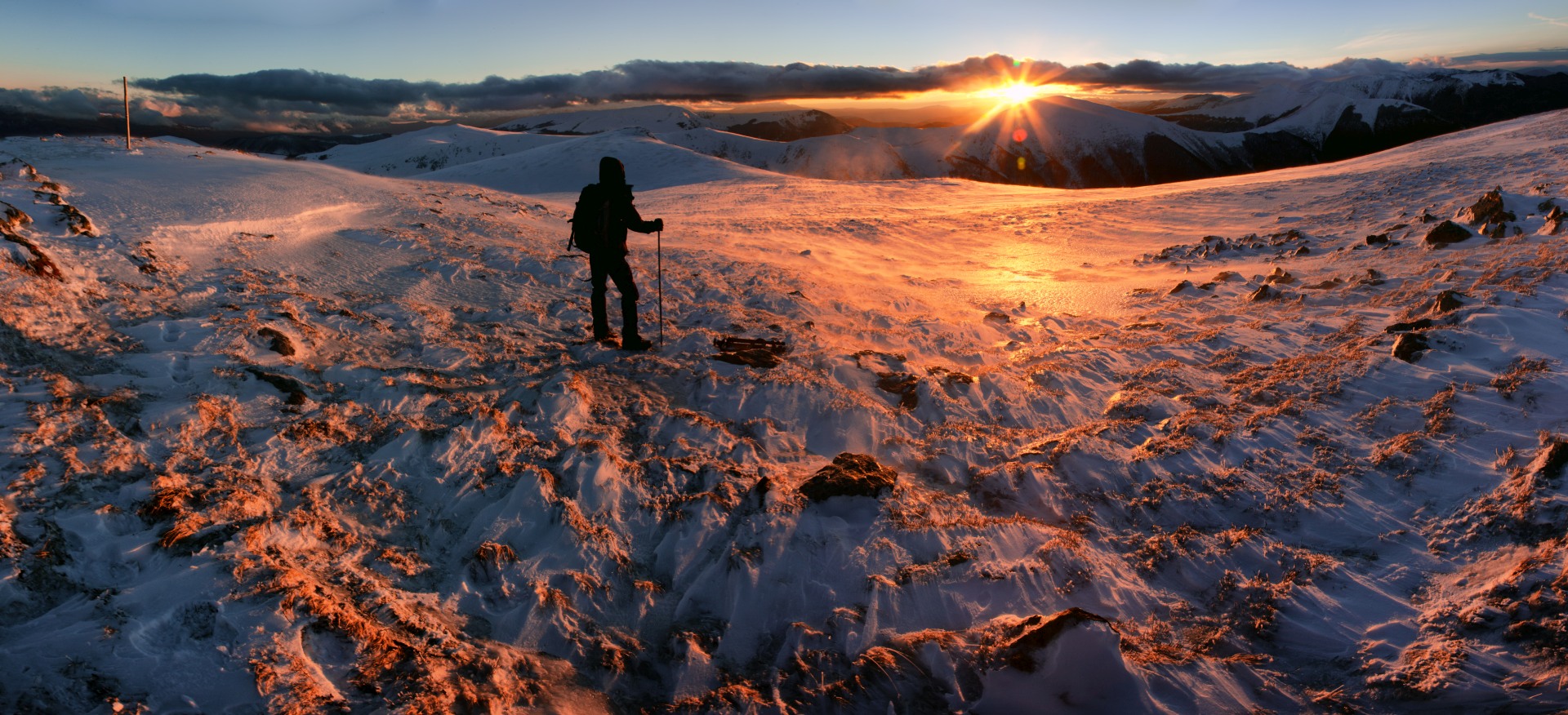
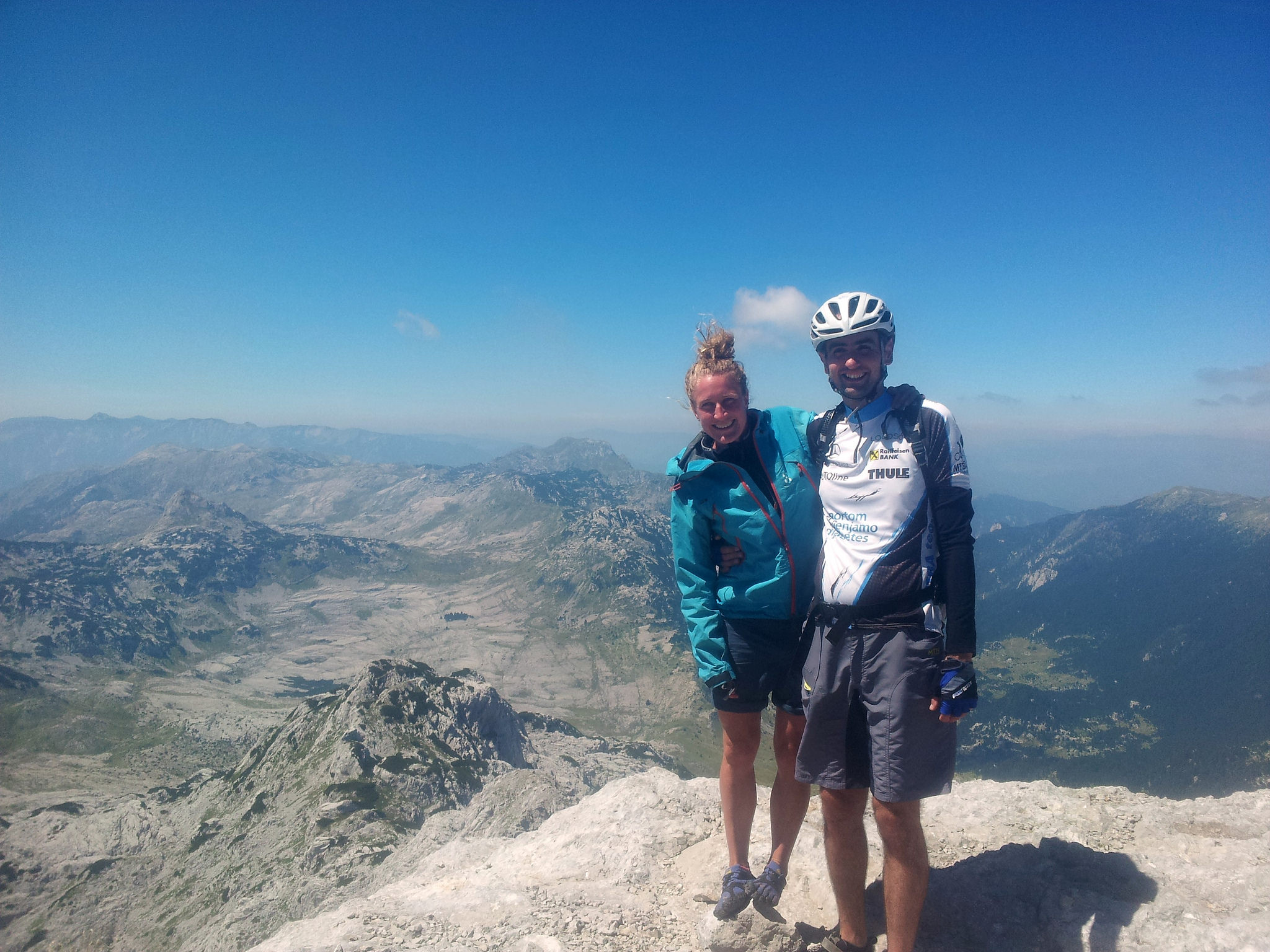
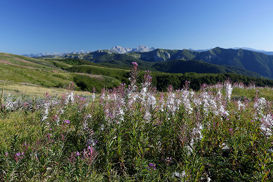
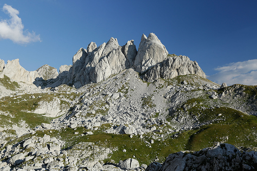
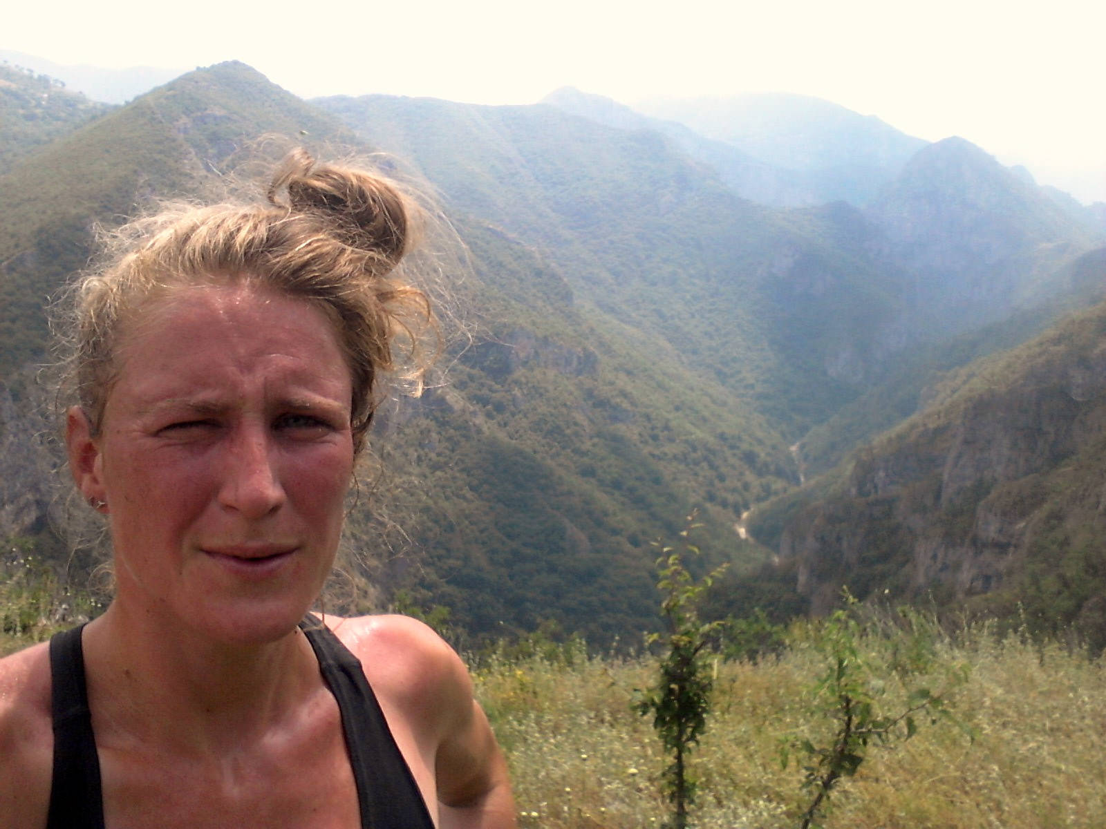
At the end of the month I like to look back on what I’ve done and where I’ve been. On how I felt and what was on my mind. It turned out that my Instagram pictures actually give a pretty good impression. So, I decided to put them together in a blog post. Here’s November where I stayed two weeks in Sarajevo before I took my bike for a ride to the Croatian coast. An exciting month full of social stuff, warm showers, blue skies and new opportunities. Scroll down to find out more!
Hiking in Bosnia and Herzegovina
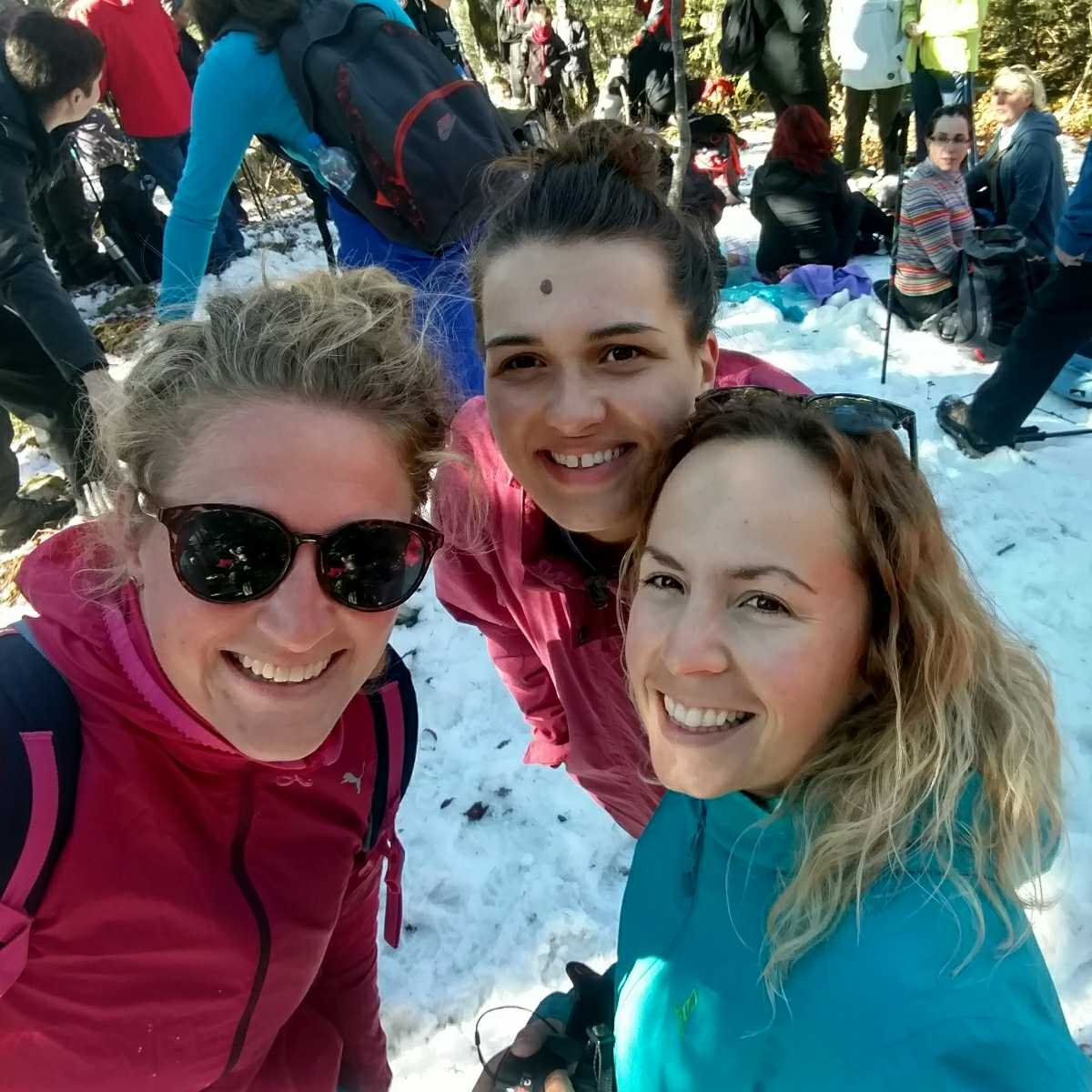
Pretty busy for a peak without view. Humanitarian Tour to Crni Vrh on Igman.˝Wild soul, warm heart˝ The Wild One & me hiking on Trebević
˝A walk in the woods˝, the abandoned Olympic bobsled track
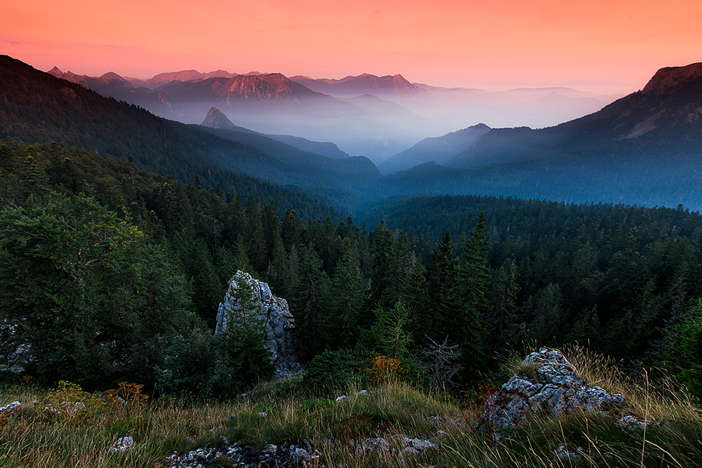
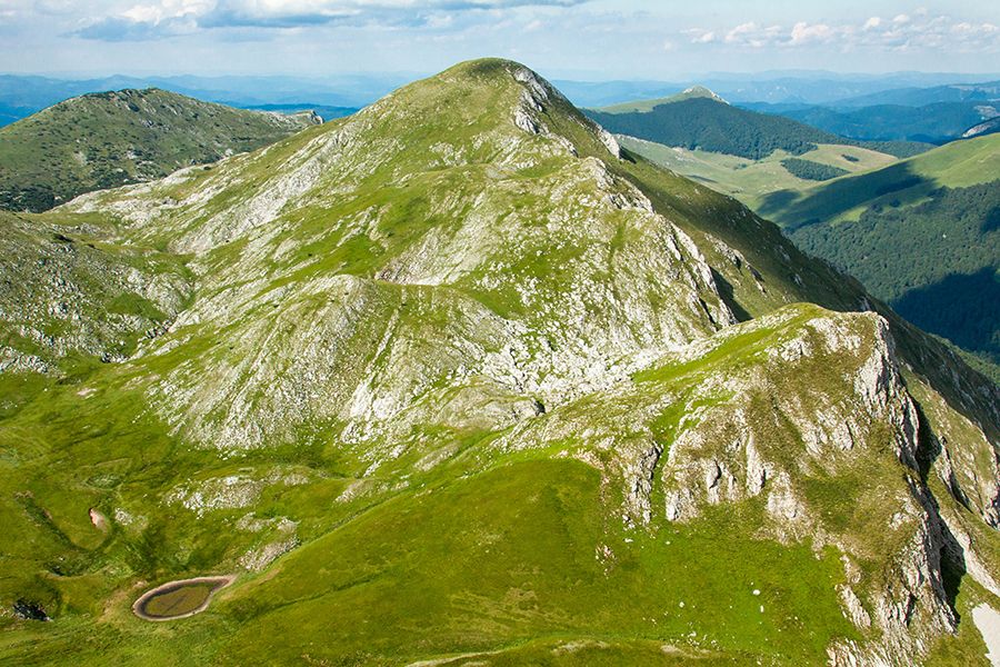
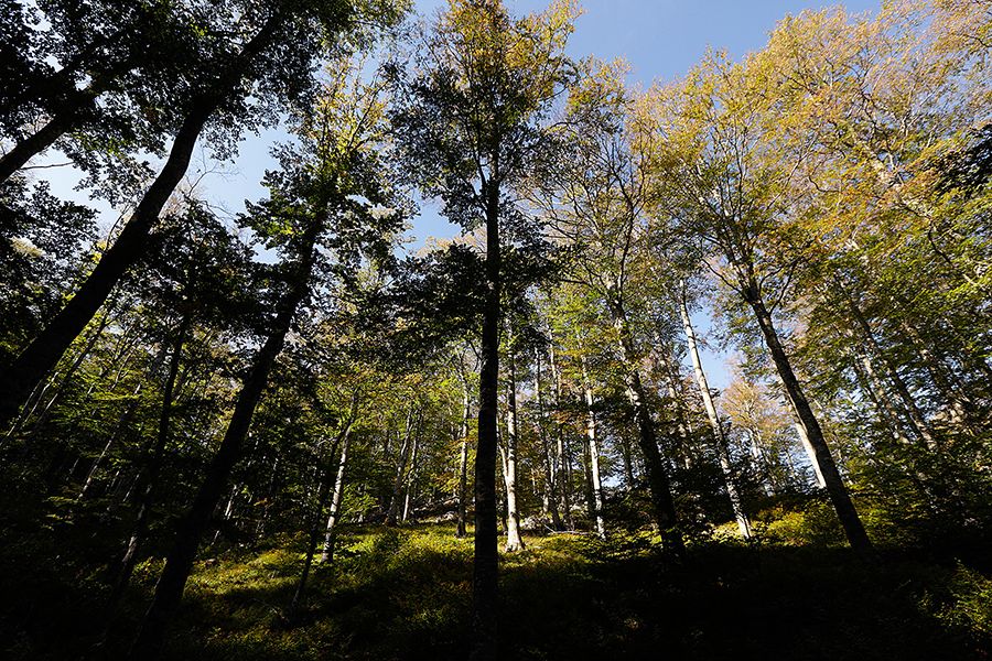
One of the things I love about Sarajevo is that it’s surrounded by mountains. This is Trebević and that beauty in the back is Jahorina, isn’t it wonderful? And seriously, this is only a 3-4 hour hike from city centre. As a Dutchie I’m used to dríve twice as much before I could even get a glimpse of some peaks. So yeah, for me this is really special. And I love it 🙂Sarajevo, A Concrete Gem Amidst Mighty Mountains
Biking in Bosnia and Herzegovina
Up up up to Bjelašnica. I’m back on the road again… By bike! After a 7 month hike I’m reunited with my old love. She’s gonna take me to Buna, Neum, the Croatian coast and hopefully back to Zagreb. No idea how long it’s going to take, no idea what the weather will be like, but we’re gonna give it a try 🙂After a pretty late start in Sarajevo, I biked up up up until I found a nice place to camp. Oeff, I forgot how tough biking on a fully loaded bike is. And oeff, there are some muscles that I didn’t use for a long long time! During the night the temperature dropped below zero, but believe it or not, the morning sun is warm. I think I even got sunburned today! This is a view on Bjelašnica on the right and Visočica in front. One of my favorite mountains ánd favorite roads through the Bosnian mountains. Happy to be back!Might be a brand new road, it’s a pain in the ass. Or legs. So much steeper than it seems. When you stop it’s difficult to get yourself rolling again. If you don’t stop, you don’t get to see the views behind… Bikers issues. This is my second day on the bike and I kind of realize that on a bicycle you really have to push through sometimes. It’s a completely different sport. I actually have to go much deeper than when I’m hiking. It’s interesting, it’s painful, but most of all it’s super, super beautiful. All of it.And that snowy mountain is Treskavica. It’s one thing to cross all those mountains on foot, you get to feel and experience them. That’s what I did last year when I hiked the Via Dinarica White Trail. By bicycle on the other hand, you get to see them. You see how they are connected, how they form the landscape, but also how each mountain has its own character. It’s own shape with it’s own specific features. This is perhaps why I like to go back to places, why I like explore both by bike and on foot. It’s like a puzzle that slowly starts to show an image. I need time to see that and I love the process of this image that is growing, getting its shape. While growing, shaping and forming they nestle themselves in me. Those mountains. I’d like to get to know them, because the more time you spend with them, the more I realize I don’t know them at all.Hello Herzegovina! Such a good idea to make a detour on the south. Although it can get windy, it’s much much warmer. It feels like spring!˝Servis Bicikla˝ It’s funny, this bicycle sign reminds of home. It’s a universal sign, I know, but still it feels Dutch. #fietsen And my bike is alright, one flat tire, but no need for a service yet.
Biking the Via Dinarica Blue Trail in Croatia
Hello blue sky! After taking this photo I rolled down into the Cetina canyon, gorgeous, but terribly cold. Couldn’t believe the difference with just a few minutes before. Later, while my tent turned into an iglo, I scrolled down all the blue sky photos I took. Oeff, nature is strong. And oeff, I’m so thankful to experience it all.Brrrreautiful BivakBiking Via Dinarica Blue Trail, Omiš. Ok, I have to admit that I want to walk up that white rocky mountain there, pitch my tent far away from the road and enjoy this powerful feeling of sleeping alone in the wild. Instead I take a super long lunchbreak at the pier, stare at my bike and give my feverish body what it needs. Warmth and rest. Not so bad neither.
Looking back, thinking feeling writingIn the middle of a thought…Split, Croatia. This is where I decided that it was enough for now. A perfect moment to stop. For now.It’s a way of living. I choose to do so. I live on the road. I choose the Dinarides to do so. ~~~~~ I’m on my way. There’s no conclusion, I’m rather in the middle of a thought. “What is your message?” a friend asked. “I don’t know.” There are loads of things I want to say, stories I want to tell, thoughts I want to share, places I want to show. But a message? It would be good if I had one. One clear message. “That’s okay, then you are the one that opens doors.” I think he’s right. I open doors. ~~~~~ One week ago I opened a new door. One for myself. Or actually I closed one, which made it possible to open new doors. I decided to give up my house in Amsterdam, stopped the rent and CHOOSE to keep on doing what I’ve been doing for the past 18 months. ~~~~~ Trekking around, Exploring the Balkans, hiking the Dinarides and sharing my stories with the virtual world. ~~~~~ It’s a way of living. I choose to do so. I live on the road. I choose the Dinarides to do so. ~~~~~ Photo credits to Kristel without Instagram.Jeheej! I’m nominated for the Dutch Hiking Blog Award!~~~~~˝Last year Eva hiked many kilometers through the Dinaric Alps, on Vibram FiveFingers shoes. After that she went back to Amsterdam. Once she was there, she decided to continue with a new Adventure: walking back to the Balkans; ˝From Amsterdam to Sarajevo˝, again on FiveFinger shoes. While she’s hiking, she keeps a blog EVAdinarica Project where she shares her experiences in an open and honest way. Not only the beautiful side of the story, but also the difficult emotions and the things she struggles with. Especially that is what’s so special about her blog: it is honest and real.˝~~~~~No need to say that I’m so so honored…~~~~~Ok, so usually I don’t ask, but… sharing is caring. And voting too. So, if you like reading my stories and if you would like to support me keep on writing and hiking, please vote via the link in bio 🙂~~~~~Thanks a million!~~~~~Liefs,Eva~~~~~
ViaDinarica{source}
{/source}
{source}
{/source}
{source}
{/source}
{source}
{/source}
{source}
{/source}
{source}
{/source}
{source}
{/source}
{source}
{/source}
{source}
{/source}
{source}
{/source}
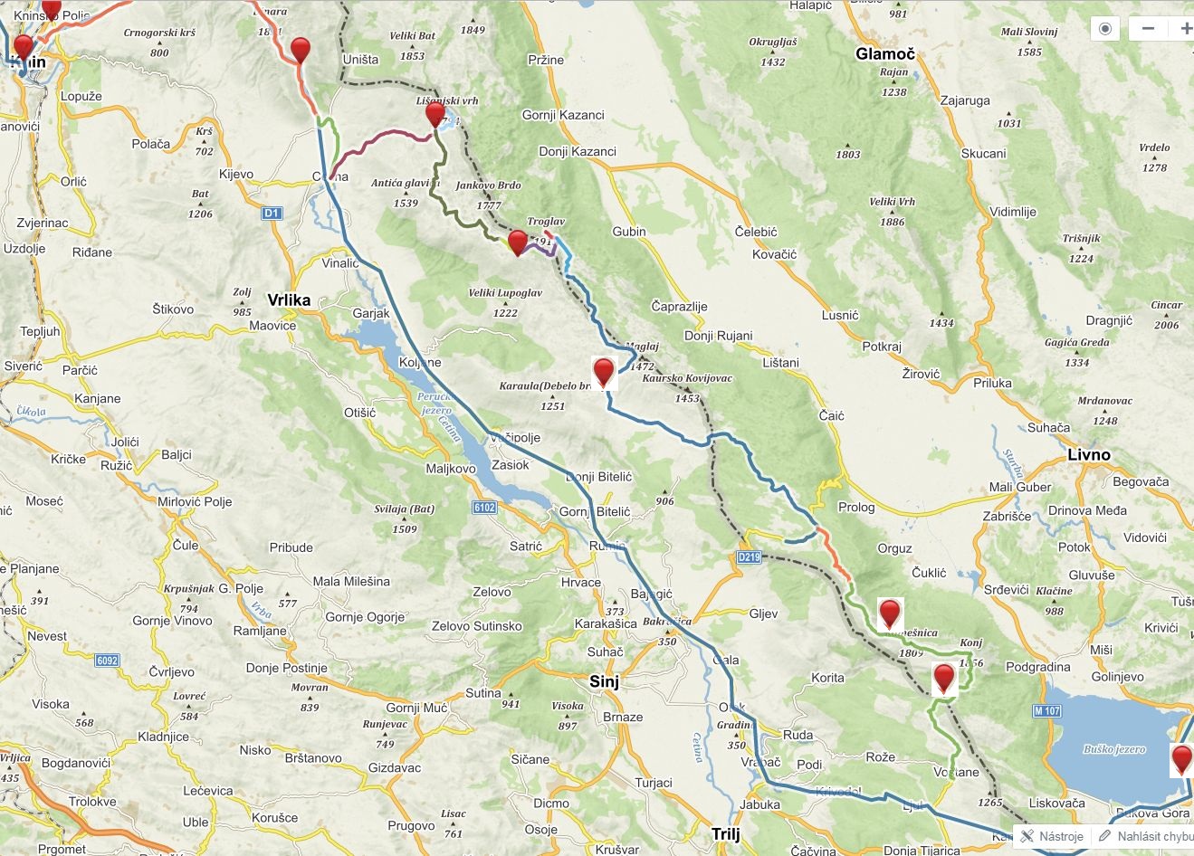
Via Dinarica climbs over Dinara, highest peak of Croatia, and then descends to the valley of Cetina and later joins with pilgrim route of Our Lady of Sinj till Bosnia and Herecegovina (I heard there will be some changes to route and will lead via mountains next year). Since we first saw this on the map we started to flirt with the idea of alternative hike via mountains. We really like hiking up in the hills and staying at high elevation if possible. And there are really beautiful mountains on the borders. So we started researching options and found trail, also called Put Oluje (relates to military operation from 1995 - Operation Storm). I don't like idea of war related naming, so we prefer to call this just Troglav and Kamešnica hike. There is not much information about this, but it appears on OSM maps and there is an organized hike every year by a mountaineering club Dinaridi. Thanks to them there are beautiful huts on the trail, open for anyone, most of them with water cisterns (very important!). Still, I was bit concerned about this hike. It is crossing state borders, there are still suspected mine areas and it is quite remote so not many people go there. For me, it was definitely an adventure.
In Knin we resupplied for 7 days as there is no option to get any food.
Blue line - official Via Dinarica going via valley Colorful line, red points - alternative we hiked via mountains
Dinara
We climbed from Knin to Brezovac much faster than expected so after lunch break at the hut we decided to continue to Dinara and sleep at Martinova košara. The hut was not very appealing to me, but it had great water source so we decided to pitch a tent outside. Just after we started cooking dinner, lovely dog (husky) came to visit us. He and his master invited us to their kuča and vrt (house and garden). He has lovely house not far from the trail and comes to Martinova košara for water as it is much better than water at his place. Young guy, in his early 20s, repaired old family property and now uses as weekend house. It was very welcome alternative for sleeping in a tent and we tasted from his dinner - delicious.
Brezovac was full. We got there beer, radler, mineral water and invitation for dinner.
Yummy strawberries everywhere
Climb to Dinara
At the top of Dinara
Almost at Martinova košara
Nor me neither Katka like the interior of the hut
Luks, lovely puppy which tried to help us with cooking/eating dinner
Evening at Nikola's place
Thank you very much for your hospitality
Source of Cetina
Descend down to Glavaš and Cetina was easy, although we struggled a bit on the section Glavaš Cetina. Easy terrain, but no visible trail nor markings and very very hot. We looked forward to Cetina source and it didn't disappoint us. Magical place, where water springs from underground in form of 100 vertical shaft or maybe more? There are still places waiting to be explored and this fascinates me here in Balkan. We gave up the idea of swimming in this place, the water was freezing cold. Besides, I would be scared to death to swim in such deep place, which is actually a cave. As all the trees have been cut here (to have better view of this natural gem), we walked a little bit along the river to find cool place for relax. It was busy with local people enjoying lovely weather and cooling drinks in the water. After I practiced my Croatian with two men, they were impressed with our hike (Slovak people do not go often here, Czech people much more), we received a tasty piece of freshly grilled pršut from them.We planned to hike to hut Rupe in the late afternoon, developing storm has forced us pack earlier. Climb is quite ok, but as the storm gets closer, we rather hide at the door of one of the ruined housed. Hiking amongst lightning is not my favourite. Rupe hut was a lovely place to sleep in, with some rain water and beautiful view, especially when sun came out after the storm.
Glavaš, old fortress on descend from Dinara
Kilogram of bacon, just enough for 3 people for 7 days
Magic Cetina source
Rupe, lovely hut, enjoying the view after storm
Pume
First time on this trip when we have to put on wet clothes plus strong wind, time for jackets. Due to strong wind we decide to hike more or less directly to another hut, Pume. We will leave Troglav for tomorrow, Kubo is very sad about skipping ridge walk from Jankovo Brdo to Troglav, so we at least hike Velika Duvjakuša instead of road. Pume hut is hut De Luxe. Water, gas, electricity, nice sitting with views - even of the sea. We decide to stay here although it is still early, but in such wind there is no point to continue. And it would be sin to skip this lovely hut.
Leaving Rupe in strong wind
Marin Bunar, the only natural water source, tasted like herbal tea
Hike to Velika Divjakusa. Ridge from Jankovo Brdo to Troglav in background
Memorial on Velika Divjakusa
Hut De Luxe
Relaxing at the hut. It had even very good cell reception
For Slovak and Czech speakers - Ne hladiti piče
Troglav
Next day we start by hiking Troglav. From the hut/road it is very short climb. Surprisingly, there is a wind shadow just on the top thanks to the steep slopes from the BiH side. Then we have choice - hike the road or trail. Problem - mine area. As we need to stick to the road or trail,I prefer the road, as it is more easy to follow. I don't have good experience with trails. I was bit nervous about this, and it felt very strange to be in place where not so long ago people were putting landmines. I felt disappointed and angry, why are people so bad and stupid? We rather decided to skip ascend to Maglaj as there was no visible trail and I was afraid to go there just following gps. We were in landmine area. Sv. Jakov hut was closed, but there was water and nice sheltered benches, ideal for night. After the sunset the wind changed its direction and we were not sheltered anymore.We planned early start as tomorrow would be very long day.
Troglav
Pano from Troglav
Descending from Troglav
Difficult decision, road or trail?
Military barrack at beginning of mine field
Opasnost, mine. Strange feeling
Mine area, trail is cleared. Safe trail corridor was marked, but I was still happy with our decision to hike the road
Our camping spot at Sv. Jakov
Mračna pećina, Kurtagić dolac, Bunarić
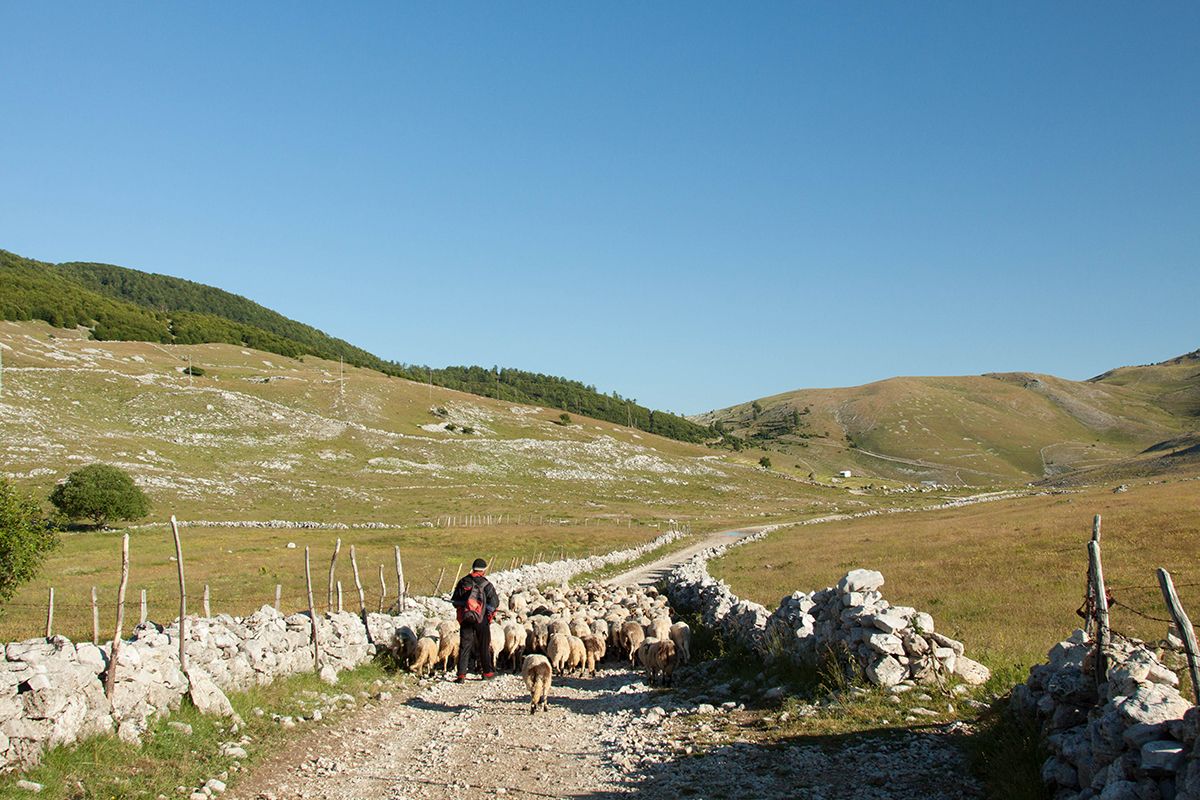
Hiking already at 6 am, our record, we knew it will be long day and wanted to avoid heat. First crossing the plain with sheep and then up the hill to the border with BiH. A lot of markings, some very old, some new, but trail almost no visible at all. Relying on GPS, but when GPS differed from markings, we had to pay very close attention to finding them. Three pairs of eyes were very helpful, but still we experienced few situations when we lost them and had to backtrack a lot. Everything in burning heat. Our first stop - Mračna pećina, accessible cave with excellent water. Very good spot for lunch break, escape from heat with cold water. Then we continued, again losing and finding markings till we crossed the road just under pass Vaganj and started climb to Kurtagić dolac. We passed by not very nice well with water, but didn't refil (mistake). At the top we found ruins of old hut and after another half an hour we reached new hut Edo Retelj in picturesque area of Kurtagić dolac. But there was no water in the tank. We tried to explore area with spring shown on map, but it was nothing just a hole with a lot of green plants. I believe there is some water there, few meters under, one just needs to dig. It was almost 6 pm, so we had to decide quickly. Continue via ridge to Bunarić (bunar means water well/spring) where should be some water. Almost 3 hours of hiking, but it was the best hike. Sun was slowly going down, beautiful trail, views and little bit of tension - will there be water? What do we do if there is nothing? We had cca 1 litre of water for all of us. Timing was right, we reached the hut just when it got dark. And there was water, at 1600 meters above sea level. Lovely small bunar with perfect cold water. Best drink ever. We hiked almost 15 hours, it was much longer as we expected (we didn't even dare to think we would go to Bunarić). So we enjoyed evening and slept in next day till 9 am as we had very short day ahead of us. We basically slept just under Kamešnica.
Long plain to cross, Kamešnica in the background. We had no idea we will sleep under that hill the same day
Mračna pećina, accessible cave, great place for relax in hot weather
Cool tasty water from the cave. Full of calcium?
Nothing resembling trail, thanks for the markings
Vaganj pass, road leads to local border crossing point
Markings
Wonderful Kurtagić dolac, but without water. We have to hike another 2,5 hours
One of the best hikes, ridge walk to Bunarić, Kamešnica
Descent before ascent to Bunarić. Kamešnica in the the last sun
So happy to find water
Bunar that saved us. Thank you!
Kamešnica
Deserved relax at the hut in the morning before we hike the last section of these mountains. Kamešnica and Konj, with views of large valley in BiH and Buško jezero. We dream of swimming there. Descending towards Croatian side and our last hut before we leave (now officially) Croatia. Sv. Mihovil is a recently built hut with water reservoir. Short day, but there is no point to continue.
Bunarić hut, morning relax
Hiking ridge towards Konj, Buško jezero on the right
Looking back at our ridge, BiH on the right, Croatia on the left
Sv Mihovil hut, our last hut in Croatia
Kamensko, Buško jezero
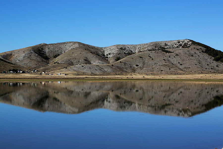
Fast descend from the hut to Voštane, famous for making pršut. We hope to buy some there, but the factory had no shop. Soon we rejoined Via Dinarica on the pilgrim route of Our Lady of Sinj and hiked to Kamensko. First real food after Knin, tasty food at the bar. We opted to hike via major border crossing Kamensko, it was fun to be walking there among cars. In BiH trail leads through more civilized areas so you can expect some shops, restaurants. Buško jezero was great for swimming. We checked Monastery of St Elijah (accommodation was too expensive for us, but had free wifi available outdoors). Wild camping at the other side was also good option for us. This was place were Tomáš, Katka's boyfriend, picked us up by car and next day we headed to family reunion in Zadar, Croatia. We spent there almost week (finally holiday at sea) and then returned back to Buško jezero to hit the trail again.
Back on Via Dinarica. Too much sun on exposed road
Some shade, thank you windmill
Dreams come true. Yesterday just a dream, today reality. Swimming in Buško jezero
Popular place for local people.
Sun setting behind Konj. Yesterday we were standing up there
Meeting with Tomáš. We enjoy having car and eating out. Heading to sea for a week break from trail.
Recovering at sea. Healthy mud from Nin to heal our bodies
Written by Lenka Syrovatkova
{source}
{/source}
{source}
{/source}
{source}
{/source}
{source}
{/source}
{source}
{/source}
{source}
{/source}
{source}
{/source}
{source}
{/source}
{source}
{/source}
{source}
{/source}
On Top of the World in Sutjeska National Park
This past summer we hiked a 10-day section of the Via Dinarica Trail (VDT), so we decide to write this Via Dinarica Trail Guide! Our route on the VDT took us through 138 km (86 miles) of the Dinaric Alps, totalling an elevation gain of about 8,000 meters (26,200 feet). We started in Bosnia-Herzegovina at Sutjeska National Park and ended in Montenegro just shy of Biogradska Gora National Park. A few of our days were quite flat, but most had steep ascents yet moderate descents. The breathtaking terrain ranged from dense pine forests to flower carpeted mountain pastures to alpine zones dotted with emerald lakes to forest-ponds teeming with fish. If you want more details about our route, read Our Via Dinarica Trail Itinerary.
And, while we had an absolutely fantastic time, we definitely learned some things along the way! We’ll share those with you down below in our Via Dinarica Trail Guide, so that if you decide to set out on this incredible route, you’ll have a smooth and satisfactory experience.
But first, a bit of background on the Via Dinarica Trail and the Balkans.
Hiking in the Balkans?
A mere 20 years ago it would have been quite impossible to safely hike in the Balkans. Yugoslavia was in the midst of a bloody war, and as its republics were at war with one another, it would have been unlikely if not downright dangerous to try and cross from one into another.
Fast forward 20 years however, and now the Via Dinarica Trail (VDT), a nearly 1,200 mile route following the spine of the Dinaric Alps actually weaves its way through many of those previously warring republics. The trail starts in Slovenia and goes through Croatia, Serbia, Bosnia and Herzegovina, Montenegro, Kosovo, and terminates in Albania.
The trail covers terrain ranging from limestone karst fields, to flower carpeted alpine pastures, to steep and rugged river canyons to dense pine forests to alpine zones dotted with emerald lakes to forest-ponds teeming with fish. It’s spectacular, and it’s largely undiscovered by mainstream tourists, so we recommend you go now.
1. Pack Right but Pack Light: Our Gear List
I’ve thru-hiked the entire 2,200 mile Appalachian Trail, I’ve thru-hike nearly the entire 273 mile Long Trail, I’ve backpacked in countless other places across the United States, and I’ve also done a good bit of backpacking in Asia as well as Europe. In my 20+ years of experience, I’ve discovered 2 things about packing. (1) Light packs make happy hikers and (2) people tend to pack their fears.
If you can leave some of your fears at home and trust in my experience, the list below details exactly what you need to safely and comfortably hike a section or even the entire Via Dinarica Trail. This Via Dinarica Trail Guide is quite comprehensive.
This is all the stuff my wife and I used this past summer, and we know it’ll be sufficient for you too.
Via Dinarica Trail GuideJulia and My Timetested Gear
Linked below are the exact items we used and/or recommend.
Clothes Gear List
The bottom line is you need one pair of clothes to hike in, and one to sleep in. I know this might sound nasty, but anything you wear while hiking is going to get sweaty and dirty right away, and therefore extra clothing will just be unnecessary pack weight.
Hiking Shoes: Julia’s, Seth’s
Low Cut Wool Socks (2 pairs per person): Unisex option
Zip Off Pants, non-cotton (1 pair per person): Female option, Male option
Quick Dry T-Shirt, non-cotton (2 per person): Female option, Male option
Quick Dry Underwear (2 pairs per person): Female option, Male option
Raincoat (1 per person): Female option, Male option
Rain Pants (1 pair per person): Female option, Male option
Long underwear top, non-cotton (2 tops per person): Female option, Male option.
Long underwear bottom, non-cotton (2 bottoms per person): Female option, Male option
Down Parka (1 per person): Female option, Male option
Wool Hat, mid-weight (1 per person): Unisex option
Light Gloves, smartphone friendly (1 pair person): Unisex option
Waterproof Mitten Shells (1 pair per person): Unisex option
Hats for sun, with neck flaps (1 per person): Unisex option
Hiking Gear List
A Via Dinarica Trail guide wouldn’t be complete without a gear list. So read on
Via Dinarica Trail GuideHiking and Sleeping at Elevation Means You Need the Right Gear
To the extent that you can afford, but the lightest weight gear you can. Again, light packs make happy hikers! For some of these items, such as the hiking backpacks, sleeping bags and pads, the most important thing to consider when buying them is comfort and fit. For those items below, we’ve linked to the things that fit us best, but make sure to try a bunch of different options before settling on a pack, sleeping bag and pad. Also, these are our affiliate links, but we fully endorse all of these products, otherwise, we wouldn’t have included them here!
Hiking backpack (one per person): Julia’s, Seth’s
Sleeping bag (one per person): Julia’s, Seth’s
Sleeping pad (one per person): Unisex option
Hiking poles (one pair per person): Unisex option
Stove (one per party)
Fuel bottle (one per party)
Cooking Pot Set (one per party)
Cooking utensils (one set per party)
Sponge
Water purifier (one per party)
Back up water purification method (one per party)
1L Wide mouth water bottle (2 per person)
3L Water storage container (one per party)
Matches/lighter
Spices
Biodegradable Soap
Spoon/Fork/Knife (one set per person)
First Aid Kit
Parachute Cord 50’ (one bunch per party)
Trowel (one per party)
Toilet Paper
Toothbrush
Headlight (one per person)
Camera
Knife
Compass
Tent (one per party)
Packtowl (one per party)
Pack cover (one per person)
Inflatable Pillow (optional, one per person)
Nylon stuff sack(s) to make bear bags
Emergency whistle
2. Get Cross Border Permits
***Quite possibly the most important section of this entire Via Dinarica Trail guide is right here.*** We almost learned this lesson the hard way. To make a LONG and boring story short, you most likely need cross border permits to cross any international border on the Via Dinarica Trail. Let me explain.
Via Dinarica Trail Cross Border Permits Via Dinarica Trail GuideGet Cross Border Permits
Follow along by looking at the above map. Originally, we planned to follow the string of yellow stars up to the huts on Mt. Maglic, cross from Bosnia Herzegovina into Montenegro via the Via Dinarica Trail, and then continue hiking south.
However, on the morning we were scheduled to start our hike, we discovered we should have applied for cross border permits (we should have done this weeks before) in order to legally cross into Montenegro from Bosnia Herzegovina. Although some locals said we didn’t need such permits, we didn’t want to take the chance of being fined and/or thrown in jail for making the crossing illegally.
So, what we ended up doing is: On day 1 we started at the road and hiked up to the huts. We slept up in the huts, and they were beautiful! Check out Where to go Trekking in Bosnia and Montenegro for more about that. On day 2 we hiked from the huts back down to the road. Then, we took a bus north to Foca and then south to the formal border crossing. At the border, we got entry stamps in our passports, and then we rode the bus a little further. We got off the bus, and we actually hiked back up the trail in the opposite direction. Even though hiking in the opposite direction meant on day 3 we would have to retrace our steps, we didn’t want to miss this beautiful stretch of trail.
So, I’m now thinking that I didn’t make this long story short, but the moral is: make the choice to get the permits, or not, based on your own personal risk tolerance. This company, Zublo, can help you with the process.
3. Have GPS Maps and Paper Maps
A Typical Trail Marking Trail Marking Via Dinarica Trail GuideA Typical Trail Marking
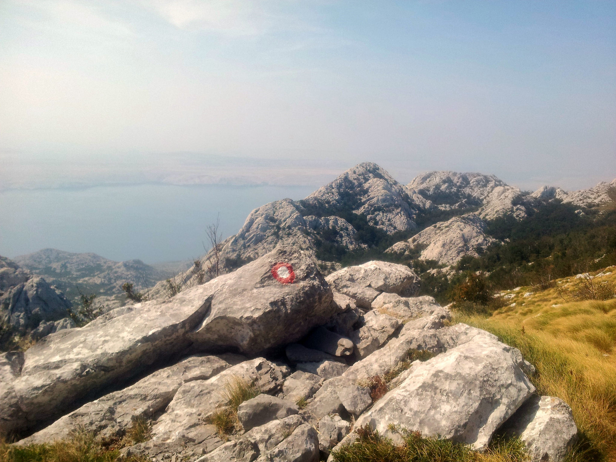
Almost as important as cross border permits are GPS and paper maps. While the Via Dinarica Trail is gorgeous, it’s often times VERY difficult to find the trail markings. On the stretches of trail that go through national parks, the trail is well marked by a red circle filled with white.
Via Dinarica Trail Hard to Follow Trail Via Dinarica Trail Guide
Beautiful but Hard to Follow the Trail Here
However, outside of the national parks, the trail is often NOT well marked. Further, much of the trail goes through tall grassy pastures. In those sections, the trail markings (which are often painted on rocks) are completely obscured by the tall grass.
Via Dinarica Trail Website Via Dinarica Trail Guide
Via Dinarica Trail Website for GPX Files
I highly recommend you download the GPX files of the stretches of trail you’re planning to hike, upload them into Google Maps, and then drop pins every few hundred meters along the trail. You can find the GPX files on the VDT website. This process is tedious, but it saved our butts, countless times. For more info on how exactly to do this, check out this video about Plotting Courses Using Google Maps.
Although there are paper maps for the national parks through which the trail runs, as of July 2017, I couldn’t find any paper maps that specifically cover the Via Dinarica Trail. So, I made my own by screenshotting and the printing the topo maps that you can find on the VDT website.
4. Consider Guesthouse/Hut Hopping
Via Dinarica Trail Planinarski Dom Mountain Hut Via Dinarica Trail GuidePlaninarski Dom Mountain Hut
If you plan your trip carefully, it’s possible that you won’t actually have to spend too many nights sleeping in a tent. I like camping out, so I’m not too concerned about this, but if you do want to hut hop, again, you can look at the maps on the VDT website, and you’ll be able to find a guesthouse/hut about every 10-20 miles (16-32km).
5. Bring Along a Small Stash of Cash
Via Dinarica Trail Bring a Small Stash of Cash Via Dinarica Trail GuideBring a Small Stash of Cash
It never hurts to have a little cash with you, but make sure you have the proper currency for the country you’re in. Bosnia Herzegovina uses the Bosnian Convertible Mark (BAM). Montenegro uses the Euro (EUR). The national parks we entered had a 3 Euro fee. There were also a few spots along the trail where we encountered some small country shops, and it was nice to be able to buy a little snack. There was even a point in a town where we needed to catch a taxi. You never know what unexpected expenses may pop up, but one thing you can be certain of is that there are no ATMs way up in the mountains. We think if you bring the equivalent of US$50-100 in the local currency you will have more than enough money.
6. Download Some Translation Apps
Via Dinarica Trail Google Translate was a Lifesaver Via Dinarica Trail GuideGoogle Translate was a Lifesaver
A Via Dinarica Trail Guide in 2017 wouldn’t be complete without some technology tips. For us, the experience of hurtling a language barrier usually falls into one of two categories: (1) comical and playful or (2) nightmare. We’ve found, the more planning we do up front, the more often we’re in the first category. Again, find out the local languages and plan accordingly. Google translate works offline for some languages, but not for others. Fortunately, we were able to use it for both Bosnian in Bosnia Herzegovina and Croatian in Montenegro.
7. Bring Thank You Cards (or Lightweight Thank You Gifts)
Via Dinarica Trail So Much Hospitality Via Dinarica Trail GuideSo Much Hospitality
Along the trail we were show an overwhelming amount of hospitality. We were taken into people’s homes when it was raining, we were given coffee and beer, we were allowed to camp in people’s backyards, and we were even given a mountainside cheesemaking lesson (if you want to read all about it, check out Where to go Trekking in Bosnia and Montenegro), yet all we had to offer were words of thanks and some dried meat we had in our packs.
Via Dinarica Trail Mountainside Cheesemaking Lesson Via Dinarica Trail Guide
Mountainside Cheesemaking Lesson
Certainly, none of the kind people along the trail were expecting anything, but a simple thank you card would have been perfect. Next time we set out, we might even bring some lightweight gifts such as herbal tea and spices to give as small thank you gifts.
8. In a Pinch, Wave a Bus
Via Dinarica Trail Wave to Flag Down a Bus Via Dinarica Trail GuideWave to Flag Down a Bus
Up in the mountains of Montenegro, things are pretty informal. While hitchhiking isn’t particularly common, and thus we struggled to thumb rides, we were quite successful at waving down busses. And while hitchhike isn’t hiking, this Via Dinarica Trail Guide wouldn’t be complete without this piece of advice. Basically, we were able to stop a coach bus, and hop on (for free) until the next stop. Keep in mind, up in the mountains there aren’t many formal looking bus stops, so we just waved when one was coming by, and voila!
9. A Little Difficult for Vegetarians
Via Dinarica Trail A Typical Meal of Meat and Potatoes Via Dinarica Trail GuideA Typical Meal of Meat and Potatoes
While there were a few places where we had some small salads, the majority of the food we encountered along the trail was quite literally, meat and potatoes. If you’re a vegetarian, be prepared to eat a lot of bread and cheese, which is actually not too bad of a charge.
Via Dinarica Trail Kaymak Cheese Via Dinarica Trail Guide
Kaymak Cheese
The bread and cheese in both Bosnia Herzegovina and Montenegro were incredible. If you have a chance to sample some Kaymak, this creamy cross between butter and goat cheese was so delicious that we ate it by the spoonful!
10. Be Mindful of Water Sources
Via Dinarica Trail Maratinje Reservoir Via Dinarica Trail Guide
Maratinje Reservoir
Some parts of the trail had ample water sources, and others were quite dry. We never had to spend the night at a dry camp (a campsite without a nearby water source), but that is because we did some careful planning up front. Use the topo maps on the VDT website as well as Google Earth to locate water sources, and plan your route accordingly. And of course download this Via Dinarica Trail Guide, so you can use it in the back country.
11. Watch Out for Wildlife
Via Dinarica Trail A Possible Bear Track Via Dinarica Trail GuideA Possible Bear Track
Much of the Via Dinarica Trail goes through Grizzly country. While we never encountered any large mammals, and certainly not any bears, we made sure to put anything with a strong odor (toothpaste, soap, food, etc.) into bear bags and strung them up in tall trees each night.
Most often, bears will not bother you unless you startle them. To reduce the chance that you’ll sneak up on bears or other animals, singing some songs, banging sticks together, or even hooking a small chain of bells to your pack are all effective ways to make noise and thus to keep the bears away.
12. Emergency Preparedness
A Via Dinarica Trail Guide needs to include these safety tips. The medical facilities in the capital of Bosnia Herzegovina and Montenegro, Sarajevo and Podgorica respectively, are quite good. However, out in the more rural areas, the ones you’ll be in if you’re hiking on the Via Dinarica Trail, are less robust. To this end, we brought a small yet comprehensive first aid kit with everything from basic bandages to some simple oral antibiotics (and guides about when/how to use them, such as this one).
We also strongly suggest you bring a cell phone. Buy a sim card before you head to the hills, and in an extreme emergency, you can dial 122 in Bosnia Herzegovina as well as Montenegro for the Police.
A Via Dinarica Trail Guide is Good, but Get Hiking!
So there ya have it, our Via Dinarica Trail Guide! After our nearly 100 miles, we’ve come up with these 12 bits of advice. If you’d like more details about our trek check, again, read Our Via Dinarica Trail Itinerary, and then lace up our boots!Source https://www.forsomethingmore.com/via-dinarica-trail-guide/
{source}
<script type="text/javascript" src="https://trail.viadinarica.com/en/tour/long-distance-hiking/via-dinarica-white-trail/17291189/tour2go"></script>{/source}{source}{/source}{source}{/source}{source}{/source}{source}{/source}{source}{/source}{source}{/source}{source}{/source}{source}{/source}
By Tim Clancy and Kenan Muftic
Are we feeling nostalgic because another year has passed or are we excited to build on the accomplishments of last year? One thing is for sure, 2016 was the Via Dinarica’s first ‘official’ year in existence, with hikers from all over Europe and North America trekking the entire 1,260 km of the White Trial from Slovenia to Albania (or visa versa). We had spoken about and pondered the Via Dinarica for years. We hiked, photographed, promoted, and explored the endless possibilities and potentials of this great concept. But we were still far from the Via Dinarica being a functional long distance trail. Well, until now. After months of marking and working out the small details and glitches on the trail, the White Trail has finally been defined and open to the world of hiking enthusiasts. In Bosnia and Herzegovina we managed to complete and fully marked the White Trail from Busko to Trnovacko Lakes, extending from the Croatian border to the west all the way to the Montenegrin border to the east. We marked more than 180 km in BiH. We mapped 45 stages in five countries. We helped open four newly established family guesthouses. All of the mountain huts along the most attractive stages of the BiH section got electricity supply through solar panels by donations from UNDP. Having all of these achievements under our belts we were ready to officially open the White Trail in Bosnia and Herzegovina in June. But even with the ribbons cut and online maps uploaded, the trail was still not whole. It becomes so by being walked. So even though the trail opened in June, we had some impatient Via Dinarica fans who started their journey hiking from Slovenia in early May. To our team’s knowledge there were six trail blazers that completed entire trail in its first year. Many hikers trekked certain stages and even more hiked the more popular sections of the trail in all five countries. Most enjoyed fully its unspoiled wilderness but some were also surprised at that the infrastructure (or lack of) didn’t meet their expectations. The truth is that some sections of stages are quite raw and can barely be considered as a trail. But this is the new thing for some people…and change here comes at a slower pace. There is undoubtedly a tremendous amount of work still to be done. There are many challenges in maintaining the older and new sections that make the Via Dinarica White Trail. This, however, has sparked a regional debate in the hiking community. Just how developed should this trail become? Do we strive to be like other mega trails that are accessible and, in some cases, overdeveloped or do we preserve the raw and rugged beauty of some of the more remote parts of the trail? Isn’t the ultimate beauty of the Via Dinarica in its pristine wilderness found so near to traditional communities and urban areas? The answer is, we’ll let time decide on that. For those who seeking comfort and good service there are guided tours already well promoted on adventure travel fairs and forums. Primarily due to this promotion, the Via Dinarica has been listed among the world’s top destinations by several well-known magazines. The Guardian included Green Visions’ tour among the 10 best holydays in Europe. The Vogue recommends the Mountain Travel Sobek journey along the Via Dinarica for honeymoon trip, but also as the one of 9 destinations every woman should visit in 2017. Lonely Planet has written several times about the Via Dinarica and the German Geo lists Via Dinarica as top trend destination. The most prestige recognition, however, was the inclusion of the Via Dinarica among the best travel destinations for 2017 by National Geographic Traveler. What does that mean for us, the Via Dinarica folks working day in and day out to make this idea a reality? Perhaps nothing special but it simply confirms that the Dinaric Alps are one of the most beautiful mountains ranges in the world. It recognizes the efforts of the people and organizations striving to promote this region in a positive way. It is also a wake up call to the political establishment who have failed to recognize, protect it[1] and utilize this great development potential. However, for all those involved in developing the Via Dinarica, whether being trail blazers, volunteers, business owners, state or local authorities, these recognitions by world’s famous magazines should be seen as a huge responsibility. If we boast to be among the best in the world, there is no room for excuses and shortfalls. It’s time to roll up our sleeves and go to work! Let’s us embrace the new with this in mind and welcome hikers and others to the world’s best travel destination and wish them that 2017 be the best year ever!
[1] Government policies which support and foster sustainable and rural tourism development are crucial to adventure tourism market competitiveness because they safeguard the destination's natural, heritage and cultural resources and provide a positive investment climate for the private sector. Per ATDI Index, Bosnia and Herzegovina is ranked 194th (third last country) in the world for its practices on sustainable development.
{source}<script type="text/javascript" src="https://trail.viadinarica.com/en/tour/long-distance-hiking/via-dinarica-white-trail/17291189/tour2go"></script>{/source}
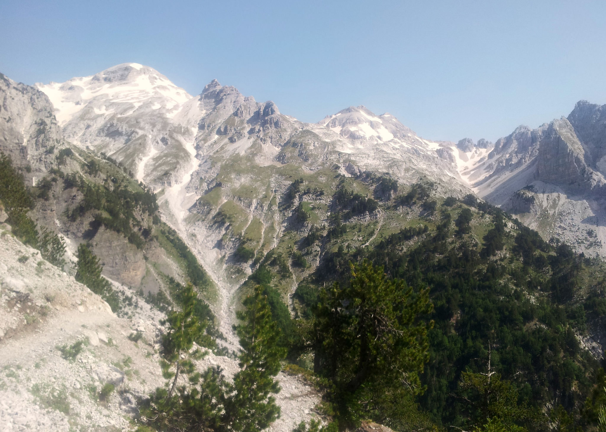
The Via Dinarica is a trail that is still in progress, only in Bosnia and Herzegovina the White Trail is officially open. In the other four countries the route is a combination of old existing trails that all together form a corridor through the Dinarides.With a distance of almost 600 kilometers, the Croatian section covers the largest part of the Via Dinarica.Although the hiking paths between well-known areas like Dinara, Paklenica, Velebit and Risnjak are often overgrown or don’t exist at all, it has been wonderful to hike and experience this part of the White Trail. To be able to enjoy it the best I could, I choose to walk it my way.The first option is to fight your way through the wilderness, – not my favorite – another option is to skip these ‘in between’ parts, but I decided to connect the popular places by hiking the biking trails. A lot of asphalt, yes, but also a lot of time to look around. For me, hiking on those roads was just as much part of the journey as every other part.
Hiking the biking trail
I hike because I can
It’s what I love about long distance trails. To cross a whole region, an area, a country and connecting the dots. Step by step. It goes slow, but with every step you take, a line on the map or another unpronounceable name on your GPS screen turns into something real. Into a story, your story.Dinara for example was just a name of another mountain to me, but once I saw her myself, I understood why the trail is named after her. She absolutely dominates the area. It took me almost three days to reach the trail-head. Three long hot days on old, exposed roads. Behind me the mountain Kamešnica slowly disappeared at the horizon and right in front of me the contours of Dinara became sharper and sharper. Because I was on the road, I could feel her impact growing on me. And because I was on the road, our story started before I could even touch her.Dinara is dry and unpredictable. Twenty minutes before the top, she showed me who’s the boss. With strong winds and dangerous dark clouds, she forced me to turn around. I could not take her and to walk the same way back. Well, what to say… That’s life. That I couldn’t reach the top, didn’t make the hike a waste of time. On the contrary, it made it unique and hey, I got a reason to come back!
8 AM
8PM On the way up to Martinova Košara, a shelter at the foot of Dinara
Martinova Košara All summer long I had a bit of bad luck with the weather. I started to think that there was not only a backpack, but also a peak-devil on my shoulders. Every time this little devil spotted a peak, he ordered some clouds, thunders or wind.. I know I might be too careful or easily scared, but I’ve been in some bad storms in the past, I really don’t want to take any risk now I’m alone.The only thing I could do is look at the bright side. I let the weather decide how and when I could move. Nature was in control and that felt extremely good. I could stop fighting. Stop fighting myself, fighting time, fighting expectations. Letting the weather decide made me feel peaceful and relax.I had enough time, I could wait. Wait out the bad weather and give my body and mind some rest.
Happy optimistic hiker…
Lovely Tatekova Koliba No such thing as bad weather? #bura ?
At Crnopac I spend three nights in the lovely Tatekova hut, because there was an extremely strong wind, the bura. I didn’t get the chance to hike the Mali Princ trail or climb the Crnopac peak, but it was a beautiful experience to be completely isolated from everything and everyone. I loved it. And I will come back for this Mali Princ, for sure.In Paklenica NP I got company from a friend from Amsterdam. Together we hiked through the popular Velika Paklenica Canyon up to mountain hut Paklenica. Instead of following the Velebit Trail, we made a little round trip that brought us back to the sea. Two weeks later, when I was back on my own, I choose the less popular NP entrance, the Mala Paklenica Canyon and continued my hike on the Via Dinarica.
Girls on Top
Pose in front of the canyon Pauza between Trees Early morning in Paklenica NP Velebit Trail from Struge to Stap
The 100 kilometer long Velebit Trail from Zavižan to Paklenica, or Velebitski Planinarski Put, is definitely one of the highlights of the Via Dinarica in Croatia. Velebit forms a natural border between the Dalmatian coast and the mountainous hinterland, so you constantly have a great view on the Adriatic Sea. Velebit is Croatia’s pride, it’s their only mountain range that completely lies in Croatia and therefor an absolute must for every Croatian mountaineer to hike the entire Velebitski Planinarski Put at least once.Along the trail there are several mountain and bivouac huts where you can stay for free and where, if you are lucky, can witness the cozy, tasty and noisy Croatian traditions. As a girl (woman) alone, it was impossible to stay unnoticed. Before I could even start to protest, I was invited to share the table and a plate full of local delicacies was put right in front of me. ˝Try! Eat!˝Well, what do you do then?
On the trail, Premužićeva staza (part of the Velebit trail) Bivouac hut Ždrilo in Velebit
Zavižan
After Velebit I had to cross another ‘in between’ part in order to get to Samarske Stijene. Velika Kapela. ˝This part is something special,˝ I wrote in my diary. ˝You’re just a little ride away from the coast and even closer to the mountains. In between there are hills, forests and small villages. The wind blows and the sun is shining. Leafs are falling from the trees and the days are getting shorter. People work on the land or in the wood-industry. Nothing reminds you of the coast tourism, except the views on the sea.˝ It was great to be able to wonder, ponder and look around instead of watching my steps all the time.˝I am on my way to Samarske Stijene. The hiking path still needs too much work to call it a trail. I am too tired to fight my way through it, so I stick to the road. I won’t complain, it’s lovely out here. A different approach, but still an adventure.˝ And that’s when suddenly something big, something brown and fluffy walked out of the bushes right on ‘my’ road. A BEAR!!! I saw a bear while I was on my way to Samarske Stijene.
The right road to Krivi Put
The last ‘pearl’ was Risnjak. A green, forested National Park full of Lynxes… No, I haven’t seen any. From here I left the White Trail and created via my own route towards Slovenia. I wanted to hike from the Croatian Snežnik peak to Veliki Snežnik in Slovenia, but that’s not an official border-crossing. ˝Strictly forbidden!˝ Instead I went further south to the border check-point at Rupa and continued my own route through Slovenia.By hiking this alternative route I avoided the parts where the hiking trails are not maintained and where fallen trees block the path, but again, I walked quite a lot of asphalt. Which I again, actually liked. Quiet and scenic roads through typical rural areas which people might call ¨less developed¨, but in my opinion have more soul than all the touristic coast villages together.Although I spend almost two months in Croatia and hiked, according to my Outdooractive statistics, about 700 kilometers, I still haven’t had enough. There is much more to explore, many places to go back to and plenty of pearls to connect. Croatia’s karst is really really, truly incredible!For more photos click here
Dom Schlosserhof in Risnjak NP View from Veliki Risnjak Peak
{youtube}XeT4peiEU9E{/youtube}
{youtube}PLRKMkWaaG3qkiN3O_DHSv-sSaxlRHF99L&v=7eI6bbKsHN0{/youtube}
On the Outdooractive platform I uploaded this alternative. It’s not finished yet, but it will give an idea of my route.
Visit my page for more stories, photos, news :)
{source}
<script type="text/javascript" src="https://trail.viadinarica.com/en/tour/mountain-hike/incredible-croatian-karst-via-dinarica-white-trail/21280684/tour2go"></script>
{/source}
{source}
{/source}
{source}
{/source}
{source}
{/source}
{source}
{/source}
{source}
{/source}
{source}
{/source}
{source}
{/source}
{source}
{/source}
{source}
{/source}
Although nature does not know borders, borders are often formed by nature. Mountains, rivers and seas are natural borders between different regions, countries or continents. Within these borders, people seem to develop their own characteristic way of living full of local traditions and old customs.Along the Via Dinarica I crossed many borders. Some were natural, some were cultural and some were just lines on a map. Lines that create countries.It did surprise me that hiking through Bosnia and Herzegovina (BiH) felt so different from Montenegro. Different landscape, different mountain-rhythm, different weather and yes, different lives and lifestyles. I even got the impression that the way people express themselves differs from country to country.
The sweetes picknick table on the trail, with on one side Maglić and on the other Sutjeska NP. Fantastic!
In Bosnia and Herzegovina it goes up and down. Everything goes up and down. Day in day out. It’s diverse and intense. Each mountain range has its own micro-climate with its own unpredictable features. Big contrasts. They are unpolished, rough, wild and pure. On Čvrsnica I had flashbacks to the Pyrenees, the forest at the foot of Treskavica reminded me of Berdorf while Prenj has more of an Alpine vibe. Vran is a character on its own. Dry, exposed and misleadingly steep. And Bjelašnica is cute and dangerous at the same time…
Hiking the Via Dinarica in BiH felt like a ride in a roller coaster. A big storm of impressions and emotions, but when the ride is over, you want to stay for the next round…
I had enough for today, not knowing that this was just the beginning…. Here I still like the Rakitnica Canyon… Waiting out the bad weather at Donje Bare… Pompiedom…
Misty peak on Zelengora… It’s really a peak. Really!
To this day the Balkans and especially Bosnia Herzegovina is unknown territory for many people. It remains a blind spot within Europe and the outdoor community. It is still associated with war and poverty instead of the beautiful, wild and untamed nature and mountains. From the Montenegran border to Croatian border the trail goes along BiH’s magnificent massifs and National Parks. Perućica, Sutjeska, Zelengora, Treskavica, Visočica, Bjelašnica, Rakitnica, Prenj, Čvrsnica, Blidinje, Vran and Svinjar.I cannot deny the scars of the past are still well visible in some areas. You will surely see houses in ruins, abandoned villages and warning signs for landmines, but the BiH nowadays is anything but a bleak and unsafe place to be. I have experienced exactly the opposite.
Love on the trail ? The sweetest and oldes lady on the Via Dinarica! Preparing a traditional Bosnian dish… That’s why they’re cleaning a cowshead…
Zelengora Once I crossed the border, the landscape changed. A beautiful well marked trail through the Perućica primeval forest and Sutjeska National Park was on the agenda for the next two days. Zelengora on the other hand was a bit of a search. Stunning nature, but poor marked. Besides mountains, there are loads of lakes along the Via Dinarica. At Orlovačko jezero (lake) I bumped into a group of 8 men who were about to have a feast meal. Of course I would like to join, which hiker says no to food?
Treskavica Kalinovik was the next town. What can I say, it’s a place that breaths the history of the last war.. Like I said before, in Bosnia and Herzegovina it goes up and down. Everything. In nature I saw and felt harmony, because of those contrasts. Because of the ups&downs. One day you hike up all day long, the next you cross the mountain range and the day after that you descend to the next town. The mountains are untamed, you never know what to expect, but every single step and all climbing and searching is definitely worth to enjoy. About searching for the route, the difficulty is the lack of consistency. Most parts are full of signposts, marks and hiking paths. Ok, not like the Alps, but that’s the beauty of this trail, it’s wild, not a hiking highway. In BiH there absolutely is a trail, but on many places it could be improved. What I found confusing is that the GPS track not exactly matches the path that is marked. In that case, I choose the path, but another confusing thing is that it quite often happens that the marks suddenly stop. Right in front a dwarfpine forest for example. At that point you have to find your own way around or bushwhack yourself through.
Prenj
Most of the times it turns out fine and it is fun to navigate through the landscape instead of following a line on your GPS all day long. And sometimes you’ll get stuck. Or maybe you don’t, but I did. At the end of the Rakitnica canyon, I took a short cut. There was no path, no sign of the marks and I did not know if the trail on my GPS was the right way or not (previous experiences learned me not automatically trust the track)… I choose wrong. Thorny bushes tried to eat me, the weather changed and I was out of water. My friends, who were waiting for me at Boračko Jezero had no idea how to get closer to me and called the mountain rescue service (GSS). ˝Sit and wait. Don’t move.˝ No discussion, so I did. For 5 hours. I still had a good signal with my phone and I knew exactly where I was. Other than a few scratches I felt fine, but I was afraid to make the situation worse if I would move. By the time it was getting dark I started to feel uncomfortable, what if they don’t find me? And I wish I didn’t listen. But they found me. ˝Where are your boots?˝ was the first thing my GSS hero said. ˝Where is the water?˝ I replied. ˝I don’t have..˝ was the answer to both questions… I survived, it got me a great story and I learned a bit more about myself and how things are handled in the BiH. Polako, Polako…
Čvrsnica I promised myself that I wouldn’t hurry, that it wasn’t a race. I did not HAVE to, but I COULD do anything. So I fully embraced the Balkans and all the beautifully, weird situations. I took my time and I said yes. Yes to the invitation of the eight crazy men to join them at their feast meal, yes to the persistent man who wanted to carry my bag, yes to the company of strangers who crossed my path and I said yes to the solitude that every now and then blurred all other emotions. By saying yes, embracing and letting go, I learned that time is the most precious thing for me. Time to look around, to breath, feel and experience. To think and to write. To connect. Time to walk it my way. Time to meet Bosnia and Herzegovina
Ridge hiking along the Rakitnica Canyon This is what I hiked, so it includes all the wrong turns I took AND the parts where I lost the trail… But I thought it might be useful in order to see where future Via Dinarica hikers might pay a bit more attention ;).
Visit my page for more stories, photos, news :)
{source}
{/source}
{source}
{/source}
{source}
{/source}
{source}
{/source}
{source}
{/source}
{source}
{/source}
{source}
{/source}
{source}
{/source}
{source}
{/source}
{source}
{/source}
After a zero waiting for my border crossing permit in Adrijevica I hit the trail again. The hike from Trešnevik to katun Stavna goes over an road. It is a fast, but not very exciting hike. From the katun the hike gets way better! In about an hour the trail reaches an empty, Alpine landscape. Today’s misty and I get treated on dramatic scenery.Due to a late start I do not see any other hikers, but there are a lot of names in the trail register on the pass. The mountains on the other side of the pass are less dry, here they are less rugged and green. Here are also a few springs (until the chapel where there’s a small lake).The last few km’s to the chapel mostly go over an unpaved road. At the chapel there are stunning views and there is also a pick-nick table and a small lake just down the trail. Here I stayed for the night. It’s a bit windy at the saddle but I really liked the views, I ended up pitching my tarp as a sort of wind shield.To Albania
Leaving the chapel is a fast hike over the same unpaved road, than a few km’s after a crossing the roads suddenly disappears. From here there’s no trail or signs until, way in, Albania.For starters there are a few tracks to follow, but these disappear fast. Than there’s only the GPS track left. It starts fine through green hills but after a while it hits a steeper area. Here there are lots of loose rocks and if not than there’s slippery grass with hidden rocks beneath it. Be cautious out here, especially in wet conditions.After this there’s a forest. Again with no trails or signs. While kind-of-sliding-downhill and doing some bushwhacking I arrived in Albania, according to the GPS. And after some more kind-of-sliding-downhill and crossing a small stream I hit an unpaved road again. In the first village the marking returns and than it is a fast hike to Vermosh.Albania AlternateJust before Vermosh I leave the Via Dinarica. While turning on my phone in Montenegro, checking on news about the permit I got a message that my data bundle had expired. No data, no balance, no shop at the mountain, no internet, no permit… So I’m hiking plan B.; the Albania Alternate. Meaning no more border crossings in this area. I printed hiking maps at the hotel in Andrijevica and even found Alternate GPS tracks online. With a little detour and if the weather is OK I will climb Maja E Jezerce, the highest peak of the Dinaric Alps. Even not really enjoying heights I cannot skip this one, can’t I?More pictures on Instagram. Support my adventures and buy me a carbonated and sugary soda pop.This blog has been written on trail and on a mobile phone.
{source}<script type="text/javascript" src="https://trail.viadinarica.com/en/tour/long-distance-hiking/via-dinarica-white-trail/17291189/tour2go"></script><p><a title="Europe’s largest outdoor platform" href="http://www.outdooractive.com/" target="_blank">part of outdooractive</a></p>{/source}{source}<script type="text/javascript" src="https://trail.viadinarica.com/en/tour/hiking-trail/via-dinarica-montenegro-komovi-to-vermosh/17303184/tour2go"></script><p><a title="Europe’s largest outdoor platform" href="http://www.outdooractive.com/" target="_blank">part of outdooractive</a></p>{/source}
“Don’t miss Prenj!” I certainly didn’t want to, so I stayed as long as the weather forecast let me. Four days, yeahh!
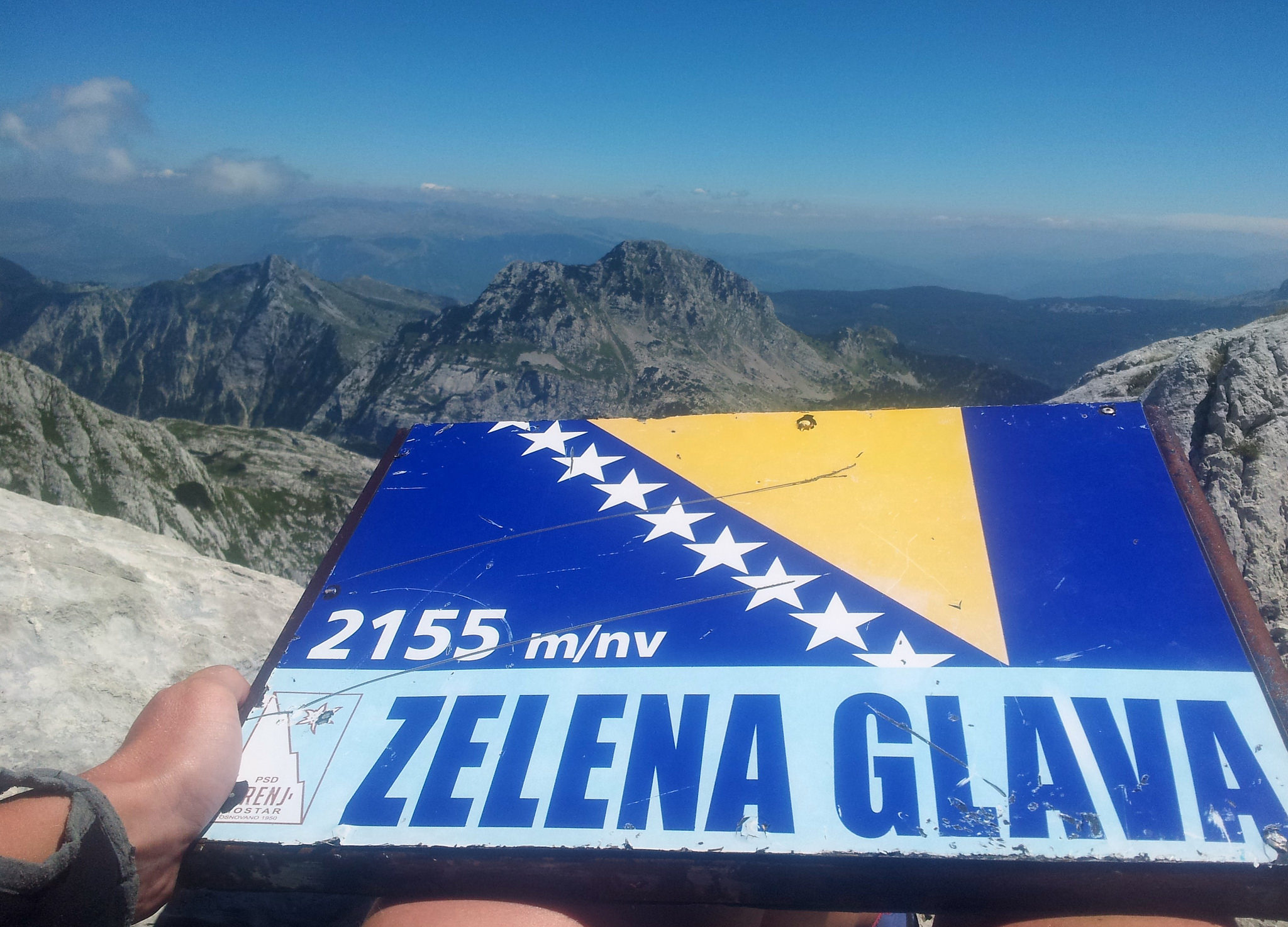
Blue blue skies and white white rocks. Wide views and mountain bikers? Haha, yes indeed. I met a friend from Mostar who cycled up from Ruište to Zelena Glava. “Is there a girl from Amsterdam here?” Đani! We knew that there was a possibility that we would run in to each other, but that we actually met on the top of Zelena Glava was amazing!A big hug and lots of photos, it was really a party on the peak. Normally I don’t like crowds, but this time it was different. Đani helped me to get back my confidence when I felt home sick and insecure about everything I could possibly feel insecure about. The last night in Buna he paid me a visit and talked me through the route on Prenj. It’s hard to explain how I felt at Zelena Glava, but “peak party” covers it quite well.Meeting Đani the mountainbiker from Mostar on the top, Zelena Glava!Zelena Glava, Prenj
{youtube}PLRKMkWaaG3qmnUebXTxjtGN263hNY8L3G&v=wEw8Ago9ALQ{/youtube}
Back at the mountain hut, the party continued. A Dutch couple just arrived and short after, five men from Mostar joined the club. Esther, the Dutch girl, lightened some candles, the men from Mostar grilled their meat and the Tuzla boys digged up a bottle of rakija. Too bad that the Czech guys left in the morning. Never the less, it was a unforgettable night.Again, normally I don’t like crowds, but when Zlatan and Damir started to sing a traditional Bosnian song and the men from Mostar shared their food, because that’s what people love to do here, I was glad that I could share this moment with people from my country. From Amsterdam even.I keep on repeating myself when I say that Via Dinarica is for me indeed more than just a trail, just like I repeat myself when I say that I keep on falling in love with the Balkans and the Balkan vibe…. But that’s how it is 🙂
{source}
{/source}
{source}
<script type="text/javascript" src="https://www.outdooractive.com/en/long-distance-hiking/bosnia-and-herzegovina/jezerce--zelena-glava--jezerce-day-32-/19547683/tour2go"></script>
{/source}
{source}
{/source}
{source}
{/source}
{source}
{/source}
{source}
{/source}
{source}
{/source}
{source}
{/source}
{source}
{/source}
{source}
{/source}
I’m happy leaving crazy, busy Žabljak, there’s too much going on here and too many people to make it a relaxed trail town. Just a few hundred meters outside of town it’s quiet again. Oemph… Pffft…The hike to Njegovuđa is about 9 kilometers and it follows partly a paved and partly an unpaved road which leads along small houses and farmland.In Njegovuđa just a bit off trail, a surprise waits; here there are a café (also serving food) and a convenient store! After a fast pits stop, I had a late start and there’s a storm building, I hit the trail again. While hiking in the woods, just after passing the lake, it starts raining. Since the rains are fierce here I set up my tarp and seek shelter for the next 1.5 hour.After the forest the trail really gets nice and it stays so all the way to Mojkovac. It actually surprises me. I didn’t prepare this stage and thought it would be way less interesting and wild.After a few more hours of hiking it starts raining again and I pitch my tarp somewhere in a field.The trail sometimes is a proper trail, it sometimes follows an unpaved road and sometimes there’s just a few sings hiding in the grass.A very close encounterAfter Zabjsko jezero the trail leads through a forest. Because of the lots-of-mud/uphill/trail runner-combination I struggle a bit to get uphill. Than, suddenly I see a bear walking towards me! He doesn’t notice me until we are very, very close to each other. The bear sits still, moves it ears and sniffs a bit… It turns around and speeds off, leaving me this fresh and muddy paw.After the bear-forest the trail leads through exposed hills. Here are no houses, just a few herders in the far distance. On this section I didn’t see a lot of springs. I also didn’t prepare this stage so I might have walked by some…
A dirt road leads into Ružica where I am welcomed by barking dogs and a herder. He offers me coffee just at the right time; the air is rumbling and it starts raining. The herder and his wife take really good care of me, offering me fresh bread, a baked egg and cheese and off course, homemade raki.When the rain stops it’s time to leave, and after showing me the spring at the other side of the village, I say goodbye (and a big thank you). From here the trail follows an unpaved road for a lot of kilometers, but this road doesn’t hurt to hike. It leads along old (and new) wooden houses, it’s got great views and there are a few springs along the trail. A few hours hiking from the town of Mojkovaj I setup my tarp, I’m done for today.Getting to townAlong the unpaved road/trail local people are collecting berries, a little ways down I find myself some decent sized raspberries. It’s snack time! Because of rains there’s clouds hanging over the valley, my head’s probably in the clouds too; I miss the trail into town and hike a small detour.MojkovacI like Mojkovac as a trail town; it’s small and there isn’t a lot going on here. It’s got a few hotels, grocery stores and restaurants. It’s right on the trail and everything is within walking distance.To Dom DžambasI’m a bit late arranging the permit for crossing the Montenegro/Albanian borders by foot. So, I need to slow down my hike, while the permit is getting arranged. From Mojkovaj I hike up to Dom Džambas, which is about 10 kilometers.The hike out of town is interesting; the GPS track is a little bit off, there are markings (sometimes) and the trail sometimes disappears in thick bushes. Oh and watch out not to walk into someone’s garden; the dog probably doesn’t like that (and you neither). Then there’s a slightly eroded road (wouldn’t want to hike that when it’s raining). After this (just a few km’s) the trail hits an unpaved road. At about two kilometers before the hut there are two springs, close by a katun, just after the crossing by the cemetery.
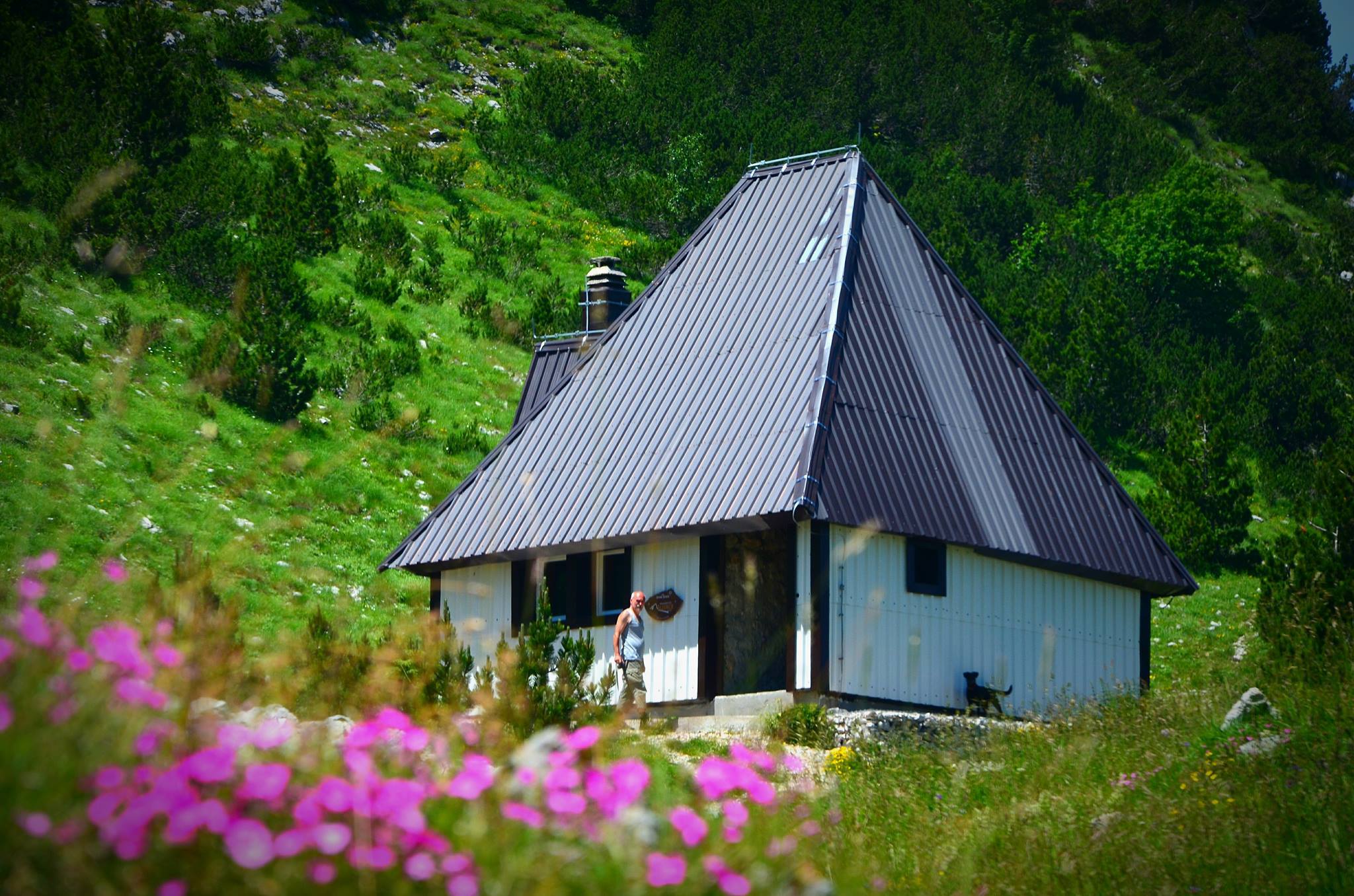
I did not meet anyone at the hut, but it’s a good place to hang out. There are benches under a veranda and there’s a fire pit and views on Mojkovac and the valley. There’s not outside water access at the hut, but there are houses nearby and a spring a few hundred meters down the trail.More pictures on Instagram. Support my adventures and buy me a carbonated and sugary soda pop.This blog has been written on trail and on a mobile phone.
{source}<script type="text/javascript" src="https://trail.viadinarica.com/en/tour/long-distance-hiking/mountains-of-montenegro-abljak-via-sinjavina-to-biogradska-gora/17303095/tour2go"></script><p><a title="Europe’s largest outdoor platform" href="http://www.outdooractive.com/" target="_blank">part of outdooractive</a></p>{/source}{source}<script type="text/javascript" src="https://trail.viadinarica.com/en/hut/mountain-hut-dambas/20375328/hut2go"></script><p><a title="Europe’s largest outdoor platform" href="http://www.outdooractive.com/" target="_blank">part of outdooractive</a></p>{/source}
Walking past her house, an old lady asks if I’d like kafu? Yes, please! She doesn’t speak any foreign language, but we do manage to have a entertaining chat. We even find out that she also met fellow Dutch and Via Dinarica-hiker Eva.After the good and strong coffee a long road walk waits. Upon this plain there’s no water-sources (ask for it at one the houses) and it’s exposed out here. There’s also little traffic. The hike isn’t bad, the views are good but it’s warm and long. Luckily for me a car came driving by, it’s driver stopped and offered me a ride. It was only 7 km, but that’s about 1.5 hour walking. Yeah!When I got out of the car I, clumsy me, stepped on my hip-belt buckle, crushing it between my foot and the asphalt. OK, breath in, breath out… Tourist town Žabljak is only two days hiking, I might be able to fix it over there, there’s worse places to end up with a broken buckle.In Nedajno there’s a café next to road/trail; they serve good, tasty, local food and they also rent out rooms. After eating a big meal and cake for dessert it’s time to hike the last few road walk km’s down the canyon and to the hut.
At the hut there’s a watersource and spots for camping. I, however, take a long break and wait for the heat to go by. From here it’s a three hour walk up to the next hut at Skrcko jezero. This hike starts on flat grounds, making the first half a fast and easy walk. The second half of the hike is uphill and offers stunning views on the Durmitor mountains.
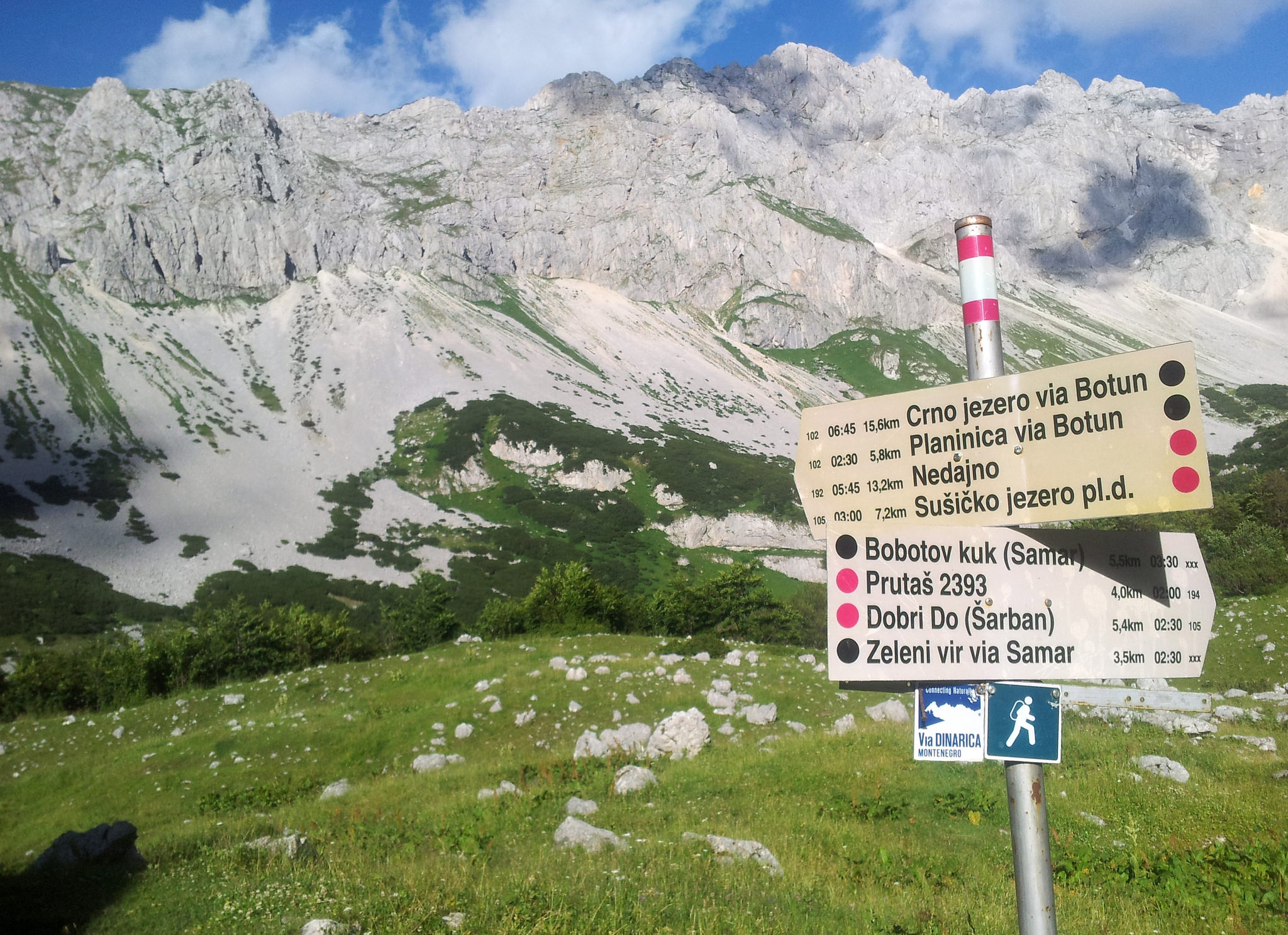
At the lake and the hut it’s pretty busy, and hikers keep arriving. After paying the park fee I set up my tarp at the small lake. I even put in my earplugs, which I never do sleeping under my tarp, to block out the noise of the other visitors.Bobotov KukToday I leave the Via Dinarica; climbing the almost highest peak of Montenegro isn’t included in the Via Dinarica-package. This is a small detour, you’ll find it on the Durmitor maps.In the cool, early morning the climb out of this valley isn’t too hard. Unless you, like me, loose the marked trail. Two hours later, getting to know a group of Montegran hikers and one guy from Serbia and a very wise lesson learned I’m back on track.With two precious morning hours lost I speed up as much as possible. There are already clouds building up in the sky and I do not want to end up hiking downhill in rain- or thunderstorm. At the saddle, just under to climb up to the peak, I leave the gear and extra weight I don’t need hiking up. Even though the trail is fine, this is outside my comfort zone. Everywhere I look I see… ehm… downhill.. steep…But, hey, I’ve come this far, I’m not turning around! So I turn off my comfort zone for the climb up Bobotov Kuk. At the top the spectacular views are a reward, but after taking a few pictures I head down again. First of all to get it over with and second because the clouds are turning dark and a storm is building.Back at the saddle I collect my gear and than the downhill walk starts. A little down the saddle there’s supposed to be a spring. A sign has been painted on two big rocks, but I have a hard time finding it. After standing still and listening I hear water running. The spring is no more than a small trickle. Someone left a piece of plastic which speeds filling up my bottle, thank you!The hike down starts with gravel, than fields of rocks and an occasional snow field. This I wouldn’t want to hike with a heavy backpack. Again I speed up as much as possible; now I hear thunder in the air. Down at the Katun beer and soda pop are sold, but these I skip because of weather. It’s party time! Thunder and lightning, just far enough to not get uncomfortable. The party is completed with a long, big hail- and rainstorm. Now the trail turns into a muddy river. The next hour or so I just hike. Slow and steady so I don’t slip. Finally the rain stops and I arrive at the parking lot just outside of Žabljak. I hike a fast 2.5 km into town and check in at the first hotel I run into. Now I deserve a real shower!ŽabljakŽabljak is the place for hikers and tourists who head out into Durmitor NP. It’s busy! I had a hard time finding a place to sleep the second night I stayed here. The hotel I checked in at the first night had only a room available for one night and I was to tired and cold to head out and find something else. The hostel only had rooms available for two or more nights…There’s a very small ski shop which sells some backpacks and clothing. I could not find a gas canister (they only ones for sale are buta gaz). I guess my food situation is getting interesting in a few days…I bought a cheap backpack at a butik and cut off the buckle to replace the broken one. In the grocery store it’s crazy busy but it sells a good variety of hiker foods. And… there’s an Internet café! The local kids are hanging out and playing games here and because of a thunderstorm electricity went out a few times. But it made me happy and I managed to do a lot of work on my blog.More pictures on Instagram. Support my adventures and buy me a strong cup of coffee.This blog has been written on trail and on a mobile phone.
{source}<script type="text/javascript" src="https://trail.viadinarica.com/en/tour/long-distance-hiking/via-dinarica-white-trail/17291189/tour2go"></script><p><a title="Europe’s largest outdoor platform" href="http://www.outdooractive.com/" target="_blank">part of outdooractive</a></p>{/source}{source}<script type="text/javascript" src="https://trail.viadinarica.com/en/tour/mountain-hike/via-dinarica-cg-w-02-durmitor-mountain/17303054/tour2go"></script><p><a title="Europe’s largest outdoor platform" href="http://www.outdooractive.com/" target="_blank">part of outdooractive</a></p>{/source}
Sunday I was supposed to meet some friends from Sarajevo at Boračko Jezero. Rewinding time! Instead I got wind up in thorny plants when I tried to take a short cut. This is my story about what happened on the descent through the Rakitnica Canyon.First of all, I have to say that I realize that knowing that everything turned out fine, might influence the way I feel and write now. I also realize that I scared some people and I feel very sorry for that. It is very hard to consider all the possible consequences of your actions while you’re in a awkward situation. Yes, I would definitely do things different next time. And yes I made some wrong judgments, but this does not mean that I will stop hiking.The most important lesson that I’ve learned is an old one. Keep on believing in yourself even when everybody tells you different, including your own insecure self.Early in the morning I left my bivouac spot at the abandoned village Blace. Totally convinced that I had done most of the climbing the day before I told my friend Ana that I tried to at Boracko Jezero at noon. I was looking forward to see her and couldn’t wait to dive in that lake.Bivouac at BlaceA well marked trail brought me to Vranske Stijene where an old lady filled my water bottle. The next water stop was Dubočani, not far away. Unfortunately it took me much longer than I thought, I lost the markers and improvised my own route. Normally this is the fun part, but now “I had no time for this”, I wanted to swim.In Dubočani I felt very unwelcome. The man I asked for water started to yell at me and didn’t want to fill my bottle for a second time. My mood changed, I was done with the hiking, my friends were waiting and wanted to be with them. Instead, I still had 45 minutes to go to Rakitnica river, if I could find the path and then do some asphalt. “Is it possible to come and pick me up?” Nope, no proper road for city cars… I had to hike.Ah well, I could survive another hour. I was being silly and “weak” to let my bad mood take over. Hoppa, just one hour.I have no idea why the signpost said 45 minutes to the river. It took me twice as long to get to the point where I could finally start descending. Around two I called my friends again. The marking disappeared, the path was unclear, but I could see where I had to go. It was only 700 meters away if I could walk in a straight line. 400 meters down, though… Through the forest.The beautiful fresh water I got at Vranske Stijene the day before. I wish I had more of that….Blehhh, I wished I could fly. And I wished I had more water. I was so close, but couldn’t find an easy way down. “Come on, you survived worse. Get some rest in the shade and find your way down. We will wait for you.” That was Edo, but I never got to meet him.Short cut. Bad decision. Thorny plants and way too steep to go back. So I went on. Negative thoughts, dry mouth and ohh yeah – thunder. Rain, lightning and dark clouds. Nice.The strange thing is that when there is serious “trouble” I seem to switch to a focused state of mind. I felt calm and searched for a good place to sit out the worst of the little storm.I did not like the situation and I wished that someone could pick me up. Although I was doing fine and I knew exactly where I was, I realized that this might be the point that it would not be too late to ask for help. I talked about this with Lorenc, a man I met during trail-marking in Sutjeska NP. “Don’t wait until it’s too late and don’t feel too proud to ask for help.”That’s my problem, I usually wait too long, because I don’t want to bother anyone with my stupid mistakes. At three O’clock I texted my friends (yes I still had a good signal) my coordinates and asked if they could hike up the trail where I was supposed to be on. I told them where they could find more information about the route and asked if they could bring water.I had enough for today, not knowing that this was just the beginning….It turned out to be a bit more complicated than I thought. I might know all about Via Dinarica, but I should have thought of the time I have put in this to find everything out. I couldn’t expect that my friends could do this in half an hour.They went to a WiFi spot to check out where I was and Ana even asked her brother in Sarajevo to look up my location. “You are in the middle of nowhere!” Uhh, yeah kind of, but I was only 100 meters away from the trail. I thought I could hike up, but at that point, I kind of wanted to have people to be closer, just in case I would loose my signal. I certainly did not want to (or could) go back the way I came, that suggestion was not a option.In the cafe, my friends met people who knew some guys from the GSS, (mountain rescue service) and at that point they thought it was the best they could do for me. In the mean time, I was sitting and waiting not knowing what was going on. I made some selfies, but deleted them all, because I looked terrible.“GSS is coming your way, they know the area very good and it should be easy to get you out.” What? “They should be there in an hour.” Is this really happening, I thought. I’m going to be “rescued”…At 17.20 GSS called and I gave them my coordinates again. “Stay where you are, don’t move…”I tried to explain where I was, but I wasn’t sure if they knew which trail I was supposed to follow. My answer to their question “what do you see?” was not very helping. “Trees, forest and bushes…” It frustrated me that I was no longer in control. I just had to sit and wait. At 19.30 I started to feel desperate. They did not hear my wizzle and I could not hear or see them. I was done with the waiting and ready to move, but they told me to stay at the same place. I certainly did not want to spend the night there and if it would take them much longer, it would be too dark to find the way out myself.Time for another “hulplijn”, Kenan. He called me back immediately and located me within five minutes. He talked to the GSS and told me that they located me as well. Of course he wondered why I did not hike these 100 meters west and I did not fully understand it myself neither. The waiting was stressful and at the point that I texted Kenan I was loosing faith in the GSS and myself.Half an hour later I finally saw a guy, jeej! “Can you come up?” Sure! “Do you have water?” “No.” What?! What?! “The others have.” “Can they come here then?” Walkie Talkie conversation and I heard something about dehydration. It took us only fifteen minutes to reach the other guys who gave me Cola and snickers. I had been at most thirty minutes away from the trail, but I had to be rescued by five men. Luckily they actually seemed to have a good time and I could also laugh about the situation. It made no sense to be frustrated, scared or angry.My GSS heroes!Chatting and laughing about the whole situation we went down to the bridge. It was dark, but that made the river and the canyon nice and quiet. Beautiful. The GSS guys were great. In the beginning I felt guilty and ashamed, but they were unbelievably relaxed. Sweating, because they carried my backpack, but no way that I got to carry it myself! Pauza, photos, selfies and Facebook posts. I could not believe it, but I have to admit that I liked it. Haha, Balkan style!They had to call the police to tell them that I was alright. Hmm, the police. I crossed the border at Trnovačko Jezero which means that I was not officially in Bosnia and Herzegovina. Actually, officially I am still in Albania. But it was no problem according to the GSS. For a second I worried about my travel insurance which might not cover the expenses, but mountain rescue is all based on volunteers. They don’t ask money for a intervention like this. Lucky me.They did give the media an exciting story. I was a bit disappointed that I was called a “middle age woman” and that they spelled my name wrong, but the fact that I hardly recognized the story as “mine” striked me. To me it’s all new that facts are changed into a juicy soap.I’m Struggling a bit what to write and share. I don’t want to say anything bad about the guys who did the best they could to “safe” me. It’s amazing how willing to help they were. It’s a little less amazing that there are different versions of this story. The version in the media makes them a bit more heroic and me a bit more stupid. But that’s the price I have to pay, I guess.23.30: Safely reunited with my friends Ana and Ogy.
{source}
{/source}
{source}
<script type="text/javascript" src="https://www.outdooractive.com/en/long-distance-hiking/bosnia-and-herzegovina/blace--boracko-jezero-day-30-/19399636/tour2go"></script>
{/source}
{source}
{/source}
{source}
{/source}
{source}
{/source}
{source}
{/source}
{source}
{/source}
{source}
{/source}
{source}
{/source}
{source}
{/source}
It’s a fast hike down from Donje Bare to the road. It seems like a lot of maintenance work has been done on the last few km’s to the road (thank you!). Thinking about omelet and kafa I don’t mind hiking the asphalt road to Tjentiŝte. Even though calories and protein are waiting for me I cannot resist hiking up the enormous monument just before the hotel Mladost. At the hotel I totally ignore Kenan, who happens to be out here too (not wearing my glasses and thinking about omelet and kafa…hmmmmm). Just outside of Tjentište, in Popov Most, I stay at Household Radović. This is a good spot for a zero. Mira, the owner, bought me resupplies which saved me carrying a lot of weight through from Kalinovik.Leaving TjentiŝteThe road walk back to the trail is a few km’s from here, the hike’s not too bad, there’s some good views and even though there’s traffic, it’s OK to walk. After the road walk there’s a 4×4 road, where I actually surprised, if I’m correct, a mountain goat. The climb up to Prijevor is over a fine trail (I believe recent work has been done here too). Than there’s the first view on Maglić. This is the place were other hikers and tourists park their cars and today it’s busy!The trail to Trnovačko Lake is like a red carpet and this thru-hiker is speeding! The lake is really, really, really touristic. I get why: within a two hour walk from the car one gets stunning Alpine views and the experience of being out in the wild.
After meeting Ranger Milos and paying the park- and camping fee, I decide to leave this tourist trap. This is way beyond my comfort zone. On an old map I have seen a camping spot up the saddle, somewhere near a spring. I’m not sure if it is still allowed to bivouac here (camping is only allowed at designated areas). But, for once, I decide to act like an oblivious tourist and to not find out if it’s OK. So, after an early supper I hike up from the lake to the saddle and leave it to the loud tourists. The spring I find (it’s just after the crossing, there’s a sign). The camping spot I do not find. Well, it’s too late to change anything about that, now. I find myself a spot for bivouac and try to leave as little as trace as possible.
The only way is up…The next morning I only bring what I need for hiking up Maglić, all other gear I leave at the bivouac. There’s no need for carrying extra weight if I’m returning here. Maglić (and Bosnia and Herzegovina) are kind to me: I get to hike it with a clear blue sky. Yeah! This is the best way to say goodbye!…and down…After Maglić it’s time to leave impressive Bosnia and Herzegovina and hike down into Montenegro. And down it is! Today is a warm day, there’s fields full of zooming bees feasting on the flowers and there are, again, awesome views (there’s also a few springs on the way down).MratinjeThen getting back into civilization, also means hitting an asphalt road. The upside: lots of springs along the road. At Piva I take a long break to seek shelter from the heat and to eat an early dinner (here’s a camping spot and a mum and here son were swimming out here).…and up again…It’s too early to stop hiking and I’m in for a challenge: climbing Piva canyon is going to be today’s dessert. Not after more road walking (about 5 km)…The trail out of the canyon is pretty steep and there’s lots of weeds growing. This probably isn’t a wise hike with a heavy backpack or in rainy weather. But I guess I like hiking this one uphill better than downhill… At two thirds of the climb it gets way better, here the trail follows something that seems to be an old unused forest road.Up the canyon there are, to my surprise, farms (they’re not on my gps maps). I find myself a spot along the trail. It seems to been a car track too. A bivouac this visible is not what I like, but I’m tired and all I want to do is lay down…Note: Between the Mratinje and the houses up the canyon there’s no water. Just up the canyon there are more secluded spots for bivouac.More pictures on Instagram. Support my adventures and buy me a carbonated and sugary soda pop.This blog has been written on trail and on a mobile phone.
{source}<script type="text/javascript" src="https://trail.viadinarica.com/en/tour/hiking-trail/via-dinarica-bh-w-12-donje-bare-via-suha-and-prijevor-to-trnovako-lake/17303012/tour2go"></script><p><a title="Europe’s largest outdoor platform" href="http://www.outdooractive.com/" target="_blank">part of outdooractive</a></p>{/source}
My phone drowned in the Treskavica showers and I had to take a zero to buy a new one (no phone, no blogs…). At six in the morning a bus runs from Kalinovik to Sarajevo and it returns at four in the afternoon, which gave me a few hours to arrange the phone, charge and set it up.On the road to nowhereAsking the bus driver to drop me off just outside of Kalinovik confuses him and another passenger. ‘This is the road to nowhere’. He really doesn’t get me (probably not a hiker) and doesn’t want me to leave the bus. I firmly get up and out, waving happily at them while they drive off.The first 10 km’s or so out off Kalinovik go through hills and meadows where I find a good flat, somewhat dry and somewhat insect-free spot for bivouac. The next morning getting up and out of my warm and comfortable sleeping bag is challenging. Ending me up with a late start at around nine. The weather, with a little below 100% humidity, doesn’t help.The hike up to Lelija turns up being wet, misty and windy. Out here there’s lots of markings and signs of previous hikers making it a fast and easy hike. On my way down to Štirinsko Lake I meet the first hikers since the day leaving Sarajevo; a large group of Czechs on a camping trip going in the opposite direction. From the lake the markings get scarce, but due to the landscape navigating isn’t very challenging. Oh and if there’s no mist spectacular views are out here!Lovacka kućaBecause of the rainy weather I quit hiking today upon arriving at Lovacka kuća, which is closed (open by arrangement), but the large veranda (with table and benches) seems like a ****accommodation out here and with this kind of weather. It must, at least, be more comfortable than camping at the cold and windy lake just down the road. I get into my comfi sleeping bag early, ending this day like I started it this morning.An almost encounter with Eva, fellow Dinarica hiker, Dutchie and blogger. Hiking the second part of this stage starts misty, windy and rainy: just like yesterday, only with better views.The hike up on Zelengora’s highest mountain, Bregoč, is easy and when entering my name in the register I realize I barely ran into fellow hiker and blogger Eva.It being windy and chilly there’s one thing to do: hike on. And that’s what I do. Slowly the clouds move and patches of blue appear in the sky and I get to enjoy the surroundings while hiking to Donje Bare.At the hut I get to speak Dutch for the first time since leaving the low countries six weeks ago; there’s Dutchies staying at the hut. At the nearby picknick area a log is left burning in the fire ring. I collect wood and make a big campfire to dry my trail runners and warm my feet.More pictures on Instagram. Support my adventures and buy me a carbonated and sugary soda pop or a strong coffee.This blog has been written on trail and on a mobile phone.
{source}<script type="text/javascript" src="https://trail.viadinarica.com/en/tour/mountain-hike/via-dinarica-bh-w-11-via-lelija-and-zelengora-mountain-to-sutjeska-national/17303001/tour2go"></script><p><a title="Europe’s largest outdoor platform" href="http://www.outdooractive.com/" target="_blank">part of outdooractive</a></p> <script type="text/javascript" src="https://trail.viadinarica.com/en/hut/mountain-hut-at-orlovacko-lake/16794995/hut2go"></script><p><a title="Europe’s largest outdoor platform" href="http://www.outdooractive.com/" target="_blank">part of outdooractive</a></p>
<script type="text/javascript" src="https://trail.viadinarica.com/en/hut/mountain-hut-at-donje-bare/16793836/hut2go"></script><p><a title="Europe’s largest outdoor platform" href="http://www.outdooractive.com/" target="_blank">part of outdooractive</a></p>
{/source}
After buying a new trekking pole and eating lots of calories in busy and warm Sarajevo it’s time to leave for the cool Bjelasnica mountains. Not after drinking coffee with Kenan, coordinator of the trail, who wants to know all about my experiences on trail. Asking difficult questions like, what part do you like best?Because of the coffee I have a late start. I planned on hiking out of town, but it’s too warm for that now. A taxi brings me to the hotel area at Bjelašnica. There’s quite some preparation going on for the upcoming winter season, but after a few hundred meters I’m back in the silent, white mountains.Back on trackA fast hike over a 4×4 track brings me back to Umoljani and after a few km’s next to the road-walk and a few more km’s through farmland (lots of springs at the side of these roads). I’m at the foot of Visočica mountain. Here I meet some local people who left the Sarajevo warmth for a cool and relaxing village home in summer.It’s five in the afternoon: too late to hike up Visočica, too early to stop hiking. Via a walk around the mountain over quiet village roads I reach hut Vrela. The keeper speaks a little English and there’s cola for sale, the hut is well taken care of and there’s a shower. Yeah!And then, a small group of hikers arrive. They just climbed the mountain and we chat a little. People being people and being concerned they somehow mistake me for tourist who doesn’t now what she’s up to. The upcoming hike over the road through Treskavica is, I agree, not the most scenic hike in Bosnia and Herzegovina. ‘No one from here would ever walk that!’ True, thru-hiking is not the same as a day out climbing a peak and riding home afterwards. Sometimes there’s not so spectacular parts to hike, also because there’s mine danger on Treskavica.When things get clarified they invite me for dinner and as fast as they arrived at Mountain Lodge Vrela, they leave (guys I did not even get the chance to ask your names?!).Up and over TreskavicaOvernight there has been a change of weather; now there’s thick and dark clouds instead of clear blue skies. The first few km’s are a hike over the road. The drivers of the few cars driving by stop and ask me about my plans and telling there’s mines at Trescavica, offering me a ride. ‘Yes, I know, thank you for sharing, no thanks’ – in multiple languages.In the afternoon it’s partytime: it rains showers, just as I start the hike up the boring forest road up Treskavica. Now I wouldn’t mind a ride. Too bad there’s no traffic out here.Arriving at the top of the road the showers stop and there’s a spring. Upon taking my full Gore-tex suit off, I discover a soaking wet and propably drowned phone in one of my pockets. The phone I bought just over a week ago to replace the one I lost in the dwarf pine bushes at Prenj.How do I manage to do this? Shame, shame, shame, shame, shame on me. A few rays of sun and nice views after the boring forest road cheer me up a little.Then there’s a crossing: the trail goes through the mountains to the town of Kalinovik (longer, more scenic) or it’s the pretty ok and faster roadwalk to Kalinovik. There’s also pretty impressive clouds being blown in the direction I’m going. I take a break and watch the clouds for a bit and decide to take hike the fast route.After buying a bag of rice for my phone at one of the convinience stores I check in at the hotel in Kalinovik. A little while later a 24hr rain-, thunder- and lightning-show starts.More pictures on Instagram. Support my adventures and buy me a carbonated and sugary soda pop.
This blog has been written on trail and on a mobile phone.
{source}
<script type="text/javascript" src="https://trail.viadinarica.com/en/list/where-to-stay/108297468/list2go?noHeader=false&initMap=false"></script><p><a title="Europe’s largest outdoor platform" href="http://www.outdooractive.com/" target="_blank">part of outdooractive</a></p>
{/source}
Many many wild plants were in my way. If I had known which I could eat, I perhaps would appreciate them more. I’m a city girl,but I’m getting more and more used to the wilderness. Still most of the time, the plants are in my way.Of course I also feel thankful that nature actually allows me here. When it’s wild and rough, completely overgrown it shows who is the boss. And that is absolutely not me!On my Vibram FiveFingers I gently step my way through the fields and the forests. Carefully I climb the rocky mountains, constantly aware of what’s below my feet. I feel everything, much more than I can see. Because hey, the plants are still in my way!I made it through Zelengora without getting lost and without losing my phone (or finding one). Proudly I arrived at Orlovačko jezero where I met three men. “Planinarski dom? Huhh, no Planinarski dom.” No way! I was looking forward to a place where I could dry my clothes and drink a strong cup of coffee. Now these men were telling me there was no mountain hut. No way!ZelengoraI thanked them and continued hiking to the place where I believed the hut would be. “Heeey!” They shouted. “Kafa?” Haha, hell yeah! And I slowed down to join the three men on their Saturday afternoon walk. “Polako…”they of course said and I slowed down a bit more.The funny thing was that they were heading towards the exact same place I planned my coffee stop. They might not call it a mountain hut, but to me it was. At the hut, there were two more men and more and more kept coming. “Eight men and one girl from Amsterdam”, they repeated all evening.I have to admit that I felt a bit intimidated. Especially when one of them tried to steal a kiss when his friends were not watching. I’m not used to people touching each other the way they do here. You easily get kisses, not only from men. And men are hugging and kissing each other as well. It’s nothing to be afraid of, most of the time their intentions are good. But this men went a bit too far, I don’t want kisses on my mouth and when I say no, I really mean NO!In the arms of Mister-kiss-stealerAt one point I thought it would be better to go back to the lake and camp there. I wanted to sleep in the hut, but I didn’t want to sleep between eight snoring men. They were having their men party and I had no idea what time it would end or how drunk they would get.You should have seen the disappointment on their faces, they were totally surprised that I was about to leave them. “No you stay!” I thought it would be best to be honest with them and I explained that I didn’t like the touching and kissing of the men who seemed to be in charge of the hut. They understood and promised me that there would be no provocation. “No touch, no kiss, no provokatie. You room, sama. OK?”“OK, I’ll stay.” Of course they were making jokes about it, but it was all in a friendly way. Of course I was way out of my comfort-zone, but somehow this was an interesting learning-zone. Like I’m getting used to the wilderness, I’m getting more and more used to wild men.I have to be clear about what I do not want, but I also have to be able to move along and trust people, even when they behave different than I’m used to.Seven Wild MenThe kitchen was outside, since I was the only woman, I had to cook. I tried to tell them that I’m bad with cooking and that I would do the dishes instead. But they saved themselves the trouble by using plastic plates and cups. I had no choice, I had to help preparing the meal. Grill. Telling them that I had been a vegetarian half my life didn’t help neither. They gave me some BBQ tools and suddenly I was in charge of the meat. Flipping it, put it in a pan when it was done and add oil and luk. Onion.Oh well, that wasn’t too hard, except that I was in the cooking team with mister – kiss – stealer. I warned him that I would use the BBQ tools to flip him on the grill. That worked. It became our joke. Slowly I started to feel more relaxed and could actually enjoy the evening.When I walked back into the common room, a handsome man had joined the group of eight wild men. Politely he introduced himself in English. Wow, how did he end up here? “Same way you did”, he answered. He met three men at the lake and they invited him to come over for a drink. This new man, Aleksandar, was at Zelengora to hike and explore, searching for edible plants. That’s his thing, surviving on what nature has to offer. I couldn’t help being impressed. And a bit ashamed.All day plants has been in my way and my backpack is full of food. While treating myself on a cup of coffee was what kept me going, this man was moving with nature. I’m fighting it.How I get around, around here..I know I shouldn’t blame myself or feel guilty that I know nothing about the environment I’m trying to find my way through. There are many different ways, many different adventures. I can’t do it all at the same time. And I surely have to learn a lot before I can even think of feeding myself with wild plants.But I it did inspire me. Aleksandar inspired me. He has been teaching his daughter about plants since she was two years old. How amazing! How many kids learn those things these days? Enthusiastic I accepted his invitation to meet him again next morning. He wanted to show me how to find some good plants and roots, if I had time.Time, hmmm. I was a bit worried that I couldn’t tell my friends in Sarajevo that I would be much later in Umoljani. I already was a day behind on the schedule I had send them and was afraid that I couldn’t meet them anymore. At the same time, this was exactly what I was trying to avoid. Hiking on a tight schedule and letting the non-polakoness take over.So, I decided to spend the day with Aleksandar. Decided it with my head, choose with my heart (yeah that sounds cheesy), but could feel the restlessness in my body. Unfortunately the weather was bad again. We could not go up into the mountains. Cold after sitting for an hour making and drinking wild tea, we went to the hut to warm ourselves. Without success, the eight men wanted some private time. Waiting the whole day in the cold without knowing that it would be better the next, was too much for me.Wild TeaI realized that I had been out of my comfort-zone for too long. My flexibility was at it’s end. I needed to do something I new I could. Hiking, even if it was the macadam road instead of the White Trail through the mountains.I said goodbye and left Aleksandar in the cold.I felt sad somehow, but at least my feet were warming up. All day I thought about what it would be like if I had stayed. I know I choose the easy way. Struggling to let it go and trying to enjoy the hiking. Trying. Wondering, pondering completely in my own world I marched thirty kilometers without taking a break. Almost like I was punishing myself with doing the complete opposite of what I could have done. Really? Why! I absolutely don’t know.I’m not going back to the lake and I try not to regret my decision. OK, I accept. I really do. Although I felt sad, I kind of enjoy the fact that I can allow those feelings and fully feel them.What did these wild men and wild plants teach me? That I am constantly moving out of my comfort-zone? That I need time to recharge every now and then? That all of this, my journey, my adventure is in fact my learning-zone and I don’t have to regret any decision, but be proud that I made one.Cheers to that!
{source}
<script type="text/javascript" src="https://www.outdooractive.com/en/long-distance-hiking/bosnia-and-herzegovina/donje-bare--orlovacko-jezero-day-23-/19190686/tour2go"></script>
{/source}
{source}
{/source}
{source}
{/source}
{source}
{/source}
{source}
{/source}
{source}
{/source}
{source}
{/source}
{source}
{/source}
{source}
{/source}
After buying a new phone and rewriting lost blog posts the cab driver drove me back up the pleasantly cool mountains.This stage, from Ruište to Boračko Jezero, is a roadwalk and roadwalks aren’t the most appealing to thru-hikers. But, it turns out to be a nice hike. Today it’s cloudy which makes hiking this exposed road less of challenge, there’s nice views and there’s no traffic. I did hike the shortcut to the lake, making the hike 5km shorter, but I missed some historical sights.Boracko LakeAt the beautiful, but touristic lake I ate a big lunch at one of the restaurants. After buying resupplies at the mini-market I topped off with ice-cream, crisps and more soda pop getting ready for some more kilometres.
The canyonFirst there’s a roadwalk over asphalt. The views and lots of afternoon shade eased the hike. After crossing the suspension bridge over the Neretva (not my favorite) the trail runs through farmland and a few settlements to the next river, the Rakitni. I met a German speaking pensioner/herder. We talked a bit and he showed me the mountains I had hiked through and the ones coming up. He also told me the last time a bear had been seen in this area was thirty years ago, before the war. They have all been shot and eaten.After the Neretva/Rakitni confluence I was warned, the trail is in a bad state. The weather being good and the sun setting I wanted the see the evening views on the canyon and decided to hike on. I have to agree this part of the trail is in a bad state. There has been a forest fire which means lots of weeds growing. Further up there’s loose rocks along steep slopes down into the canyon. However, I did not have any problems finding my way.I did get to see great evening views, but finding a decent spot for bivouac turned out to be a challenge… I ended up doing some landscaping. Then laying in my bivy I was eaten by mosquitoes and there were lots of big nocturnal grasshoppers. Oh and there was this huge flying bug, helicopter style, which was very interested in me too. Using my tarp I fixed myself an upper-body-mini-tent locking out bugs and locking in the damp I produced while breathing.The closer the trail gets to the village of Dubocani, the better it gets. From Dubocani, I was told, there’s two choices. The marked trail follows the road, the GPS track is the shortest option but this is trailless terrain. I ended up hiking the GPS track, along this track there’s a surprise watersource just after the last roadcrossing at about 1000 meter.PlateauAfter a hike through the forest, which is easy to navigate through, there’s the plateau with stunning views! At the, in the war, completely destroyed village of Blace there’s a somewhat dirty watersource (including a dead snake laying in it when I checked it out). And then there’s more hiking along the plateau with more stunning views.LukomirAt the spring in Lukomir one of the villagers told me where I could camp (I was just refilling my waterbottles and did not yet ask her). As I lay in my bivy near a haystack the sheep and herders returned home for the night.Since being out here I decided to leave the trail and hike an alternate so I can go into Sarajevo without hiking the same trail twice. From Lukomir I hiked to the village of Umoljani. On the trail I met a young couple exploring the area. We ended up chatting for a while and the served me second breakfast fresh bread, tomatos, cheese… hmmm At Umoljani I enjoyed a big third breakfast at one of the restaurants. This village is quite touristic, espacially in the weekends.From here I hiked to another part of Bjelasnica mountains. This trail is not marked, but navigating and the terrain is easy.Close to Sitnik, the first mountain hut I reached, old markings were visible. This hut is locked but there’s an outside well and from this hut there’s a perfect trail to the next hut.Within no time i’d hiked the two kilometres to Stanari, according to the information I found on internet this hut is openend in the weekends… and yeah! there were two man sitting, drinking and eating in front of Stanari.StanariEven though they did not speak any foreign language the gave me a warm welcome, a princess room with a princess blanket, they served me food and drinks and gave me candy and cookies. They were surprised that I’d hiked all the way and all alone from Lukomir. While enjoying music from the 80’s en 90’s we overlooked the mountains and the sunset.The next morning man came crawling ouy of every corner of the hut. One of them living in Sweden and speaking English. He found out that even though the hut has been there since the fourties, there has never been a fridge. So he bought one and today it’s being delivered.While waiting for the fridge I asked the man for some muscalair power to fix my trekking pole. This ending up using pretty big tools and completly dissecting the pole. The thing got fixed but we were unable to put it back together…Than a Jeep arrived bringing the fridge.Making this a memorable moment: from now on there’s cold beer available at Stanari!!!Sarajevo and a shower (and hopefully a shop selling trekking poles) were waiting for me and I left this mans’ cave. After hiking a fast and easy nine kilometres I reached the town of Pazaric from where I took the bus into Sarajevo.More pictures on Instagram. Support my adventures and buy me a carbonated and sugary soda pop.This blog has been written on trail and on a mobile phone.
{source}<script type="text/javascript" src="https://trail.viadinarica.com/en/tour/mountain-bike/via-dinarica-bh-w-07-ruite-and-borako-lake/17302961/tour2go"></script><p><a title="Europe’s largest outdoor platform" href="http://www.outdooractive.com/" target="_blank">part of outdooractive</a></p>{/source}
{source}<script type="text/javascript" src="https://trail.viadinarica.com/en/hut/mountain-lodge-sitnik/17032511/hut2go"></script><p><a title="Europe’s largest outdoor platform" href="http://www.outdooractive.com/" target="_blank">part of outdooractive</a></p>{/source}
Montenegro or Crna Gora in Serbian. I have to confess that I didn’t know where the name comes from, I only knew that it meant ˝Black Mountain˝. I didn’t really see black mountains though. In Montenegro the mountains were green. Everything was green. Green valleys, green peaks, green forests, green fields.. Green, green, green in all possible shades and shapes. The Via Dinarica trail leads you from National Park to National Park, it connects one stunning piece of nature after another. Day after day I slept high up in the mountains. Just a few little towns along the way, but other than that, it’s mountains mountains mountains. Karst mountains. Mountains covered with white rocks and colorful flowers. Steep cliffs, sweet hills, impressive peaks and a lot of cattle. Sheep mostly.
Komovi National Park
Stones
Sheep
From Rikavačko Jezero I followed a macadam road to Katun Krivodoljski and went further up until I found a nice place to camp. This was my first bivouac without any people, village or mountain-bar-kafe-restaurant nearby. The first night absolutely, completely on my own. I felt it, it did something, confused me. A strange mix of emotions. The beauty, the silence, the solitude. Tired, hungry and happy. Komovi got from that moment on, a special place in my heart. I became a fan.
Welcome Fans of Komovi!
Bivouac
Early in the morning
This is Komovi ?
Komovi flew over into Bjelasica and Biogradska Gora National Park. It was quite some unpaved road hiking with here and there a real hiking path, but I enjoyed every step. The road gently curved along the mountains, a real treat for everybody who likes to look around during a hike. Wide vistas, spectacular views all day long. Until the descend to Mojkovac.
Bjelasica
Biogradska Gora
From Bjelasica to Biogradska
In Mojkovac the Tara river begins, a phenomenal river that follows its way all into Bosnia and Herzegovina. I didn’t get to see much of it though, I went immediately up to Sinjajevina. This was the part I was a bit afraid of. ˝No water for over 70K and it’s really hard to find your way up there… No shelters, no facilities, no maps, no nothing!˝ Hmmm..
Family that offered me a dry place to sleep.
Their house in Sinjajevina
Sinjajevina surprised me. Perhaps because I had low expectations and took all the precautions I could. I carried a lot of water and food, way-marked possible shelters I came across and carefully watched the clouds. In the end it all wasn’t as difficult or dangerous as I thought it would be. It was a pleasant surprise to be on this high ˝plateau˝ for a few days in a row. Even without stunning peaks or significant changes in altitude, for sure, Sinjajevina was intensely beautiful. Beautiful and wild in its own way.
Hiding from the thunder and rain…
The trail itself mostly followed the Crna Gora Transversale, the CT-1. Not extremely demanding in terms of steep climbs or exposed ridges. Actually the terrain was mostly grassy, covered with stones and rocks. The CT-1 isn’t extremely popular (anymore/yet). This means there is no obvious hiked path and as far as the marks go, they are really hard to spot in the high grass. So yeah, thank you Garmin for keeping me on track.
Random marker
Random flower
Between Sinjajevina and Durmitor there are some unavoidable road sections. Still I wouldn’t say that this is a bad part of the trail. It’s part of the deal when you’re hiking a long distance trail. You hike through a country, connecting the places, mountains, National Parks. You’re connecting the dots. It is inevitable that you cross some towns and some roads every now and then. They are to me just as much part of the deal, part of the trail. The trail as a story of a country in total.
A macadam section, with water ?
Arriving in Žabljak was a bit overwhelming. This little town is full of apartments, B&B’s and hotels. Restaurants, bars, cafes and shops. The tourist centers selling maps and on every corner there is an outdoor agency that sells tours. This National Park that is doing good business. But still, once you’re up in the mountains, up in Durmitor, you hardly meet anyone else. And the good thing is, that there are accessible, well maintained hiking paths.
Luckily it is easy to escape the towny, touristy craziness by camping at Ivan Do, next to Crno Jezero at the foot of Durmitor NP. Once you’re there, you can see, smell and feel Durmitor.
Kamp Ivan Do, Žabljak
Wow wow wow. Durmitor really rocks! I prefer hiking in rocky terrain with a little bit of forest every now and then. I love ridges, traversing on a mountain or mountain range. Staying up high, exposed and open. The possibility to go to some peaks, but the guaranteed pleasure of hiking through a stunning scenery all day long. Who doesn’t want that?
Škrčko jezero
Again, nature was in control, the weather, the terrain, water sources, not knowing what to expect. During the day the temperatures could rise pretty high, but at night is was all of the sudden chilly. Clouds and thunderstorms told me when and how to move. I respected that, respected the mountains. Patiently waited out bad weather. Let the weather decide.
Sušica Kanjon
Trnovačko jezero
Trnovački Durmitor
The last leg of the Via Dinarica trail in Montenegro followed the Sušica Canyon to Nedajno, led me through this so called Trnovački Durmitor and brought me to the famous heart shaped lake, Trnovačko Jezero. With the mountain Maglić on the border between Montenegro and Bosnia and Herzegovina, this was the last climb in Montenegro. With this climb, I managed to completely cross the second country on the Via Dinarica. I connected the mountains of Montenegro from border to border. From lake to lake. Every mountain massif had its own story, its own character with its unique features and typical appearance. All beautiful. Spectacular, strong and powerful. Peaks, lakes, rocks. Canyons and high plateaus. Sharp lines, shapes and colors. Bright colors. Splendid vistas, majestic view. Rapidly changing weather, unpredictable nature. Diverse landscape and rural mountain life. The mountains of Montenegro are absolutely magnificent!{youtube}Y11roIMmQW8{/youtube}{youtube}PLRKMkWaaG3ql4cH1mtBycWCMkrmE8UPzB&v=M-EVAH-RuFI{/youtube}
For more photo’s click here
{source}
<script type="text/javascript" src="https://www.outdooractive.com/en/mountain-hike/montenegro/magnificent-mountains-of-montenegro-via-dinarica-white-trail/19569336/tour2go"></script>
{/source}
{source}
{/source}
{source}
{/source}
{source}
{/source}
{source}
{/source}
{source}
{/source}
{source}
{/source}
{source}
{/source}
{source}
{/source}
{source}
{/source}
After a resupply and a zero I left the town of Jablanica for Prenj mountains. Usually the hike out of town isn’t the most scenic one. This one’s pretty OK. First there’s the broken bridge over the Neretva, then the tunnel where the train used to run the through and then there’s an uphill hike with scenic views over the Neretva.Here the GPS-track is a little bit off. Just follow the markers and the trail these will lead you to the village of Ravna and along a spring. In Ravna I was welcomed by not so friendly barking dogs, all they do is barking since they’re on a leash… After Ravna the trail is new and it slowly gets steep. If it’s or has been heavily raining and you’re hiking on trailrunners it might be wiser to do a detour. Alternative is to walk towards Glogosnica and take a forest road up to Catrnja (about 2-3 hours). All is marked. The spring after Ravna, mentioned on the GPS track I did not see. This left me with just enough water for the remainder of the day. As mentioned this trail is new meaning slow hike while looking for the markers and the trail and loosing it easily when not paying attention.Milanova koliba Arriving at the shelter I was happy to find a cistern full of ice-cold water. Milanova is a run down shelter, a new one, called Međuprenje, is being build next to it, but a key is needed for that one.This is also where I slept, outside since the weather was, again, really nice. I should have put better thought into hanging my foodbag: a Puh bit through it and attacked my cheese.To VrutakThe next morning weather had changed and I hiked up a field of rocks in the mist. Again slow hiking. After this I followed old signs that led me into evil bushes of dwarf pines. It’s best to follow the GPS and track/sign to Cetina. After returning on the right trail I discovered I had lost my phone. And after backtracking for a bit I considered it truly lost. Bad move for a blogger…At this time the fog had moved and again warm it was and finally I got to see the stunning mountains I’d been hiking through.I found the trail to hut Vrutak quite strenuous: there’s markings, there’s old trail, there’s new trail, there’s no trail, there’s lots of rocks… Navigating through it cost me a lot of energy, probably also since I was hiking alone and wanted to be sure not to wander offtrail.At this locked hut Vrutak (no water access) I met three young Croatian hikers. I was pretty tired and feeling a bit down because of losing my phone and hiking at such a slow pace. They eventually went on hiking to another hut and I invited me to come along.This hut turned out to be over half an hour offtrail and several hundreds of meters downhill. But Jezerce is a brand new and beautiful hut with fresh water coming from a nearby spring.I later found out that from this hut there’s trails running back to the Via Dinarica, so the next day I didn’t have to backtrack all the way. Starting at Vrutak is also where the trails are trails again. Here hiking is like hiking on a red carpet. And the next morning I hiked a nice and fast hike to Ruiste. Along the way I refilled my waterbottles at a nice looking well. In Ruiste the people at the charming motel didn’t speak any foreign language, they did call a taxi for me which drove me back to Mostar. Awakening in the morning at a charming mountain hut, shopping at Mepas Mall that same afternoon – only at the Via Dinarica.More pictures on Instagram. Support my adventures and buy me a carbonated and sugary soda pop.This blog has been written on trail and on a mobile phone.
{source}
<script type="text/javascript" src="https://trail.viadinarica.com/en/tour/long-distance-hiking/via-dinarica-white-trail/17291189/tour2go"></script><p><a title="Europe’s largest outdoor platform" href="http://www.outdooractive.com/" target="_blank">part of outdooractive</a></p>
{/source}
{source}
<script type="text/javascript" src="https://trail.viadinarica.com/en/tour/mountain-hike/via-dinarica-bh-w-06-prenj-mountain/17302956/tour2go"></script><p><a title="Europe’s largest outdoor platform" href="http://www.outdooractive.com/" target="_blank">part of outdooractive</a>
{/source}
{source}
<script type="text/javascript" src="https://trail.viadinarica.com/en/hut/mountain-hut-jezerce/14825193/hut2go"></script><p><a title="Europe’s largest outdoor platform" href="http://www.outdooractive.com/" target="_blank">part of outdooractive</a></p>
{/source}
{source}
<script type="text/javascript" src="https://trail.viadinarica.com/en/hut/mountain-hut-vrutak/14825507/hut2go"></script><p><a title="Europe’s largest outdoor platform" href="http://www.outdooractive.com/" target="_blank">part of outdooractive</a></p>
{/source}
{source}
{/source}
{source}
{/source}
{source}
{/source}
{source}
{/source}
{source}
{/source}
{source}
{/source}
The cab driver drops me off at the start of stage 27. Here it is the first time I’m welcomed by bright and shiny Via Dinarica-waymarkers. Together with a clear and blue sky this feels like a warm welcome! Today is an easy hike over a Jeep track following green and flowery hills. Along the way there’s some sights: caves, sinkholes, Eastern European art and crosses marking a pilgrims route.Today is an easy hike over a Jeep track following green and flowery hills. Along the way there’s some sights: caves, sinkholes, Eastern European art and crosses marking a pilgrims route.For thru-hikers there’s something more interesting waiting: restaurant Lovre (WiFi, good food and very friendly staff). A few down the road there’s also a convenient store which is opened from 7-21. After a plentiful lunch I decided to also hike stage 28 – making it a 40km day. This stage starts with the crossing of a plain, a nice and fast hike through fields of grain and flowers.Than starts the climb up the mountain. There plenty of markings, but sometimes they’re hiding I have the bushes. At some points there’s quite some weeds growing, but not as much as at certain parts in Croatia. Getting good closer to the top the markings disappear but it’s easy navigating up here. Together with Maria I share the views over the valley.Hiking downhill there’s almost no markings, these return at the little stream where whereas refill my waterbottles. Than starts a easy hike over a green forestroad. Lots of work has been done here to mark the trail.Just before the sun sets behind the mountains I find myself a spot to bivouac with a a view on the upcoming stage.Vran mountain It is summer in BiH! Today: again clear blue skies and it is very, very warm. This stage starts with a hike over a forest road. People and big machines were cutting trees and probably getting this pittoreske road ready for forestry. An exposed hikeHiking up and over Vran mountain on a very warm day wasn’t easy. There’s lots off extra ups and downs due to small peaks and the saddle. I actually had to rewrite this blog since I lost my mobile phone, I but there’s way more kilometers in this stage than mentioned on the Via Dinarica website.The hike downhill, towards mountain Hut Blidinje, is pretty steep with lots of loose rocks. It’s tough on the knees.Mountain lodge BlidinjeThis lodge is a little off trail and it’s being renovated at this moment. I actually met some people working on it, lucky me! Within no time I was seated, given a cola and a beer and their lunches’ leftovers! I intended to sleep at the grill area, but I was given a key so I could sleep inside. And take a shower. And charge my devices. Even though the hut is being renovated it’s already a nice place to stay!Čvrsnica To get to Cvrsnica there’s first a plain to cross. Here the GPS was a little bit of the markings. At Donje Bare spring there’s lots off weeds, a little bit of Bushwhacking is needed here. After this it’s marking-galore again to almost to hut Plasa. Later more on that. From here the only way is up. And here too lots of trailwork has been done. A trail has been cut through dwarf pines and there’s markings and waymarks. The trail is new, so not all parts are an easy hike.Once out of the forest there’s stunning views on the surrounding mountains. Here my camera really got broken, to see the stunning views you’ve got to hike these mountains yourself. After a hike over a high plain there’s the climb up to Vrutak. This seems like a imposing hike, but the trail is easy to hike and it’ll take less than 45 minutes.After this it’s a short and easy hike to Hut Vrutak. It’s 5 minutes off trail and not 15 like stated on the signs. The hut is only open by arrangement, I took a long break at it (and refilled my waterbottles).To Hut PlasaThe trail from Vrutak to Plasma is great: amazing views (also on Prenj), well maintained maintained and probably attracts a lot hikers. Just before Plasa the markings disappear. A trail seems to lead into dwarf pine bushes. Don’tever try to Bushwhack those! I eventually ended up hiking around the evil dwarf pines and than up to last hill.From here it is straight down over gravel. This part of the trail definitely needs some TLC.Even though I only stayed outside this hut, I this is a really nice one. Even the outhouses are near. The The views on Prenj are amazing from here. The first part of the hike to town from Plasa is pretty OK, just lots of downhill with views on the mountains. Then it reaches a dirtroad, than the city’s landfill and than few km’s asphalt lead into Jablanica.JablanicaThis is a small town with two big grocery stores, restaurants, a motel above café Hollywood (don’t stay there they play loud music every night. Café Ruza also has rooms) and busses running to Sarajevo and Mostar. I took a zero to buy a new camera in Mostar.More pictures on Instagram. Support my adventures and buy me a refreshing soda pop.This blog has blog has been written on trail and on a mobile phone.
{source}<script type="text/javascript" src="https://trail.viadinarica.com/en/tour/mountain-hike/via-dinarica-bh-w-04-vran-mountain-and-blidinje-lake/17302916/tour2go"></script><p><a title="Europe’s largest outdoor platform" href="http://www.outdooractive.com/" target="_blank">part of outdooractive</a></p>{/source}{source}<script type="text/javascript" src="https://trail.viadinarica.com/en/tour/mountain-hike/via-dinarica-bh-w-05-vrsnica-mountain-and-jablanica-city/17302945/tour2go"></script><p><a title="Europe’s largest outdoor platform" href="http://www.outdooractive.com/" target="_blank">part of outdooractive</a></p>{/source}{source}<script type="text/javascript" src="https://trail.viadinarica.com/en/hut/mountain-lodge-blidinje/14969475/hut2go"></script><p><a title="Europe’s largest outdoor platform" href="http://www.outdooractive.com/" target="_blank">part of outdooractive</a></p>{/source}{source} <script type="text/javascript" src="https://trail.viadinarica.com/en/hut/mountain-hut-plasa/14955126/hut2go"></script><p><a title="Europe’s largest outdoor platform" href="http://www.outdooractive.com/" target="_blank">part of outdooractive</a></p>{/source}
Traveling from Starigrad to Knin took me a day, but I got to see the beautiful old town of Ŝibenik. In Knin I checked in at a hotel at the outskirts of the town and close to the trail. Since it’s really warm out here I decided to leave the hotel early in the morning.After hiking for about an hour I crossed a dirt road, just at the moment an old truck came slowly driving uphill. In it were the bee keeper and his two friends, I learned. Since they were driving all the way to Brezovac, where I was heading too, I had to get in truck. No discussion.So as I sat on a plastic chair between bee hives enjoying the early morning views on the surrounding mountains, I was slowly driven up to Brezovac.BrezovacThere were no other hikers, so Brezovac mountain hut was closed (it’s only open by arrangement). There’s some nice, shaded camping-spots near the hut. But, don’t count on getting water from the cistern: it’s locked!As I wasn’t carrying enough water to hike the Dinara on this warm day, I tried my luck at some holiday houses close-by. No one was in and there was no outside access to water. As one house was being renovated an old barrel stood outside, from which I took water.The next cistern is at the other side of Dinara at Skloniŝte Martinova Košara – so hopefully the cistern at Brezovac will be unlocked for thru-hikers.To the topThe hike to the top of the Dinara is quite easy. The only hard part, is that’s its very exposed. I reached the top around 10.30 and since I heard thunder I hiked down at fast as possible.Skloniste Martinova KoŝaraThis from the outside nice looking shelter is kind of a mess inside; lot’s of flies and bugs and critter droppings. The good thing about this hut is the earlier mentioned cystern nearby. Since of the mess, the threatening thunder and the exposed surroundings I decided to hike to GlavašOn trail at a 1000 meter there’s a, again, surprise spring; fresh water coming straight from the mountain, yum yum! Just before Glavaš there’s the impressive ruins of a 15th century fort. I took a short break, since of the weather.As I arrived a Glavaš it started to rain. The door of the hut (container) was closed, so I pitched my tarp as quick as possible. Just as the thunderstorm started I lay under the tarp, a big storm it was including hail as big as M&M’s.Later, when it stopped raining, I discovered a second door in the hut. This one’s open and in it an pretty OK space containing bunk beds.KijevoThe next morning I hiked eight kilometers to the road and village of Kijevo. There was supposed to run some busses, but after waiting for 2.5 hours and no bus showing up, I decided to hitch back to Knin. From were I traveled by train to Split. The next two stages aren’t hiking trails, they’re biking trails over paved roads. So after buying a new pair of trail runners and other supplies I’m taking a bus from Split to Tomislavrad in BIH. After getting Bosnian cash and a sim card I’ll get back to trail at stage 27. From here, hopefully, no detours (except for resupplies) until Albania anymore.More pictures on Instagram. Support my adventures and buy me a refreshing soda pop.This blog has blog has been written on trail and on a mobile phone.
{source}<script type="text/javascript" src="https://trail.viadinarica.com/en/tour/mountain-hike/via-dinarica-hr-w-23-path-across-the-peak-of-dinara/16008868/tour2go"></script><p><a title="Europe’s largest outdoor platform" href="http://www.outdooractive.com/" target="_blank">part of outdooractive</a></p>{/source}{source}<script type="text/javascript" src="https://trail.viadinarica.com/en/hut/mountain-shelter-martinova-koara/16326222/hut2go"></script><p><a title="Europe’s largest outdoor platform" href="http://www.outdooractive.com/" target="_blank">part of outdooractive</a></p>{/source}{source}<script type="text/javascript" src="https://trail.viadinarica.com/en/hut/mountain-hut-glava/16326247/hut2go"></script><p><a title="Europe’s largest outdoor platform" href="http://www.outdooractive.com/" target="_blank">part of outdooractive</a></p>{/source}
Leaving town is always hard. Especially when the forecast is rain.And rain there was. I hiked the shortest/fastest trail to Ŝugarska Duliba; about halfway there’s a crossing and two choices to get to the shelter. I guess the other one’s more scenic, but who cares when get soaked by the rain? I later found out that there’s a new shelter (5 person, solar panels and water) on the Dinarica – choice, it’s not on the maps yet.Šugarska dulibaAnother hiker just left Šugarska duliba (the wood stove was still burning), which helped drying my clothes and gear. This shelter is in an awful state, it’s a big mess, dirty, run down, taken over by Puh’s and other critters…At the beginning of the evening the weather changed and I decided to sleep outside, under my tarp – save from the Puh’s. There’s a cistern close-by and around the cistern there’s some good camping spots too.
Tetekovo duliba/Stap (daddy’s shelter)The next day it’s a short hike to the shelter (5 to 6 hours). Heading on is not an option, the next shelter is to far to hike to that same day and this area has been affected by the war – it’s not save to leave the trail. And; camping is only allowed next to the shelters in the national parks.The first half of the hike is really nice; some good views on the coast, hiking through shaded forest, etc. Then after the ruins of forest house Juliba a logging area starts. There’s signs, but some are easy to miss and there’s also a lot of ruined trail. So keep on checking if you’re still on it (or somewhat on it).After the logging area it’s time for a treat: great views on those beautiful Karst peaks! Tatekova koliba has been build on an amazing spot, surrounded by high peaks. This shelter is being taken care of, it’s small but clean.Closeby runs a little stream (use the one after the shelter, the first one’s being used as a toilet area). If the stream’s dry there’s a water pump a little down the trail. Again I slept outside, since of the Puh and also because of the warm temperature. There’s a donation box inside this shelter, don’t forget the leave some money for maintenance.StapThis morning I start my hike early, since I’m expecting it to be warm. Today there’s a lot change in scenery; the hike starts with views on the Karst mountains, then forest and then green hills full of flowers.Along the way there’s a few cisterns containing water next to ruined houses. Like all water from cisterns it needs purifying, but if you’re a thru-hiker you’re probably carrying a filter anyway. Next is a plain, it’s beautiful but exposed, so burning hot and flies everywhere.
At the chapel I take a break. There’s benches and shade and most important; a cistern. A little after here the climb up to Struge starts. It’s about 500 meter and got stunning views. The trail is nice and well maintained. There’s even two springs on the way to the top.StrugeStruge is a nice and busy shelter, this is were I met other hikers for the first time in days. Two day-hikers who fed me speck (bacon), bread onion. ‘Please eat. Don’t be ashamed you need it to hike to Macedonia’. This is also were I met Ivan and his friend. Two well informed hiker. Do you remember the dog? Well it’s common for him to walk along with hikers. He always returns to his boss. They also showed me pictures of the new hut between Baŝke Oŝterije and they tell me that the next hut has been torn down. They invite me for dinner; risotto with homemade speck and cheese. Yummy! Again in Struge there’s mice, Puh and other animals living in and around it. Water can be collected from a cistern which is a 20 minutes hike from the hut (or carry water uphill taken from the spring).Tulove gredeI start my hike early since I want to reach Tulove grede as early as possible. First is the ascent to Vaganski vrh., the highest peak in NP Paklenica.Although I hiked in the mist most of the morning, the views are stunning and I really enjoyed this part of the trail!Leaving NP PaklenicaShelter Vlaški Grad doesn’t exist anymore. There’s a cistern close-by and a little further down the trail there’s a spring – it only had a small trickle. Just before exiting NP Paklenica there’s a spring, fresh and delicious water coming straight from the mountain. This is also where a plain starts. From now on the hike is exposed and blazing hot! There’s almost no shade and no water sources.After the plain an endless road starts, it does have stunning views. Even though I tried to avoid it, I hiked this part of the trail in the full heat. This area has been heavily affected by the war, don’t go off trail.Tulove gredeAt Tulove grede there’s a little bit of shade. Here I decided to try to hitch back to civilization. There’s quite some tourists driving up here and there’s no suitable spot for bivouac (mines and very exposed to both weather and muggles). This road is only used by either hikers or tourists (most of being driven by in a 4×4 and on a photo-safari). Don’t count on an easy hitch here! After waiting for a long time, at a parking lot occupied by three cars, three Slovenian hikers gave me a ride to Starigrad. Way out of way… but I was very happy to get this ride.About stage 19, 20 & 21Stage 19 is in my opinion not a very pleasant stage to hike. Its very exposed and since of the mine situation its not safe to go offtrail. Therefore im skipping the remainder of this stage. If you’re planning on hiking this, make sure you got a good (better) strategy then I had. I’m also skipping stage 20 and 21. It will be hard to reach the start of stage 20 and after the climb to the summit its roadwalking. Stage 21 leads over paved roads and through rural areas – I guess finding a safe spot for bivouac will be difficult. So from Starigrad I will travel by public transport to Knin to hike Dinara, Croatias highest peak.More photos on Instagram. Support my adventures and buy me a refreshing soda pop.This blog has blog has been written on trail and on a mobile phone.
{source}<script type="text/javascript" src="https://trail.viadinarica.com/en/tour/mountain-hike/via-dinarica-hr-w-18-southern-velebit-iv-tulove-grede/15966982/tour2go"></script><p><a title="Europe’s largest outdoor platform" href="http://www.outdooractive.com/" target="_blank">part of outdooractive</a></p>{/source}{source}<script type="text/javascript" src="https://trail.viadinarica.com/en/tour/mountain-hike/via-dinarica-hr-w-17-nacionalni-park-paklenica/15966852/tour2go"></script><p><a title="Europe’s largest outdoor platform" href="http://www.outdooractive.com/" target="_blank">part of outdooractive</a></p>{/source} {source}<script type="text/javascript" src="https://trail.viadinarica.com/en/hut/mountain-shelter-ugarska-duliba/16325263/hut2go"></script><p><a title="Europe’s largest outdoor platform" href="http://www.outdooractive.com/" target="_blank">part of outdooractive</a></p>{source}<script type="text/javascript" src="https://trail.viadinarica.com/en/hut/mountain-shelter-tatekova-koliba-at-stap/16325350/hut2go"></script><p><a title="Europe’s largest outdoor platform" href="http://www.outdooractive.com/" target="_blank">part of outdooractive</a></p>{/source}
The Via Dinarica White Trail officially ends in Albania, in the highest part of the Dinaric mountains, but I decided to start there. Surrounded by pointy sharp peaks and deep, green valleys it had been challenging, but stunning. Although there are only three stages in Albania, it took me a week to get to the Montenegran mountains.
On the 17th of June, I started at the end of the asphalt road in the Valbona river valley. From there, a four wheel drive track leads you to some small villages with charming little bars where they serve local food and drinks. The route from Valbona to Theth is one of the most popular day hikes in Albania and is also part of the Peaks of the Balkan trail. Despite the though climb and the adventurous steep parts, many tourist give it a try. Halfway I stopped at “Somoni Kafe” and ended up talking all afternoon with the father and son who were running the place during the summer months. I felt no need to go on, so I put up my tent at their bivouac spot and sat down for another chat with the two men.
Cuku i Valbones, Albania
Only 5K..
Where to go, Valbona Valley NP
The next day I continued hiking up and down the steep mountain passes. Prokletije, the accursed mountains were actually covered with colorful flowers, herbs and all sorts of butterflies. After Thethi I met just a few other hikers, but most of the time I was all on my own. It’s great to feel the strength of the nature all around you, but it can be scary too. The dark clouds and strong wind forced me to stay in the valley. I couldn’t climb Maja Jezercë, Albania’s highest mountain, because of the weather conditions. On the other hand the unpredictable weather brought me into unplanned, unique situations like spending the night in a Alpine mountain hut whit a shepherd family.
Thethi NP
Mushroom of Concrete, typical Albanian bunkers from the cold war.
The people I met along the trail were friendly and very helpful. They offered me places to sleep and even left me with the keys of their house while they went out for a family diner. The Albanian language had been hard, impossible to understand, but it never really was a problem. I met an old lady who went up into the mountains with her sheep, every day. On the way down to her house she showed me her favorite view points and sang a beautiful song while we were holding each others hands. It’s these moments that don’t need words. And it’s these moments that mean the world to me.
Above Vermosh where I met the sweet shepherd lady, Drande.
Crossing the border to Montenegro from Vermosh was interesting. Via Dinarica has got GPS tracks you can download from their website. I did not expect a marked trail, but a path or something that looked like a hiking trail would have been nice. After several tries hiking, climbing, crawling through bushes, I gave up. Went back with the old shepherd lady and tried an alternative route the next day. It was hard to find, steep and completely overgrown, but I managed to reach the border. I’m still curious if it’s possible to follow the GPS track, but on the other hand I think that the trail to Rikavačko Jezero is an amazing hike with spectacular views. I recommend the other Via Dinarica hikers to follow this route, because it will bring you to the most beautiful lake I have seen in Montenegro, Rikavačko Jezero.
New route to Montenegro, the trail to Rikavačko Jezero
Rikavačko Jezero, Montenegro
Albania has been stunning, steep and wild. During the day, the weather was unpredictable, but every night I’ve seen falling stars and fire flies. Good coffee, home made raki, sweet people and loads of funny sheep along the way. I’m glad that I took my time, but really the Albanian Alps deserve more than just one week…
For more photos click here
{youtube}LwlmdGbo2tY{/youtube}
{youtube}PLRKMkWaaG3ql4KZaTlMFn_3HKzffmgAUc&v=UWDxXMTR_Ok{/youtube}
{source}
<script type="text/javascript" src="https://www.outdooractive.com/en/mountain-hike/albania/amazing-albanian-alps-via-dinarica-white-trail/19094515/tour2go"></script>
{/source}
{source}
{/source}
{source}
{/source}
{source}
{/source}
{source}
{/source}
{source}
{/source}
{source}
{/source}
{source}
{/source}
{source}
{/source}
{source}
{/source}
After the adventure with Drande the sweet shepherd lady from Vermosh, I gained an experience, but unfortunately I didn’t gain much knowledge about a route out of Albania. But I did notice, while looking out over the valley, that there might be another possibility. The valley kind of splits into two branches, of which I only examined one. I hoped if I would follow the river, I would find a path to Rikavačko Jezero, a lake that a local from the valley mentioned earlier. From there I would be able to venture further into Montenegro. It took a while (two hours) before I found the right turn to Rikavačko. While I almost gave up and walked back to Vermosh (for the third time), an arrow saying Vermosh caught my eye. ˝Yes, I know where I’m going˝, I wanted to yell at the tree. But hey, would this mean that it is possible to go the other way as well?? Haha! Yessss!!!!
The other branch of the Vermosh valley
My way to Montenegro
I couldn’t believe my eyes! After all the wilderness there finally was a clearly marked track! Adventurous and wild, overgrown and steep, but very pretty. Every step kind of felt like victory. I found my own way out of Vermosh. From the border it was a bit of improvising, slithering over the marshy, grown over hill, but with a great view on the lake. At the other side of the lake I ran into cows, horses and a panorama restaurant to be. From a distance the owner was mysteriously looking at me through his sunglasses. With a glass of red wine in one hand and a cigarette in the other, he was carefully watching his surroundings. No Engliski, but a friendly gesture to come over and sit down with him. With some words out of my Bosnian vocabulary and an online dictionary we managed to have a decent conversation. But in fact we didn’t need words to take in and enjoy the incredible place around us.
Rikavačko jezero
Simon joked about wanting to see my papers, since I just crossed the border. ˝Only if I get a stamp with a picture of the lake˝ I joked back. ˝This is Simon transit, slobodan!˝ He said. Together we drank some wine on that. Simon also had a happiness project. He was building his Eko Katun Rika i Tor. Tor meaning cattle and Rika referring to the lake; Rikavačko jezero. ˝The confrontation between lake and cattle˝ he filosophized. At this spot you experience the consequences of that confrontation. In other words: grilled meat served with cheese and yoghurt. Local habits and traditions are both visible and touchable. And edible. People tradition and nature. In nature.
Rika i Tor, Simons project
At this moment it is a pretty big job to put the restaurant, kitchen (grill-house) and five little cabins together. Although the design is done by a friend, Simon is both the foreman and the brain behind the project. A tough thing and Simon is not the most organized person. But hey, polako polako. That’s how I decided to take it easy as well, to give myself a rest day. Sunbathing, swimming and sleeping. Drinking coffee, writing and listening to music. Meanwhile Simon was rummaging around pulling out cigarettes like there was no tomorrow. ˝Work, swimming i vino. This is sam raj˝, he kept repeating. I think it meant my paradise. This place makes him happy and I understood why. Still I believed to see some sadness. An escape into a project, into paradise. Away from reality.
A day in Simons paradise
But why not? Enjoy wherever you can and don’t put too much time into systems and expectations. I would have loved to give him a hand, but I have my own project. My own escape into my own paradise. Through the Balkan by foot, day after day glued together by special meetings and incredibly beautiful places. Yes, the Via Dinarica is my paradise!
Visit my page for more stories, photos, news...:)
Translated by Sytske
{source}
{/source}
{source}
{/source}
{source}
{/source}
{source}
{/source}
{source}
{/source}
{source}
{/source}
{source}
{/source}
{source}
{/source}
{source}
{/source}
{source}
{/source}
After a relaxing day, a stay in a room with a view, some good seafood and buying resupplies in a well assorted store in Senj the bus brings me back to trail. Yeah, the trail beat me on the last section. But I know good things are waiting ahead! After a short road walk all trails lead to Oltari and hiking-paradise Velebit. A candy-red Lada Niva (I love those cars!), parked at a farm, brightens up my day. From now on things are getting better.OltariThe hike to Oltari is pleasant; green hills, flowers, farmland and (almost) no bushwhacking. Since it’s a weeks day the hiking hut in Oltari is closed, so I install myself on the terrace. It’s got all these luxuries; a toilet, a table and bench, water from a tab (that needs to be cleaned)… Then, after finishing dinner, a dad with two kids arrive. They’re staying at the hut this week, so I move from the terrace into a private dorm.ZavižanThe next morning the sun is shining, but I’m not feeling fit (I caught a cold thanks to the rain). I decide to hike to mountain hut Zavižan, there I’ll see if I feel fit enough to hike on. It’s still early when I arrive at Zavižan and although it’s a nice hut, it’s not a cozy place to hang around. So, after taking a break, I decide to keep on hiking – at a slow but steady pace.Premužić trailFrom Zavižan the Dinarica follows the scenic Premužić trail. This trail was build in the 1930’s, it leads along the mountains but there’s small ascends and descents. It makes an inaccessible and rugged part of Velebit easy to hike. This is like hiking a red carpet!Today is the first day I meet quite some other hikers; it’s a well known trail, easy to get to by car and yeah the stunning views… too bad I’m feeling ill. After a lunch break at Rossijevo Sklonište I decide to hike on to mountain hut Alan. This small shelter has recently been renovated, but there’s traces of Puh inside.There also a group of four French who are staying the night, I tell them about the Puh and to put away their food – I really hope they had a good night sleeping.AlanIn Alan there’s not many hikers staying, so I get a small, private room. After a good, long and deep sleep I feel better the next morning. Too bad, this morning it is nasty outside; wind, rain, fog… At nine I decide to leave, this area is close to the coast and I hope the winds will change weather – after Inger, a wise Swedish stugvärd (warden), once taught me. My hike starts foggy. Then it gets better.In the afternoon it’s clear blues skies and it’s getting hot! Halfway between Alan and Skorpovac there’s a spring (there ‘s only a trickle of water coming from it and I bet it’ll run dry later in summer).At Skorpovac, a small shelter with a well, I pause for a while and chat a bit (in German) with the warden. He tells me not to be scared of wolfs and bears, it’s the snakes to watch out for (true, I really don’t like snakes – meeting them makes me jump and act like a girl – ieieieieie).After leaving Skorpovac the warden’s dog joins me on my hike and while I’m not befriending him, he sticks with me. Yeah! Another Balkan experience!
Ravni DabarSince camping is only allowed close to the huts and shelters we hike on to Ravni Dabar. It’s a weeks day, so this hut isn’t open. After installing my tarp a dog somewhere in the valley starts barking. Then another. It’s pretty loud, impressive and annoying. It is also bothering my new friend – it is a relaxed dog but he’s getting nervous. Maybe it’s his presence in this valley? So we move to a shed that’s being used as a BBQ-area. I sleep on the table, my friend sleeps on an old cushion on the floor. I believe it caught (or scared) a Puh during the night.Baške OšterijeThat morning it’s an eight km hike to Baŝke Oŝterije from where the bus to the village of Karlobag runs. My friend has suddenly left me – I hope he found his way back to Skorpovac.I’m early and try to hitch to town, without any luck. At the hostel/restaurant the waitress tells me there’s no bus running, as do two elderly ladies who are out on a walk. Again I try to hitch. Again no luck. Then, lucky me, there’s the bus. The ride about a 1000 meter down to the coast is stunning. Karlobag is a tiny and relaxed village. I stayed at the decent and chearfull hostel Val. There’s a few small shops and with a bit of creativity I managed to buy resupplies for the next 100km.More photos on Instagram. Support my adventures and buy me a coffee, soda pop or a high calorie meal.This blog has blog has been written on trail and on a mobile phone.
{source}<script type="text/javascript" src="https://trail.viadinarica.com/en/tour/mountain-hike/via-dinarica-hr-w-10-northern-velebit-national-park-i-zavian/15957422/tour2go"></script><p><a title="Europe’s largest outdoor platform" href="http://www.outdooractive.com/" target="_blank">part of outdooractive</a></p>{/source}{source}<script type="text/javascript" src="https://trail.viadinarica.com/en/tour/mountain-hike/via-dinarica-hr-w-11-northern-velebit-national-park-ii-roanski-kukovi/15957577/tour2go"></script><p><a title="Europe’s largest outdoor platform" href="http://www.outdooractive.com/" target="_blank">part of outdooractive</a></p>{/source}{source}<script type="text/javascript" src="https://trail.viadinarica.com/en/tour/mountain-hike/via-dinarica-hr-w-12-from-alan-to-central-velebit/15957706/tour2go"></script><p><a title="Europe’s largest outdoor platform" href="http://www.outdooractive.com/" target="_blank">part of outdooractive</a></p>{/source}{source}<script type="text/javascript" src="https://trail.viadinarica.com/en/tour/mountain-hike/via-dinarica-hr-w-13-dabri-and-dabarski-kukovi/15957781/tour2go"></script><p><a title="Europe’s largest outdoor platform" href="http://www.outdooractive.com/" target="_blank">part of outdooractive</a></p>{/source}{source}<script type="text/javascript" src="https://trail.viadinarica.com/en/tour/mountain-hike/via-dinarica-hr-w-14-southern-velebit-i-route-to-ugarska-duliba/15966510/tour2go"></script><p><a title="Europe’s largest outdoor platform" href="http://www.outdooractive.com/" target="_blank">part of outdooractive</a></p>{/source}{source}<script type="text/javascript" src="https://trail.viadinarica.com/en/hut/mountain-lodge-zavian/14827887/hut2go"></script><p><a title="Europe’s largest outdoor platform" href="http://www.outdooractive.com/" target="_blank">part of outdooractive</a></p>{/source}{source}<script type="text/javascript" src="https://trail.viadinarica.com/en/hut/mountain-shelter-rossijevo-sklonite/16325849/hut2go"></script><p><a title="Europe’s largest outdoor platform" href="http://www.outdooractive.com/" target="_blank">part of outdooractive</a></p>{/source}{source}<script type="text/javascript" src="https://trail.viadinarica.com/en/hut/mountain-hut-alan/16325890/hut2go"></script><p><a title="Europe’s largest outdoor platform" href="http://www.outdooractive.com/" target="_blank">part of outdooractive</a></p>{/source}{source}<script type="text/javascript" src="https://trail.viadinarica.com/en/hut/mountain-shelter-skorpovac/16325041/hut2go"></script><p><a title="Europe’s largest outdoor platform" href="http://www.outdooractive.com/" target="_blank">part of outdooractive</a></p>{/source}
A few km’s after leaving Skloniste Miroslav Hirtz (stage 7) the fun started again. Fallen trees, an overgrown trail, searching for way markers – or all three combined. I bet there aren’t a lot of hikers using this trail! Hiking it solo, sliding over rocks, climbing over or under trees, head-high bushes, hidden rocks under the growth, checking the GPS – it slowed me down a lot.After hitting the road and seeing the run down mountain hut, kuća Stalak, (probably meaning that there isn’t a lot of hiking going on around here) an almost empty food bag and another 30km to hike I decided to hitch to the town of Senj and skip the remainder of stage 8 and stage 9.Hitching at this empty road took me an hour, and I was lucky the girls in first car driving by gave me a ride.More photos on Instagram. Support my adventures and buy me a coffee, soda pop or a high calorie meal.This blog has blog has been written on trail and on a mobile phone.
{source}<script type="text/javascript" src="https://trail.viadinarica.com/en/tour/mountain-hike/via-dinarica-hr-w-08-connecting-trail-kapela-velebit/15957274/tour2go"></script><p><a title="Europe’s largest outdoor platform" href="http://www.outdooractive.com/" target="_blank">part of outdooractive</a></p>{/source}{source}<script type="text/javascript" src="https://trail.viadinarica.com/en/tour/mountain-hike/via-dinarica-hr-w-09-senjsko-bilo/15957323/tour2go"></script><p><a title="Europe’s largest outdoor platform" href="http://www.outdooractive.com/" target="_blank">part of outdooractive</a></p>{/source}{source}<script type="text/javascript" src="https://trail.viadinarica.com/en/hut/mountain-shelter-miroslav-hirtz/16336282/hut2go"></script><p><a title="Europe’s largest outdoor platform" href="http://www.outdooractive.com/" target="_blank">part of outdooractive</a></p>{/source}
Rain. Two full days of rain after leaving Fuzine. Including thunder and lightning. Oh and hail too. A hiker I met in one of the dom’s told me this area is known for the bad weather. Seven days of rain is supposed to be quite common. Because of the rain (and the lack of people out here) I saw a lot of bear signs; paw prints, scratching on trees and scat.Bitorajska ShelterI stayed at the Bitorajska Shelter (a shelter with a wood stove and water collected from the roof into a water tank). It’s a little offtrail but it kept me warm and dry, which I needed after even getting my underwear soaking wet. I didn’t get a lot of sleep; there’s a pack of door-mice living in this shelter.I hiked the Dinara-route to Botorajska but it might also be possible to hike from the town of Vrata, close to Fužine, up to Bitorajka. This saves a lot of km’s. The trail seems at certain parts not to be used a lot. Again a lot of plants growing, fallen trees on the trail and again bushwhacking (old markings were sometimes visible). Not very well maintained, but doable, although I did a lot of sliding because of the very wet conditions and I choose to road-walk the last part to the town of Tuk. I did not meet a single person on a weekend’s day. Bitorajska does get a lot of visitors, according to the trailregister.TukAfter another very rainy day I stayed at Mountain Lodge Bijele Stijene in Tuk. There was a hikers meeting, so a lot people and free bean soup. They left in the afternoon and I had the hut to myself (if I promised to close the door after leaving the next morning). The shower and warmth were welcome after that very rainy day.Bijele StijeneStage 7 starts quite easy. First road-walking, then a forest road and then the trail. There’s this very nice shelter, Ratkovo sklonište, a little off-trail. It’s build against/in a cave and a must see. Especially since there’s water (again being collected from the roof). Then the trail gets slowly demanding; climbing over and under trees, scrambling, rock-climbing, chains and stairs. As a reward there’s stunning views on the white Karst rocks!Luckily for me today was a day without rain, which made hiking it (on trail runners and carrying a 40 liter backpack) way easier. Hiking this stage took a lot of time and energy. I decided to stay the night at Sklonište Miroslav Hirtz (also inhabited by door-mice), with a well close-by.More photos on Instagram. Support my adventures and buy me a cup of the strong Turkish coffee they’re serving here.This blog has blog has been written on trail and on a mobile phone.
{source}<script type="text/javascript" src="https://trail.viadinarica.com/en/tour/mountain-hike/via-dinarica-hr-w-06-strict-nature-reserve-bijele-i-samarske-stijene/15948691/tour2go"></script><p><a title="Europe’s largest outdoor platform" href="http://www.outdooractive.com/" target="_blank">part of outdooractive</a></p>{/source}{source}<script type="text/javascript" src="https://trail.viadinarica.com/en/tour/mountain-hike/via-dinarica-hr-w-07-along-kapela-hiking-trail-towards-the-adriatic-sea/15957187/tour2go"></script><p><a title="Europe’s largest outdoor platform" href="http://www.outdooractive.com/" target="_blank">part of outdooractive</a></p>{/source}{source}<script type="text/javascript" src="https://trail.viadinarica.com/en/hut/mountain-shelter-miroslav-hirtz/16336282/hut2go"></script><p><a title="Europe’s largest outdoor platform" href="http://www.outdooractive.com/" target="_blank">part of outdooractive</a></p>{/source}
The first few km’s hiking from Izvor Kupe are nice, then I hit another paved forest road. The thing goes on and on and on. Endless asphalt. Endless turns. Endless forest. In the heat of the day. There is zero traffic, so I listen to some upbeat music on my phone. Then this road hits a bigger road. Again endless asphalt, topped with cars. Oh what joy is hiking out here.At the convenient store in Crni Lug I buy myself an ice cream, soda pop and a bag of crisps. Bread has sold out at the end of the day. I then continue hiking to the entrance of Risjnak NP. The hotel is closed due to renovation, the restaurant is open (including WiFi, yeah!). Since camping (or bivouac and hitting bears, see sign on entrance ticket) isn’t allowed, I stayed at a sobre (room) just down the road.Running up to Schlosserov domI’m in a shower, wearing my cloths and backpack. It’s raining, cats and dogs, and frogs and the whole arch of Noah…The hike up the mountain to the hut is a nice one, I did not see of lot of though. At the dom they’re only serving beansoup, only beansoup sounds delicious to me!
It doesn’t stop raining, so after waiting for a while I hit the trail again. That evening I arrive soaking wet at dom Lepenica – a little off-trail. This hut is only open in the weekends, but I guess it’s ok if I use the garden. It’s got pick-nick tables, a stream running next to it and a campfire area (don’t use the wood that’s laying in the garden, that’s meant for heating and cooking).Bushwhacking, againA few km’s after leaving the dom and back on the Dinarica, it’s obvious this trail doesn’t get used a lot. At a some points it’s pretty OK hiking, at other points I’m up to my chest in the bushes, the nasty, stinging ones. At again another point I’m even up to my head in the bushes, yeah that was fun!After passing over the A6 highway I was done with the bushwhacking. I found an old unused road and hiked to Fužine.
FužineIn the small town of Fužine the lady of the tourist office helped me find a place to stay – a nice and quite hostel (a group of Buddhists were heaving a silence retreat). The convenient store is, again, well stocked for buying resupply on the go and there’s even free WiFi in the town centre. Tomorrow I’m taking a zero. My photo camera is broken and I’m taking a bus to Rijeka to buy a new one.More photos on Instagram. This blog has blog has been written on trail and on a mobile phone.
{source}<script type="text/javascript" src="https://trail.viadinarica.com/en/tour/mountain-hike/via-dinarica-hr-w-04-gornje-jelenje-fuine/15948472/tour2go"></script><p><a title="Europe’s largest outdoor platform" href="http://www.outdooractive.com/" target="_blank">part of outdooractive</a></p>{/source}{source}<script type="text/javascript" src="https://trail.viadinarica.com/en/tour/mountain-hike/via-dinarica-hr-w-05-fuine-mrkopalj/15948550/tour2go"></script><p><a title="Europe’s largest outdoor platform" href="http://www.outdooractive.com/" target="_blank">part of outdooractive</a></p>{/source}
These parts of the Via Dinarica are not yet ready for hikers – in my opinion…Leaving Prezid was a pleasant hike, through rural Croatia; small villages with beautiful fields and gardens full of flowers and vegetables. Shortly after Goraci the trail needs maintenance; a lot of trees were blown. After searching and trying for a while I returned to the road, skipped Ćabar and hiked over the paved road to Tršće. After I bought snacks and a soda at the convenient store I hiked back to the trail. Soon it lead through forestry area. Paths were missing, new ones were created… It was kind of a messy hike. I spent the night at this amazing church in the middle of the woods.The next morning a trail was nowhere to be found. I ended up bushwacking for 2 km, at the end I was up to my chest in plants and weeds…The next part of the trail leading to Izvor Kupe was easy to be missed; again severely overgrown (see photo above, do you spot the marker?). I took a paved road to the entrance of Risjnak NP. Here there was a note hanging, telling that this trail is closed and people are advised to take the paved road.Izvor Kupe, the spring of the river Kupe, reminded me of little Crater Lake along the PCT with it’s clear blue water. A few km’s after leaving Izvor Kupe, again paved roads all the way to the other part of Risjnak NP (part of stage 5). After this hike my legs are burning from the sun, the scratching of the bushes and hiking on the paved roads. Ouch! Out of a 28km hike, 2 were bushwhacking, 4 were hiking trails and 24 were paved roadsMore photos on Instagram. This blog has been written on trail by Claire Leenen.
{source}<script type="text/javascript" src="https://trail.viadinarica.com/en/tour/mountain-hike/via-dinarica-hr-w-02-tre-sveta-gora-izvor-kupe-crni-lug/15948208/tour2go"></script><p><a title="Europe’s largest outdoor platform" href="http://www.outdooractive.com/" target="_blank">part of outdooractive</a></p>{/source}{source}<script type="text/javascript" src="https://trail.viadinarica.com/en/tour/mountain-hike/via-dinarica-hr-w-03-nacionalni-park-risnjak/15948304/tour2go"></script><p><a title="Europe’s largest outdoor platform" href="http://www.outdooractive.com/" target="_blank">part of outdooractive</a></p>{/source}
The trail from Postojna to Mašun is like a forest highway, but with little cars. It’s a fast and OK hike. I caught quite some rain, but there were some abandoned (or emty) houses along the road. Some had patios, which I used to hide from the rain.
I got to Boardinghouse Mašun around dinner time. They’re widely known for the food they serve. Yes, the food was really good. I, however, skipped the dishes containing bear… Since it was a weekend’s day Mašun was fully booked. I asked if I could camp in the front garden and they then showed me the summer bar (a tiny shed), in which I could sleep. The next morning I heard a heavy sound, as I was walking towards Snežnik mountain. Then I saw something brown and fluffy running. It moved fast away from me and it moved like a dog (and not like a pig). Oh yeah! A bear! Lucky me!
The climb to the top of Snežnik isn’t very demanding, it’s a pleasant walk and not many hikers take the Dinarca-route. Parts of the of trail are a bit overgrown (or need maintainance).
On top there’s this very, very nice hut. It’s open in the weekends and on Sunday until four in the afternoon. Hikers can stay for the night and they serve (good!) food and drinks. If the weather is good, it’s possible to overlook the whole of Slovenia. Because it’s an easy walk up, it’s a popular hike among Slovenians (and Italians). Both in summer and in winter.
On Snežnik I met Iztok, he’s a regular visitor and loves to explore the mountain. We went to search for a geocache to put my travel-bug (Reise(ver) in. Iztok was happy to help, since this was a new discovery on the mountain. Mission accomplished: TB86F83E is on it’s way!Through Iztok I got invited to have supper with the staf of the hut. Katia (and the other lady’s name I forgot, shame on me) are really good cooks and so friendly. They did not let me pay and sent me on the way with a home-brewed pear-schnapps and good luck charm. Thank you!I left the Dinarica and took a shortcut to Babno Polje through the forest. Since there’s serious forestry going on, it’s not a very inspiring hike. But, it shaved off quite a few kilometers from, an also uninspiring, hike over a main road.That evening I camped next to an English couple who were out on tour with their old school Land rover for a few weeks. They invited me for tea and a beer, to which I off course could not say ‘no’. After entering Croatia I got myself Croatian money from the ATM and bought some snacks from one of the small, but well stocked grocery stores in Prezid.More photos on Instagram. Support my adventures and buy me a coffee, soda pop or a high calorie meal.This blog has been written on trail.
{source}<script type="text/javascript" src="https://trail.viadinarica.com/en/tour/long-distance-hiking/slovenija-postojna-via-snenik-to-prezid/17236133/tour2go"></script><p><a title="Europe’s largest outdoor platform" href="http://www.outdooractive.com/" target="_blank">part of outdooractive</a></p>{/source}{source}<script type="text/javascript" src="https://trail.viadinarica.com/en/tour/mountain-hike/via-dinarica-hr-w-01-prezid-abar-tre/15085364/tour2go"></script><p><a title="Europe’s largest outdoor platform" href="http://www.outdooractive.com/" target="_blank">part of outdooractive</a></p>{/source}
The last 1.5 days I hiked from the Italian/Slovenian border to Predjama Castle – where the White Trail according to www.viadinarica.com starts. I mostly hiked along the Nanos plateau, which has stunning views! Too bad it has been raining a lot and when the rain stopped, mist set in. So, I actually hiked in the clouds most of the time. Yesterday, after lunch in a nice restaurant called Gostilna Tratnik in Col, I couldn’t find a side trail I wanted to take. I changed plans and ended up hiking all the way to Predjama Castle and arriving there just before night fell. I earned myself a AAA-bivouac with a view, though.PostojnaI got to the town of Postojna early. And after buying resupplies in one of the many well-stocked grocery stores, insect repellent (six tick bites is a bit too much) and a stay in the really nice and comfortable youth hostel I’m ready for stage 1: Croatia here I come! More photos on Instagram.Support my adventures and buy me a coffee, soda pop or a high calorie meal.This blog has been written on trail and on a mobile phone.
{source}<script type="text/javascript" src="https://trail.viadinarica.com/en/tour/long-distance-hiking/slovenija-postojna-via-snenik-to-prezid/17236133/tour2go"></script><p><a title="Europe’s largest outdoor platform" href="http://www.outdooractive.com/" target="_blank">part of outdooractive</a></p>{/source}
The Via Dinarica White Trail finds its way through the mountains of the Dinaric Alps. It crosses the highest peaks of every country and Maja Jezercë in Albania is the last in row.
I walk the other way around and started in Valbona. Maja Jezercë would be my first peak to climb. It’s a quite demanding one, especially the south-east approach. This time of the year there is still a lot of snow and the weather is kind of unpredictable. Will I be able to do it? That question has been on my mind for days now. Is it wise to do it? Alone, on Vibram FiveFingers, with a very heavy backpack in the first week of hiking..
Jep, only 5K
Many people advised me to skip Jezercë. It would be too hard to find my way and the conditions are not good. It would be dangerous if I would try it on my own. Are they really right, or just afraid? Ok, I promised myself not to do steep snow-slopes and decided to find another route around Jezercë. By doing that, I could add useful information for other Via Dinarica hikers who are not really into climbing all the peaks. The most obvious alternative would be to follow the Peaks of the Balkan trail from Thethi to Vuthaj (Vusanje). That one goes straight into the valley after the Peja pass, but it seemed a bit of an too easy option. After a closer look on the map, there turned out to be a way in between. A partially marked trail that goes up to the lakes, Buni i Jezercës, north of Maja Jezercë. Perfect. A little extra climbing, lakes and a spectacular view. I had a plan!
Up there is Maja Jezercë
During the first day on the trail, I bumped into group of Greek hikers from Thessaloniki who were about to have lunch in a cuet little wooden bar in Pragami. They invited me in and ordered a salad for me. Although it didn’t feel like I deserved that, because I just started hiking one hour ago, I couldn’t refuse. They insisted on sharing the table with them which was a very cheerful start of the day.
Lunch at Rrogami!
Their plan was to climb Maja Jezercë the next day. “Why don’t you come with us?” Uhhhh… “I don’t have the right gear.” “We have that” “But I can’t do it on my FiveFingers.” “Alexandra! Do you have a exyra pair of shoes?” How could I possibly end up in this situation. I finally made up my mind NOT to go to the peak, then these people came along. I have to confess that it was a relief that there were no proper shoes for me. Although I try to be flexible, I had a hard time to switch. Somehow I didn’t want to climb Maja Jezercë anymore. It was not about concurring a mountain, but about the experience of being there. And I had a great plan B.
Taking it easy! Wow wow wow this is the Thethi National Park!
On the third day, (yes, I took my time) Maja Jezercë finally appeared. Hmm, it doesn’t look that difficult. One more look on the map, but I made up my mind. It’s not worth the risk. I ignored the grey trail on my GPS that turned right towards the peak and went on to the Peja pass. A breathtaking view on the Thethi valley and an impressive karst landscape on the other side. Wow! The first day I met a few “Peaks of the Balkan” hikers, mostly between Valbona and Thethi. But here I was all alone. Just me and the mountains. And clouds.. Although it was still morning, it started to get darker and the clouds seem to rise up from all directions towards me. “If the clouds are coming in, you have to go down.” is what a guide I met earlier told me. Hmm, I didn’t want to go down. I wanted to see the lakes, so politely I asked the sun to come back.
Albanian bunker in the valley to Montenegro after the Peja pass
Well, if it’s just clouds, it will be OK. As long as there is no thunder storm. I slowly continued, trying to ignore the strong wind and fact that it was getting colder. “I’m in the mountains, it can’t be sunny all the time…” I thought. A little bit of rain won’t hurt me. But I still had to go up another 600 meters, right into these dark clouds. On moments like this I do wish that there would be someone else to discuss what to do. It would be easier. But I had to make a decision. I didn’t want to let myself blown of a mountain, but I also didn’t want to let my fears control the situation.
What to do next?
I waited and looked at the sky. Took another break, filled my bottle with water. Hesitated and waited a bit more. At the junction I gave it a go and took the path that traversed along the mountain, parallel to the Peaks of the Balkans trail, but a bit higher. I could easily go back. Suddenly a strong wind came around the corner and almost knocked me off my feet. “OK, that’s it, this doesn’t feel good.” I was too insecure. Maybe it would have been a piece of cake, but I was afraid. I could still see the other trail below me, so I scrambled down the grassy stony hill until I was back in the valley. No Maja Jezercë, no Buni i Jezercës for me. Today. For a minute (or actually an hour) I thought of camping in the valley and wait what the weather would be like the next day. Arhgg, it’s so hard to make a choice. I felt so stupid, skipping the highest part. On the other hand, it would be even more stupid to continue going up while the weather was getting worse every minute.
Walking through the valley, leaving Jezercë behind…
I tried to let go of it all and went down. A long way down, Vuthaj was much further than I expected. My feet were tired and my moral was down. It felt like I lost the battle, however I actually won by not letting my pride get in the way. I tried to tell myself that, but I couldn’t feel it yet. Vuthaj was still another 2,5 hour and I wasn’t sure if I could camp there. On my GPS a saw an Alpine hut named Zastan which was again a bit up, but much closer. This time I didn’t need much time to decide and started to walk up on the 4 wheel drive track.
Alpine hut Zastan
FiveFingers in the disappeared lake, Liqeni i Gjeshtarës
Once I saw the hut in the middle of an open space between high beautiful steep mountains, I could feel the smile on my face coming back. Optimistic with renewed energy I crossed the field and knocked on the door. Two women and a little boy were surprised to see a hiker. They looked at me if as I must be crazy or lost, but started to laugh as soon as they saw my shoes. “Are you alone?” “Yes.” “No friends?” “Not here.” “Not coming? ” “No, not today.” “Why?” “Well, because. ..” “Ok, you come in.” The minute I entered the door, heavy rain covered the valley with a thick grey curtain. Showers, thunders and lightning went on for the rest of the afternoon, evening and night. Impressive how strong nature can be. And impressive how excellent my timing was. They gave me a room, one they didn’t use. I found out that a Alpine hut isn’t the same as a Mountaineering hut. Here this family lives during the summer months with their sheep and cows. It was a very minimalistic, old windy building. I had to sleep on the flour, the window was broken and it was dirty, but it was perfect. I was still in the middle of the mountains and suddenly a guest in a rural shepherds household.
I love sheeeep!
“Come here for coffee.” The lady said, next minute I sat in their warm cozy living/bedroom sipping a cup of Turkish coffee. We talked about their life and mine. About why I’m alone “No good, must be together”. I tried to explain that it is a choice, it makes my adventure the way it is and I love it. Maybe people here don’t understand me, but they give me a friendly, warm welcome. And a cup of coffee :). They invite me in, let me stay and share their stories with me. Meeting people, sitting down with them is exactly what it is about for me. This is worth so much more than climbing a peak of a high mountain. This is what gets me high ;-).
Visit my page for more stories, photos, news...:)
{source}
<script type="text/javascript" src="https://trail.viadinarica.com/en/tour/hiking-trail/via-dinarica-prokletije-bjeshket-e-nemuna-via-maja-jezerce-to-theth/17303206/tour2go"></script>
{/source}
{source}
{/source}
{source}
{/source}
{source}
{/source}
{source}
{/source}
{source}
{/source}
{source}
{/source}
{source}
{/source}
{source}
{/source}
{source}
{/source}